TopoQuest Logo
Do you find TopoQuest useful?
Help keep TopoQuest running and adding new maps/features by donating!
Bitcoin:  19c7KJd3qBynnjoSw5npx9KScwjBe4ifkT
Litecoin:  LXs6TkuXGGXo1vDsWCkWVdjQX94eUKd6ui
Home View Maps Find Maps Find Places Resources & Links


Dorris Reservoir, California Topographic Map

USGS Map Title: Dorris Reservoir, CA
USGS Map MRC: 41120D4
DRG (GeoTIFF) Download: o41120d4.tif


Neighboring USGS Topographic Map Quads:


  Mahogany Ridge, CA  
41120E5
 

  Surprise Station, CA  
41120E4
 

  Payne Peak, CA  
41120E3
 

  Alturas, CA  
41120D5
 

  Dorris Reservoir, CA  
41120D4
 

  Shields Creek, CA  
41120D3
 

  Infernal Caverns, CA  
41120C5
 

  Little Juniper Reservoir, CA  
41120C4
 

  Soup Creek, CA  
41120C3


Map MRC Location:

N42°
W121°
N42°
W120°
H8 H7 H6 H5 H4 H3 H2 H1
G8 G7 G6 G5 G4 G3 G2 G1
F8 F7 F6 F5 F4 F3 F2 F1
E8 E7 E6 E5 E4 E3 E2 E1
D8 D7 D6 D5 D4 D3 D2 D1
C8 C7 C6 C5 C4 C3 C2 C1
B8 B7 B6 B5 B4 B3 B2 B1
A8 A7 A6 A5 A4 A3 A2 A1
N41°
W121°
N41°
W120°

Dorris Reservoir, CA USGS 1:24K Topographic Map Preview:
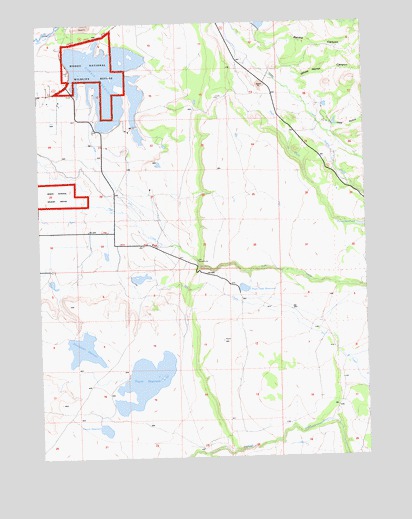
Dorris Reservoir, CA USGS Topographic Map
Click on map above to begin viewing in our Map Viewer.

This topographic map contains these locations and features:
Feature Name Type Latitude Longitude GNIS ID View Map
BrooksLocaleN41.4774°W120.4919°275679View Map
Dannhauser 161 DamDamN41.4082°W120.4911°1663766View Map
Dannhauser ReservoirReservoirN41.4062°W120.4847°259043View Map
Dorris DamDamN41.4882°W120.4894°1664596View Map
Dorris ReservoirReservoirN41.4836°W120.4741°263719View Map
French ReservoirReservoirN41.3830°W120.4768°260403View Map
Hog GulchValleyN41.4688°W120.3883°261397View Map
Payne 143 DamDamN41.3982°W120.4677°1663754View Map
Payne ReservoirReservoirN41.3969°W120.4613°264577View Map
Pine Creek ReservoirReservoirN41.4234°W120.4230°264752View Map
Plum CreekStreamN41.4918°W120.4247°264857View Map
Porter ReservoirReservoirN41.4413°W120.3753°1663751View Map
Renfro CanyonValleyN41.4927°W120.4150°265375View Map
Shields CreekStreamN41.4710°W120.3941°266115View Map
Upper Pasture 161-002 DamDamN41.4248°W120.4641°1663767View Map
White Horse CanyonValleyN41.4849°W120.4036°269003View Map
Yankee Jim RanchLocaleN41.3963°W120.3755°238229View Map

Note: Coordinates in the location and feature list above are referenced to NAD83 datum.


Copyright (C) 2008-2024 Ryan Niemi / Sunset Dynamics ... All Rights Reserved