TopoQuest Logo
Do you find TopoQuest useful?
Help keep TopoQuest running and adding new maps/features by donating!
Bitcoin:  19c7KJd3qBynnjoSw5npx9KScwjBe4ifkT
Litecoin:  LXs6TkuXGGXo1vDsWCkWVdjQX94eUKd6ui
Home View Maps Find Maps Find Places Resources & Links


Dogtown, Florida Topographic Map

USGS Map Title: Dogtown, FL
USGS Map MRC: 30084F5
DRG (GeoTIFF) Download: o30084f5.tif


Neighboring USGS Topographic Map Quads:


  Faceville, GA  
30084G6
 

  Fowlstown, GA  
30084G5
 

  Climax South, GA  
30084G4
 

  Mount Pleasant, FL  
30084F6
 

  Dogtown, FL  
30084F5
 

  Havana North, FL  
30084F4
 

  Gretna, FL  
30084E6
 

  Quincy, FL  
30084E5
 

  Havana South, FL  
30084E4


Map MRC Location:

N31°
W85°
N31°
W84°
H8 H7 H6 H5 H4 H3 H2 H1
G8 G7 G6 G5 G4 G3 G2 G1
F8 F7 F6 F5 F4 F3 F2 F1
E8 E7 E6 E5 E4 E3 E2 E1
D8 D7 D6 D5 D4 D3 D2 D1
C8 C7 C6 C5 C4 C3 C2 C1
B8 B7 B6 B5 B4 B3 B2 B1
A8 A7 A6 A5 A4 A3 A2 A1
N30°
W85°
N30°
W84°

Dogtown, FL USGS 1:24K Topographic Map Preview:
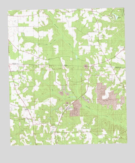
Dogtown, FL USGS Topographic Map
Click on map above to begin viewing in our Map Viewer.

This topographic map contains these locations and features:
Feature Name Type Latitude Longitude GNIS ID View Map
AttapulgusLocaleN30.7485°W84.5005°310662View Map
Betts Mill CreekStreamN30.7235°W84.5671°311258View Map
Black CemeteryCemeteryN30.6413°W84.5755°278883View Map
Campbell ChapelChurchN30.6796°W84.5619°279946View Map
Campbell ChapelChurchN30.6794°W84.5621°300181View Map
Chester CemeteryCemeteryN30.7427°W84.5169°312625View Map
Cool Spring CemeteryCemeteryN30.7460°W84.6235°312930View Map
Cool Spring ChurchChurchN30.7463°W84.6249°312931View Map
Crescent LakeLakeN30.7423°W84.5091°313106View Map
DogtownPopulated PlaceN30.6788°W84.5032°295245View Map
Englehart Decatur MineMineN30.7331°W84.5053°2674902View Map
Fain CemeteryCemeteryN30.7432°W84.5841°314027View Map
Franklin ChurchChurchN30.7057°W84.5927°355906View Map
Gunn Farm MineMineN30.6956°W84.5417°2674901View Map
Hopewell ChurchChurchN30.7046°W84.5824°315639View Map
Lewis CemeteryCemeteryN30.7432°W84.5169°344576View Map
Mount Calvary CemeteryCemeteryN30.6941°W84.6235°300182View Map
Mount Calvary ChurchChurchN30.6941°W84.6235°287207View Map
Mount Hosey CemeteryCemeteryN30.6930°W84.6146°287229View Map
Mount Hosey ChurchChurchN30.6902°W84.6138°287230View Map
Mount Olive ChurchChurchN30.7452°W84.5341°318722View Map
Oak Grove School (historical)SchoolN30.7196°W84.5282°319820View Map
Philadelphia ChurchChurchN30.6438°W84.5771°288760View Map
Pottevint CemeteryCemeteryN30.7246°W84.5266°321096View Map
Robertsville Volunteer Fire DepartmentBuildingN30.6900°W84.6147°2644470View Map
Saint Elizabeth ChurchChurchN30.6366°W84.5760°290172View Map
Saint Hebron CemeteryCemeteryN30.6271°W84.5274°300180View Map
Saint Hebron ChurchChurchN30.6271°W84.5274°290185View Map
Saint Johns SchoolSchoolN30.6585°W84.6069°290241View Map
Smith Grove ChurchChurchN30.7132°W84.5007°323130View Map
Sweetwater ChurchChurchN30.7491°W84.5521°323825View Map
Taylor CemeteryCemeteryN30.6766°W84.5188°292066View Map
Viola Farm AirportAirportN30.7236°W84.5413°2442649View Map

Note: Coordinates in the location and feature list above are referenced to NAD83 datum.


Copyright (C) 2008-2024 Ryan Niemi / Sunset Dynamics ... All Rights Reserved