TopoQuest Logo
Do you find TopoQuest useful?
Help keep TopoQuest running and adding new maps/features by donating!
Bitcoin:  19c7KJd3qBynnjoSw5npx9KScwjBe4ifkT
Litecoin:  LXs6TkuXGGXo1vDsWCkWVdjQX94eUKd6ui
Home View Maps Find Maps Find Places Resources & Links


Dixie, Idaho Topographic Map

USGS Map Title: Dixie, ID
USGS Map MRC: 45115E4
DRG (GeoTIFF) Download: o45115e4.tif


Neighboring USGS Topographic Map Quads:


  Orogrande, ID  
45115F5
 

  Moose Butte, ID  
45115F4
 

  Trapper Creek, ID  
45115F3
 

  Silver Spur Ridge, ID  
45115E5
 

  Dixie, ID  
45115E4
 

  Whitewater Ranch, ID  
45115E3
 

  Mackay Bar, ID  
45115D5
 

  Fivemile Bar, ID  
45115D4
 

  Sheepeater Mountain, ID  
45115D3


Map MRC Location:

N46°
W116°
N46°
W115°
H8 H7 H6 H5 H4 H3 H2 H1
G8 G7 G6 G5 G4 G3 G2 G1
F8 F7 F6 F5 F4 F3 F2 F1
E8 E7 E6 E5 E4 E3 E2 E1
D8 D7 D6 D5 D4 D3 D2 D1
C8 C7 C6 C5 C4 C3 C2 C1
B8 B7 B6 B5 B4 B3 B2 B1
A8 A7 A6 A5 A4 A3 A2 A1
N45°
W116°
N45°
W115°

Dixie, ID USGS 1:24K Topographic Map Preview:
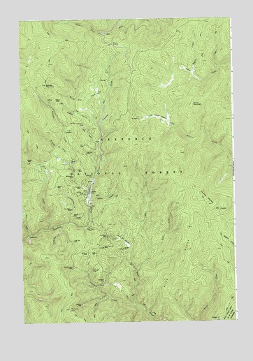
Dixie, ID USGS Topographic Map
Click on map above to begin viewing in our Map Viewer.

This topographic map contains these locations and features:
Feature Name Type Latitude Longitude GNIS ID View Map
Ajax MineMineN45.5630°W115.4673°376489View Map
American MineMineN45.5596°W115.4598°376595View Map
Bagely CreekStreamN45.6027°W115.3990°376845View Map
Black Diamond MineMineN45.5310°W115.4526°377745View Map
Blane CreekStreamN45.5507°W115.4615°377847View Map
Blowout MountainSummitN45.5052°W115.4735°377884View Map
Boulder CreekStreamN45.5616°W115.4571°378077View Map
Burpee MineMineN45.5910°W115.4782°378569View Map
Burpee MountainSummitN45.5980°W115.4854°378570View Map
Churchill MountainSummitN45.5524°W115.3951°396286View Map
Comstock CreekStreamN45.5063°W115.4326°379605View Map
Comstock MineMineN45.5169°W115.4521°379607View Map
Crooked CreekStreamN45.5505°W115.4615°380080View Map
Dillinger MineMineN45.5302°W115.4426°380596View Map
DixiePopulated PlaceN45.5541°W115.4612°1802953View Map
Dixie GulchValleyN45.5744°W115.4568°380646View Map
Dixie House (historical)LocaleN45.5813°W115.4637°380647View Map
Dixie Queen Mine (historical)MineN45.5466°W115.4710°380649View Map
Dixie SummitGapN45.6144°W115.4476°380651View Map
Dixie WoodyardLocaleN45.5791°W115.4721°380652View Map
East Fork Rhett CreekStreamN45.5302°W115.4257°381162View Map
Fourth of July CreekStreamN45.5519°W115.4612°381980View Map
Gold Leaf MineMineN45.5216°W115.4596°382387View Map
Horse FlatFlatN45.5952°W115.4512°383379View Map
Horse Flat CreekStreamN45.5877°W115.4512°383380View Map
Hundred Dollar GulchValleyN45.5388°W115.4846°383545View Map
Juanita MineMineN45.5432°W115.4657°384032View Map
L MineMineN45.5732°W115.4635°384325View Map
Little Mallard MeadowsFlatN45.5846°W115.4212°384890View Map
Long Tom CreekStreamN45.5399°W115.4771°386085View Map
Long Tom MineMineN45.5332°W115.4707°386090View Map
Lost Hunter CreekStreamN45.6019°W115.3760°386155View Map
McKinley MineMineN45.5285°W115.4623°386642View Map
MidasvillePopulated PlaceN45.5602°W115.4701°396887View Map
North Star MeadowsFlatN45.5332°W115.4410°387847View Map
North Star MineMineN45.5355°W115.4510°387849View Map
Nugget GulchValleyN45.5796°W115.4540°387883View Map
Olive CreekStreamN45.5388°W115.4846°387949View Map
Ontario MineMineN45.5446°W115.4671°387968View Map
Penn Dixie MineMineN45.5391°W115.4607°388334View Map
Prichard MineMineN45.5560°W115.4651°388875View Map
Rabbit PointSummitN45.5005°W115.3846°389009View Map
Robinson Dike MineMineN45.5227°W115.4710°389456View Map
Sams CreekStreamN45.5360°W115.4968°389881View Map
Sams Creek CampgroundLocaleN45.5360°W115.4965°389882View Map
Sams Creek Recreation SiteLocaleN45.5349°W115.4962°400545View Map
Sinker MountainSummitN45.5891°W115.3998°397167View Map
Sixtyfour MineMineN45.5794°W115.4607°390505View Map
Skylark MineMineN45.5555°W115.4793°390551View Map
Slip Easy MineMineN45.5699°W115.4623°390629View Map
Swastika MineMineN45.5071°W115.4660°391747View Map
Tiawaka MineMineN45.5663°W115.4721°392120View Map
Toropah MineMineN45.5660°W115.4957°392246View Map

Note: Coordinates in the location and feature list above are referenced to NAD83 datum.


Copyright (C) 2008-2024 Ryan Niemi / Sunset Dynamics ... All Rights Reserved