TopoQuest Logo
Do you find TopoQuest useful?
Help keep TopoQuest running and adding new maps/features by donating!
Bitcoin:  19c7KJd3qBynnjoSw5npx9KScwjBe4ifkT
Litecoin:  LXs6TkuXGGXo1vDsWCkWVdjQX94eUKd6ui
Home View Maps Find Maps Find Places Resources & Links


Diana, West Virginia Topographic Map

USGS Map Title: Diana, WV
USGS Map MRC: 38080E4
DRG (GeoTIFF) Download: o38080e4.tif


Neighboring USGS Topographic Map Quads:


  Newville, WV  
38080F5
 

  Hacker Valley, WV  
38080F4
 

  Goshen, WV  
38080F3
 

  Erbacon, WV  
38080E5
 

  Diana, WV  
38080E4
 

  Skelt, WV  
38080E3
 

  Cowen, WV  
38080D5
 

  Webster Springs, WV  
38080D4
 

  Bergoo, WV  
38080D3


Map MRC Location:

N39°
W81°
N39°
W80°
H8 H7 H6 H5 H4 H3 H2 H1
G8 G7 G6 G5 G4 G3 G2 G1
F8 F7 F6 F5 F4 F3 F2 F1
E8 E7 E6 E5 E4 E3 E2 E1
D8 D7 D6 D5 D4 D3 D2 D1
C8 C7 C6 C5 C4 C3 C2 C1
B8 B7 B6 B5 B4 B3 B2 B1
A8 A7 A6 A5 A4 A3 A2 A1
N38°
W81°
N38°
W80°

Diana, WV USGS 1:24K Topographic Map Preview:
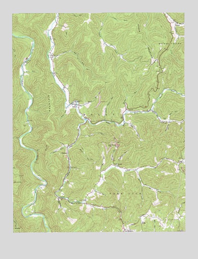
Diana, WV USGS Topographic Map
Click on map above to begin viewing in our Map Viewer.

This topographic map contains these locations and features:
Feature Name Type Latitude Longitude GNIS ID View Map
Adam Miller Cemetery CemeteryN38.5001°W80.4281°2728240View Map
Barrenshe HollowValleyN38.5237°W80.4395°1535281View Map
Bethany ChurchChurchN38.5745°W80.4526°1535678View Map
Big Lick ForkStreamN38.6190°W80.3809°1535884View Map
Big RunPopulated PlaceN38.5998°W80.4720°1535900View Map
Big RunStreamN38.5334°W80.4343°1535905View Map
Big RunStreamN38.5637°W80.4334°1535906View Map
Big Run CemeteryCemeteryN38.6008°W80.4703°2573994View Map
Blaze ForkStreamN38.5265°W80.4062°1536095View Map
Buffalo Bull KnobSummitN38.5148°W80.3879°1727835View Map
ChapmanPopulated PlaceN38.5451°W80.4606°1554109View Map
Clifton CemeteryCemeteryN38.5962°W80.4912°1537405View Map
Clifton FordCrossingN38.5987°W80.4887°1554152View Map
Clifton Ford BridgeBridgeN38.5981°W80.4893°2647349View Map
Columbus McCourt CemeteryCemeteryN38.5760°W80.4874°2586330View Map
Cool Spring KnobSummitN38.5490°W80.4312°1554184View Map
Cool Spring School (historical)SchoolN38.5629°W80.4240°1727843View Map
Cool Springs Cemetery CemeteryN38.5616°W80.4239°2728619View Map
Cougar ForkStreamN38.6243°W80.4304°1537707View Map
Cutlip CemeteryCemeteryN38.5643°W80.3881°1537945View Map
David Daniel Hamrick Memorial BridgeBridgeN38.5643°W80.4449°2647351View Map
Deep RunStreamN38.5712°W80.4609°1538109View Map
Desert ForkStreamN38.5696°W80.3990°1538145View Map
DianaPopulated PlaceN38.5737°W80.4565°1554299View Map
Diana Elementary SchoolSchoolN38.5720°W80.4551°1727849View Map
Diana Post OfficePost OfficeN38.5639°W80.4455°1727850View Map
Diana Volunteer Fire DepartmentBuildingN38.5642°W80.4436°2577627View Map
Elk MountainSummitN38.5557°W80.4712°1554383View Map
Enoch RunStreamN38.5740°W80.4531°1538720View Map
Ezra RunStreamN38.5915°W80.4920°1538782View Map
Fisher RunStreamN38.5565°W80.4515°1538998View Map
Grassy CreekStreamN38.5643°W80.4462°1539628View Map
Green CemeteryCemeteryN38.5609°W80.4901°1539667View Map
Gregory School (historical)SchoolN38.5090°W80.3787°1727859View Map
HodamPopulated PlaceN38.6204°W80.3826°1549746View Map
Hodam Creek CemeteryCemeteryN38.6192°W80.3832°2573995View Map
Hodam MountainSummitN38.5912°W80.3929°1540328View Map
Holly River ChurchChurchN38.5732°W80.4573°1540397View Map
Holly River Church CemeteryCemeteryN38.5725°W80.4566°2573996View Map
JumboPopulated PlaceN38.5626°W80.3879°1541040View Map
KovanPopulated PlaceN38.5396°W80.3776°1554896View Map
Laurel ForkStreamN38.5487°W80.4590°1541440View Map
Laurel Mountain ChurchChurchN38.5007°W80.4190°1541485View Map
Leatherwood RunStreamN38.5207°W80.4673°1541595View Map
Little Grassy CreekStreamN38.5171°W80.4481°1542108View Map
Lower Big RunStreamN38.6018°W80.4743°1542523View Map
McCourt FordCrossingN38.5271°W80.4768°1727878View Map
Miller CreekStreamN38.5351°W80.4095°1543381View Map
Miller KnobSummitN38.5051°W80.4070°1555124View Map
Mount Zion CemeteryCemeteryN38.5380°W80.4248°2729037View Map
Mount Zion ChurchChurchN38.5379°W80.4251°1543823View Map
Mountain View Golf CourseLocaleN38.5074°W80.4061°2634140View Map
Mudlick RunStreamN38.5629°W80.4195°1543955View Map
Oddfellows Cemetery CemeteryN38.5719°W80.4514°2729041View Map
OrndoffPopulated PlaceN38.5376°W80.4243°1555274View Map
Orndoff ChurchChurchN38.5182°W80.4481°1544445View Map
Orndoff School (historical)SchoolN38.5182°W80.4484°1727890View Map
Schoolhouse RunStreamN38.5496°W80.4126°1546502View Map
Shop RunStreamN38.5632°W80.3859°1546714View Map
Snuffville School (historical)SchoolN38.5371°W80.4587°1727915View Map
SummitLocaleN38.5198°W80.4662°1547741View Map
Union Valley ChurchChurchN38.5368°W80.4584°1548495View Map
Upper Mudlick RunStreamN38.5626°W80.3865°1548538View Map
Warner RunStreamN38.5373°W80.4287°1548805View Map
Weedy RunStreamN38.5507°W80.4551°1548879View Map
Weese RunStreamN38.6201°W80.4687°1548881View Map
Wrack Timber RunStreamN38.5634°W80.4334°1549425View Map

Note: Coordinates in the location and feature list above are referenced to NAD83 datum.


Copyright (C) 2008-2024 Ryan Niemi / Sunset Dynamics ... All Rights Reserved