TopoQuest Logo
Do you find TopoQuest useful?
Help keep TopoQuest running and adding new maps/features by donating!
Bitcoin:  19c7KJd3qBynnjoSw5npx9KScwjBe4ifkT
Litecoin:  LXs6TkuXGGXo1vDsWCkWVdjQX94eUKd6ui
Home View Maps Find Maps Find Places Resources & Links


Diamond City, Montana Topographic Map

USGS Map Title: Diamond City, MT
USGS Map MRC: 46111E4
DRG (GeoTIFF) Download: o46111e4.tif


Neighboring USGS Topographic Map Quads:


  Hellgate Gulch, MT  
46111F5
 

  Whites City, MT  
46111F4
 

  Watson, MT  
46111F3
 

  Canyon Ferry SE, MT  
46111E5
 

  Diamond City, MT  
46111E4
 

  Boulder Baldy, MT  
46111E3
 

  Townsend NE, MT  
46111D5
 

  Gurnett Creek West, MT  
46111D4
 

  Gurnett Creek East, MT  
46111D3


Map MRC Location:

N47°
W112°
N47°
W111°
H8 H7 H6 H5 H4 H3 H2 H1
G8 G7 G6 G5 G4 G3 G2 G1
F8 F7 F6 F5 F4 F3 F2 F1
E8 E7 E6 E5 E4 E3 E2 E1
D8 D7 D6 D5 D4 D3 D2 D1
C8 C7 C6 C5 C4 C3 C2 C1
B8 B7 B6 B5 B4 B3 B2 B1
A8 A7 A6 A5 A4 A3 A2 A1
N46°
W112°
N46°
W111°

Diamond City, MT USGS 1:24K Topographic Map Preview:
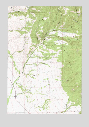
Diamond City, MT USGS Topographic Map
Click on map above to begin viewing in our Map Viewer.

This topographic map contains these locations and features:
Feature Name Type Latitude Longitude GNIS ID View Map
09N02E16CCCD01 WellWellN46.5305°W111.4902°816687View Map
09N02E16CDAD01 WellWellN46.5322°W111.4825°816694View Map
Baker MineMineN46.5894°W111.4391°802528View Map
BarkerPopulated PlaceN46.5344°W111.4894°794647View Map
Blacktail CreekStreamN46.6091°W111.3889°780026View Map
Boom MineMineN46.5891°W111.4450°802660View Map
Boulder (historical)LocaleN46.5902°W111.4008°1762213View Map
Boulder CreekStreamN46.5891°W111.4369°780262View Map
Cement GulchValleyN46.6141°W111.3808°781124View Map
Cement Gulch City (historical)LocaleN46.6180°W111.3841°1762210View Map
Clear CreekStreamN46.5205°W111.4950°781355View Map
Diamond CityPopulated PlaceN46.5972°W111.4239°782354View Map
Diamond City CemeteryCemeteryN46.5885°W111.4336°782355View Map
Diamond City Post Office (historical)Post OfficeN46.5972°W111.4239°1762157View Map
El Dorado (historical)LocaleN46.5222°W111.4939°1762202View Map
Elk Meadows Ranch AirportAirportN46.5363°W111.4974°2650692View Map
Greenhorn GulchValleyN46.5980°W111.4227°784304View Map
Hinaman CreekStreamN46.5572°W111.4716°784901View Map
Hunter GulchValleyN46.5480°W111.4744°785169View Map
Jimmys GulchValleyN46.5808°W111.4475°785493View Map
Johnson Post Office (historical)Post OfficeN46.5202°W111.4869°1762162View Map
Johnson School (historical)SchoolN46.5205°W111.4869°785547View Map
Lucky GulchValleyN46.6172°W111.3841°794741View Map
Miller GulchValleyN46.6216°W111.4650°787417View Map
Miller MineMineN46.6199°W111.4169°802661View Map
Miller MineMineN46.6199°W111.4152°794740View Map
Montana GulchValleyN46.5994°W111.4164°787568View Map
Montana Regent MineMineN46.5855°W111.4433°802659View Map
NE NW Section 25 MineMineN46.6013°W111.4191°802665View Map
NE SW Section 26 MineMineN46.5935°W111.4430°802658View Map
NoblePopulated PlaceN46.5199°W111.4869°794648View Map
Number Two GulchValleyN46.6177°W111.4933°788027View Map
Pyatt GulchValleyN46.6016°W111.3947°789240View Map
Silver Snowflake MineMineN46.6097°W111.3891°802663View Map
Springs GulchValleyN46.6227°W111.4652°791327View Map
Springs Gulch CreekStreamN46.6224°W111.4647°793912View Map
Spruce CreekStreamN46.5847°W111.4397°791333View Map
Upper Number 2 Gulch MineMineN46.6194°W111.4975°802662View Map
Upper Number Two GulchValleyN46.6183°W111.4891°792644View Map
Woods CreekStreamN46.5655°W111.4633°793511View Map

Note: Coordinates in the location and feature list above are referenced to NAD83 datum.


Copyright (C) 2008-2024 Ryan Niemi / Sunset Dynamics ... All Rights Reserved