TopoQuest Logo
Do you find TopoQuest useful?
Help keep TopoQuest running and adding new maps/features by donating!
Bitcoin:  19c7KJd3qBynnjoSw5npx9KScwjBe4ifkT
Litecoin:  LXs6TkuXGGXo1vDsWCkWVdjQX94eUKd6ui
Home View Maps Find Maps Find Places Resources & Links


Dexter, Michigan Topographic Map

USGS Map Title: Dexter, MI
USGS Map MRC: 42083C8
DRG (GeoTIFF) Download: o42083c8.tif


Neighboring USGS Topographic Map Quads:


  Gregory, MI  
42084D1
 

  Pinckney, MI  
42083D8
 

  Hamburg, MI  
42083D7
 

  Chelsea, MI  
42084C1
 

  Dexter, MI  
42083C8
 

  Ann Arbor West, MI  
42083C7
 

  Manchester, MI  
42084B1
 

  Bridgewater, MI  
42083B8
 

  Saline, MI  
42083B7


Map MRC Location:

N43°
W84°
N43°
W83°
H8 H7 H6 H5 H4 H3 H2 H1
G8 G7 G6 G5 G4 G3 G2 G1
F8 F7 F6 F5 F4 F3 F2 F1
E8 E7 E6 E5 E4 E3 E2 E1
D8 D7 D6 D5 D4 D3 D2 D1
C8 C7 C6 C5 C4 C3 C2 C1
B8 B7 B6 B5 B4 B3 B2 B1
A8 A7 A6 A5 A4 A3 A2 A1
N42°
W84°
N42°
W83°

Dexter, MI USGS 1:24K Topographic Map Preview:
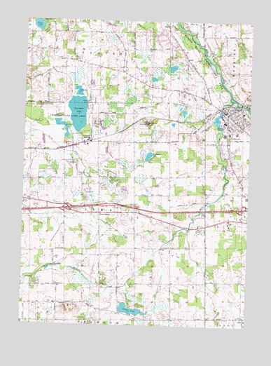
Dexter, MI USGS Topographic Map
Click on map above to begin viewing in our Map Viewer.

This topographic map contains these locations and features:
Feature Name Type Latitude Longitude GNIS ID View Map
Bates Elementary SchoolSchoolN42.3292°W83.8861°2648964View Map
Chelsea ChurchChurchN42.3006°W83.9994°623144View Map
Chelsea Rest AreaLocaleN42.2958°W83.9981°2646832View Map
Chelsea State Game AreaParkN42.3364°W83.9763°623145View Map
Chelsea-Dexter Road CemeteryCemeteryN42.3247°W83.9486°2646807View Map
City of DexterCivilN42.3320°W83.8800°2398719View Map
Cornerstone Elementary SchoolSchoolN42.3281°W83.8801°2648959View Map
Creekside Intermediate SchoolSchoolN42.3283°W83.8883°2648963View Map
DexterPopulated PlaceN42.3384°W83.8886°624624View Map
Dexter Area Fire Department Station 1 HeadquartersBuildingN42.3391°W83.8901°2619926View Map
Dexter Area MuseumBuildingN42.3340°W83.8800°2648957View Map
Dexter CemeteryCemeteryN42.3500°W83.9641°624625View Map
Dexter Church of ChristChurchN42.2909°W83.9034°2648946View Map
Dexter Depot Historical MarkerParkN42.3404°W83.8838°2635722View Map
Dexter District LibraryBuildingN42.3397°W83.8889°2648956View Map
Dexter Family PracticeBuildingN42.3413°W83.8958°2344011View Map
Dexter Gospel ChurchChurchN42.3229°W83.8873°2648949View Map
Dexter High SchoolSchoolN42.3213°W83.8954°2648961View Map
Dexter Post OfficePost OfficeN42.3363°W83.8868°2648955View Map
Dexter StationLocaleN42.3411°W83.8847°2648953View Map
Dexter United Methodist ChurchChurchN42.3454°W83.8839°2648948View Map
Faith ChurchChurchN42.3195°W83.8861°625796View Map
Forest Lawn CemeteryCemeteryN42.3356°W83.8914°2646791View Map
Fourmile LakeLakeN42.3370°W83.9703°626339View Map
Fourmile LakePopulated PlaceN42.3250°W83.9666°1617569View Map
Hudson Mills Metropark Golf CourseChurchN42.3625°W83.9078°2648954View Map
Hudson Mills Metropolitan ParkParkN42.3623°W83.9033°628772View Map
Huron Valley Ambulance DexterBuildingN42.3411°W83.8761°2662095View Map
Interchange 162CrossingN42.2981°W83.9750°2646827View Map
Interchange 167CrossingN42.2986°W83.8781°2646826View Map
JerusalemPopulated PlaceN42.2748°W83.9819°629268View Map
Lima CemeteryCemeteryN42.2661°W83.9805°630411View Map
Lima CemeteryCemeteryN42.2984°W83.9491°630412View Map
Lima CenterPopulated PlaceN42.2959°W83.9574°630413View Map
Lime Post Office (historical)Post OfficeN42.2958°W83.9575°2646725View Map
Mill CreekStreamN42.3428°W83.8841°632324View Map
Mill Creek Middle SchoolSchoolN42.3292°W83.8773°2648962View Map
Nordman LakeLakeN42.3195°W83.9307°633456View Map
North Fork Mill CreekStreamN42.2842°W83.9194°633576View Map
Parker CemeteryCemeteryN42.2900°W83.9024°634383View Map
Peace Lutheran ChurchChurchN42.2927°W83.8945°2646854View Map
Phelps CemeteryCemeteryN42.3057°W83.8786°2646790View Map
Prospect HillSummitN42.3328°W83.9324°635482View Map
Reddeman Farms Golf ClubLocaleN42.2833°W83.9339°2648999View Map
Riker LakeLakeN42.3727°W83.9929°635928View Map
Saint Andrew's United Church of ChristChurchN42.3336°W83.8810°2648950View Map
Saint James Episcopal ChurchChurchN42.3394°W83.8875°2648951View Map
Saint Joseph Catholic ChurchChurchN42.3369°W83.8822°2648952View Map
Saint Joseph Catholic Church Historical MarkerParkN42.3371°W83.8826°2635750View Map
Saint Joseph CemeteryCemeteryN42.3274°W83.8858°636766View Map
Saint Vladimir Orthodox ChurchChurchN42.2951°W83.9262°2648947View Map
Salem Evangelical Lutheran ChurchChurchN42.2540°W83.8761°2646939View Map
Salem Lutheran Church CemeteryCemeteryN42.2542°W83.8767°2646789View Map
Salem SchoolSchoolN42.2534°W83.8758°637110View Map
Sutton LakeLakeN42.2565°W83.9397°639132View Map
Township of LimaCivilN42.2957°W83.9546°1626616View Map
Track Pans Historical MarkerParkN42.3400°W83.8837°2635723View Map
Wylie Elementary SchoolSchoolN42.3294°W83.8819°2648960View Map

Note: Coordinates in the location and feature list above are referenced to NAD83 datum.


Copyright (C) 2008-2024 Ryan Niemi / Sunset Dynamics ... All Rights Reserved