TopoQuest Logo
Do you find TopoQuest useful?
Help keep TopoQuest running and adding new maps/features by donating!
Bitcoin:  19c7KJd3qBynnjoSw5npx9KScwjBe4ifkT
Litecoin:  LXs6TkuXGGXo1vDsWCkWVdjQX94eUKd6ui
Home View Maps Find Maps Find Places Resources & Links


Destruction Island, Washington Topographic Map

USGS Map Title: Destruction Island, WA
USGS Map MRC: 47124F4
DRG (GeoTIFF) Download: o47124f4.tif


Neighboring USGS Topographic Map Quads:


  Toleak Point, WA  
47124G5
 

  Hoh Head, WA  
47124G4
 

  Anderson Creek, WA  
47124G3


  Destruction Island, WA  
47124F4
 

  Kalaloch Ridge, WA  
47124F3


  Queets, WA  
47124E3


Map MRC Location:

N48°
W125°
N48°
W124°
H8 H7 H6 H5 H4 H3 H2 H1
G8 G7 G6 G5 G4 G3 G2 G1
F8 F7 F6 F5 F4 F3 F2 F1
E8 E7 E6 E5 E4 E3 E2 E1
D8 D7 D6 D5 D4 D3 D2 D1
C8 C7 C6 C5 C4 C3 C2 C1
B8 B7 B6 B5 B4 B3 B2 B1
A8 A7 A6 A5 A4 A3 A2 A1
N47°
W125°
N47°
W124°

Destruction Island, WA USGS 1:24K Topographic Map Preview:
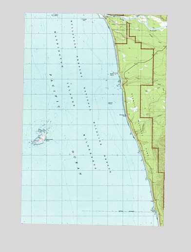
Destruction Island, WA USGS Topographic Map
Click on map above to begin viewing in our Map Viewer.

This topographic map contains these locations and features:
Feature Name Type Latitude Longitude GNIS ID View Map
Abbey IslandIslandN47.7148°W124.4213°1502924View Map
Beach Trail 5TrailN47.6651°W124.3946°1503214View Map
Beach Trail 6TrailN47.6798°W124.4041°1503215View Map
Beach Trail 7TrailN47.6862°W124.4077°1503216View Map
Browns PointCapeN47.6340°W124.3838°1510187View Map
Cedar CreekStreamN47.7126°W124.4158°1517551View Map
Destruction IslandIslandN47.6745°W124.4855°1504448View Map
Destruction Island LighthouseLocaleN47.6742°W124.4869°1514905View Map
Destruction Island ViewpointLocaleN47.6904°W124.4096°1510188View Map
Fletcher CemeteryCemeteryN47.7494°W124.4043°1510274View Map
Fletcher CreekStreamN47.7456°W124.3958°1504932View Map
Fossil CreekStreamN47.7487°W124.4108°1519718View Map
HohPopulated PlaceN47.7492°W124.4066°1509932View Map
Hoh Indian ReservationCivilN47.7380°W124.4083°1505548View Map
Hoh RiverStreamN47.7495°W124.4391°1531464View Map
Middle RockBarN47.7467°W124.4516°1506671View Map
North RockBarN47.7492°W124.4760°1507098View Map
Ruby BeachBeachN47.7109°W124.4155°1507953View Map
Sand CreekStreamN47.7104°W124.3858°1525415View Map
South RockBarN47.6973°W124.4260°1508563View Map
Steamboat CreekStreamN47.6784°W124.4046°1526516View Map

Note: Coordinates in the location and feature list above are referenced to NAD83 datum.


Copyright (C) 2008-2024 Ryan Niemi / Sunset Dynamics ... All Rights Reserved