TopoQuest Logo
Do you find TopoQuest useful?
Help keep TopoQuest running and adding new maps/features by donating!
Bitcoin:  19c7KJd3qBynnjoSw5npx9KScwjBe4ifkT
Litecoin:  LXs6TkuXGGXo1vDsWCkWVdjQX94eUKd6ui
Home View Maps Find Maps Find Places Resources & Links


Delhi, Louisiana Topographic Map

USGS Map Title: Delhi, LA
USGS Map MRC: 32091D4
DRG (GeoTIFF) Download: o32091d4.tif


Neighboring USGS Topographic Map Quads:


  Congo Creek, LA  
32091E5
 

  Epps, LA  
32091E4
 

  Panther Lake, LA  
32091E3
 

  Dunn, LA  
32091D5
 

  Delhi, LA  
32091D4
 

  Tendal, LA  
32091D3
 

  Lamar, LA  
32091C5
 

  Indian Lake, LA  
32091C4
 

  Waverly SE, LA  
32091C3


Map MRC Location:

N33°
W92°
N33°
W91°
H8 H7 H6 H5 H4 H3 H2 H1
G8 G7 G6 G5 G4 G3 G2 G1
F8 F7 F6 F5 F4 F3 F2 F1
E8 E7 E6 E5 E4 E3 E2 E1
D8 D7 D6 D5 D4 D3 D2 D1
C8 C7 C6 C5 C4 C3 C2 C1
B8 B7 B6 B5 B4 B3 B2 B1
A8 A7 A6 A5 A4 A3 A2 A1
N32°
W92°
N32°
W91°

Delhi, LA USGS 1:24K Topographic Map Preview:
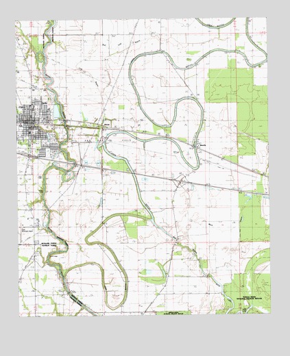
Delhi, LA USGS Topographic Map
Click on map above to begin viewing in our Map Viewer.

This topographic map contains these locations and features:
Feature Name Type Latitude Longitude GNIS ID View Map
AltoonaPopulated PlaceN32.4546°W91.4537°553295View Map
Bull Calf BayouStreamN32.4896°W91.4590°533529View Map
Couch LandingLocaleN32.4007°W91.4848°541299View Map
County LandingPopulated PlaceN32.4001°W91.4857°543112View Map
Cow BayouStreamN32.4696°W91.4585°534201View Map
DelhiPopulated PlaceN32.4576°W91.4932°543137View Map
Delhi Charter SchoolSchoolN32.4707°W91.4915°2462949View Map
Delhi Compressor StationLocaleN32.4146°W91.4921°558761View Map
Delhi Elementary SchoolSchoolN32.4623°W91.4837°548677View Map
Delhi Fire DepartmentBuildingN32.4557°W91.4925°2672843View Map
Delhi High SchoolSchoolN32.4630°W91.4914°548675View Map
Delhi Middle SchoolSchoolN32.4624°W91.4834°548676View Map
Delhi Municipal AirportAirportN32.4139°W91.4975°1632686View Map
Delhi Oil FieldOilfieldN32.4490°W91.4640°549502View Map
Delhi Post OfficePost OfficeN32.4509°W91.4925°1630724View Map
Delhi Town Police DepartmentBuildingN32.4555°W91.4922°2755255View Map
Francis LandingLocaleN32.4279°W91.4871°541298View Map
Interchange 153CrossingN32.4429°W91.4937°1630035View Map
Interchange 157CrossingN32.4315°W91.4190°1630036View Map
Joes BayouStreamN32.3913°W91.4773°536065View Map
Judd LakeLakeN32.3759°W91.3913°554902View Map
Mack BayouStreamN32.4013°W91.4123°536804View Map
Midway ChurchChurchN32.3990°W91.4257°537072View Map
Red Hill ChurchChurchN32.4782°W91.4946°538523View Map
Richland Parish Hospital DelhiHospitalN32.4529°W91.4938°548689View Map
Scott LandingPopulated PlaceN32.4343°W91.4873°543651View Map
Sutt BayouGutN32.4076°W91.4234°556177View Map
Town of DelhiCivilN32.4529°W91.4900°2406371View Map
WaverlyPopulated PlaceN32.4463°W91.4115°556375View Map
Waverly CemeteryCemeteryN32.4571°W91.4068°540268View Map
Waverly Post OfficePost OfficeN32.4457°W91.4104°1631257View Map
Zion Pilgrim Number 1 ChurchChurchN32.4699°W91.4134°540601View Map
Zion Pilgrim Number 2 ChurchChurchN32.4832°W91.3754°540602View Map

Note: Coordinates in the location and feature list above are referenced to NAD83 datum.


Copyright (C) 2008-2024 Ryan Niemi / Sunset Dynamics ... All Rights Reserved