TopoQuest Logo
Do you find TopoQuest useful?
Help keep TopoQuest running and adding new maps/features by donating!
Bitcoin:  19c7KJd3qBynnjoSw5npx9KScwjBe4ifkT
Litecoin:  LXs6TkuXGGXo1vDsWCkWVdjQX94eUKd6ui
Home View Maps Find Maps Find Places Resources & Links


Deepstep, Georgia Topographic Map

USGS Map Title: Deepstep, GA
USGS Map MRC: 33082A8
DRG (GeoTIFF) Download: o33082a8.tif


Neighboring USGS Topographic Map Quads:


  Devereux, GA  
33083B1
 

  Warthen NW, GA  
33082B8
 

  Warthen NE, GA  
33082B7
 

  Friendship, GA  
33083A1
 

  Deepstep, GA  
33082A8
 

  Warthen, GA  
33082A7
 

  Gumm Pond, GA  
32083H1
 

  Tabernacle, GA  
32082H8
 

  Sandersville, GA  
32082H7


Map MRC Location:

N34°
W83°
N34°
W82°
H8 H7 H6 H5 H4 H3 H2 H1
G8 G7 G6 G5 G4 G3 G2 G1
F8 F7 F6 F5 F4 F3 F2 F1
E8 E7 E6 E5 E4 E3 E2 E1
D8 D7 D6 D5 D4 D3 D2 D1
C8 C7 C6 C5 C4 C3 C2 C1
B8 B7 B6 B5 B4 B3 B2 B1
A8 A7 A6 A5 A4 A3 A2 A1
N33°
W83°
N33°
W82°

Deepstep, GA USGS 1:24K Topographic Map Preview:
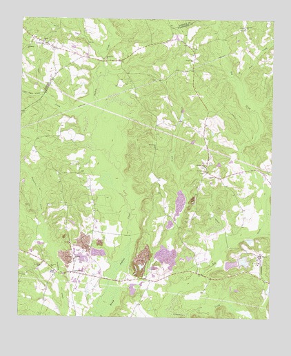
Deepstep, GA USGS Topographic Map
Click on map above to begin viewing in our Map Viewer.

This topographic map contains these locations and features:
Feature Name Type Latitude Longitude GNIS ID View Map
American Ind Clay Company LakeReservoirN33.0225°W82.8944°340777View Map
American Ind Clay Company Lake DamDamN33.0235°W82.8982°340776View Map
Bold Spring ChurchChurchN33.0715°W82.9326°354805View Map
Brush CreekStreamN33.0010°W82.9615°311915View Map
Carters Mill CreekStreamN33.0360°W82.8765°312389View Map
Darien ChurchChurchN33.1151°W82.9885°355444View Map
DeepstepPopulated PlaceN33.0182°W82.9690°331534View Map
Deepstep CemeteryCemeteryN33.0315°W82.9743°348305View Map
Deepstep CemeteryCemeteryN33.0176°W82.9782°348306View Map
Deepstep SchoolSchoolN33.0243°W82.9718°313419View Map
Deepstep United Methodist ChurchChurchN33.0182°W82.9782°348307View Map
Deepstep Volunteer Fire DepartmentBuildingN33.0175°W82.9675°2604813View Map
Goat TownPopulated PlaceN33.0188°W82.9810°331827View Map
Hood CemeteryCemeteryN33.0993°W82.9324°315623View Map
KaolinPopulated PlaceN33.0263°W82.8807°332128View Map
Kilgore Family CemeteryCemeteryN33.1049°W82.9857°1985826View Map
King CreekStreamN33.0857°W82.9738°348342View Map
LintonPopulated PlaceN33.1165°W82.9926°332222View Map
Linton Historic DistrictParkN33.1154°W82.9899°348225View Map
Little Deepstep CreekStreamN33.0340°W82.9874°348345View Map
Little Keg CreekStreamN33.0513°W82.8768°317107View Map
Little Tiger CreekStreamN33.0940°W82.9999°317222View Map
Longs BridgeBridgeN33.1076°W82.9593°348227View Map
Mink CreekStreamN33.0927°W82.9874°318317View Map
Mount Sinai Baptist ChurchChurchN33.0215°W82.9890°348361View Map
Mount Sinai CemeteryCemeteryN33.0213°W82.9840°318874View Map
Mount Sinai SchoolSchoolN33.0215°W82.9893°318883View Map
Old Darien CemeteryCemeteryN33.1085°W82.9585°348238View Map
Old Darien ChurchChurchN33.1085°W82.9574°319967View Map
Paul CreekStreamN33.0940°W82.8901°320282View Map
Pine Hill ChurchChurchN33.1215°W82.8890°320602View Map
Pleasant Grove CemeteryCemeteryN33.0632°W82.9079°348376View Map
Pleasant Grove ChurchChurchN33.0635°W82.9074°320823View Map
Robinson CreekStreamN33.0352°W82.8813°321695View Map
Second Darien ChurchChurchN33.1135°W82.9965°322690View Map
Shephard LakeReservoirN33.1035°W82.8932°336371View Map
Shephard Lake DamDamN33.1035°W82.8932°336370View Map
Shiloh School (historical)SchoolN33.1160°W82.9199°348398View Map
Smyrna ChurchChurchN33.0310°W82.9746°323178View Map
Spring BranchStreamN33.0710°W82.9626°348405View Map
Stephen Mills CemeteryCemeteryN33.1079°W82.9140°323565View Map
Swift CreekStreamN33.1101°W82.9613°323848View Map
Swint Family CemeteryCemeteryN33.1193°W82.9249°1985861View Map
Thompson Family CemeteryCemeteryN33.1049°W82.9857°1985865View Map
Thompsons BridgeBridgeN33.0157°W82.9535°348417View Map
Tiger CreekStreamN33.0779°W82.9649°324171View Map
Town of DeepstepCivilN33.0176°W82.9678°2406368View Map
Trawich CemeteryCemeteryN33.0593°W82.9060°324277View Map
Trawick Family Cemetery Number 2CemeteryN33.1096°W82.9676°1985868View Map
Veal CemeteryCemeteryN33.0443°W82.9610°348423View Map

Note: Coordinates in the location and feature list above are referenced to NAD83 datum.


Copyright (C) 2008-2024 Ryan Niemi / Sunset Dynamics ... All Rights Reserved