TopoQuest Logo
Do you find TopoQuest useful?
Help keep TopoQuest running and adding new maps/features by donating!
Bitcoin:  19c7KJd3qBynnjoSw5npx9KScwjBe4ifkT
Litecoin:  LXs6TkuXGGXo1vDsWCkWVdjQX94eUKd6ui
Home View Maps Find Maps Find Places Resources & Links


Deep Lake SW, Florida Topographic Map

USGS Map Title: Deep Lake SW, FL
USGS Map MRC: 26081A4
DRG (GeoTIFF) Download: o26081a4.tif


Neighboring USGS Topographic Map Quads:


  Belle Meade NE, FL  
26081B5
 

  Catherine Island, FL  
26081B4
 

  Miles City, FL  
26081B3
 

  Belle Meade SE, FL  
26081A5
 

  Deep Lake SW, FL  
26081A4
 

  Deep Lake, FL  
26081A3


Map MRC Location:

N27°
W82°
N27°
W81°
H8 H7 H6 H5 H4 H3 H2 H1
G8 G7 G6 G5 G4 G3 G2 G1
F8 F7 F6 F5 F4 F3 F2 F1
E8 E7 E6 E5 E4 E3 E2 E1
D8 D7 D6 D5 D4 D3 D2 D1
C8 C7 C6 C5 C4 C3 C2 C1
B8 B7 B6 B5 B4 B3 B2 B1
A8 A7 A6 A5 A4 A3 A2 A1
N26°
W82°
N26°
W81°

Deep Lake SW, FL USGS 1:24K Topographic Map Preview:
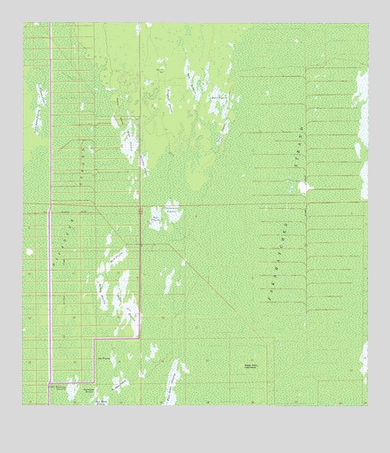
Deep Lake SW, FL USGS Topographic Map
Click on map above to begin viewing in our Map Viewer.

This topographic map contains these locations and features:
Feature Name Type Latitude Longitude GNIS ID View Map
Bear PrairieFlatN26.0994°W81.4291°278345View Map
Buck PrairieFlatN26.0476°W81.4654°279589View Map
Burnt Flat PrairieFlatN26.0798°W81.4551°279708View Map
Collier CountyCivilN26.0992°W81.3810°295754View Map
Doe PrairieFlatN26.0157°W81.4670°281642View Map
Dollar PrairieFlatN26.0326°W81.4623°281666View Map
Fakahatchee StrandSwampN26.1148°W81.3979°282362View Map
Fakahatchee Strand Preserve State ParkParkN26.0007°W81.4165°304160View Map
Little Whitney PrairieFlatN26.0057°W81.4817°285853View Map
Long PrairieFlatN26.0896°W81.4273°286071View Map
Picayune StrandSwampN26.0715°W81.4765°288770View Map
Plate PrairieFlatN26.0076°W81.4651°289035View Map
Pretty IslandIslandN26.0970°W81.4659°289301View Map
Royal Palm HammockIslandN26.0134°W81.4201°290032View Map
Slate PrairieFlatN26.0868°W81.4615°291220View Map
Soft PrairieFlatN26.1059°W81.4384°291321View Map
Starvation PrairieFlatN26.0051°W81.4729°291647View Map
Turkey PrairieFlatN26.0368°W81.4704°292540View Map
Turnback PrairieFlatN26.0993°W81.4465°292550View Map
Twelvemile PrairieFlatN26.0626°W81.4448°292591View Map
West PrairieFlatN26.0598°W81.4512°293113View Map

Note: Coordinates in the location and feature list above are referenced to NAD83 datum.


Copyright (C) 2008-2024 Ryan Niemi / Sunset Dynamics ... All Rights Reserved