TopoQuest Logo
Do you find TopoQuest useful?
Help keep TopoQuest running and adding new maps/features by donating!
Bitcoin:  19c7KJd3qBynnjoSw5npx9KScwjBe4ifkT
Litecoin:  LXs6TkuXGGXo1vDsWCkWVdjQX94eUKd6ui
Home View Maps Find Maps Find Places Resources & Links


Deadman Point, California Topographic Map

USGS Map Title: Deadman Point, CA
USGS Map MRC: 41123H4
DRG (GeoTIFF) Download: o41123h4.tif


Neighboring USGS Topographic Map Quads:


  Takilma, OR  
42123A5
 

  Oregon Caves, OR  
42123A4
 

  Grayback Mountain, OR  
42123A3
 

  Polar Bear Mountain, CA  
41123H5
 

  Deadman Point, CA  
41123H4
 

  Figurehead Mountain, CA  
41123H3
 

  Preston Peak, CA  
41123G5
 

  Happy Camp, CA  
41123G4
 

  Slater Butte, CA  
41123G3


Map MRC Location:

N42°
W124°
N42°
W123°
H8 H7 H6 H5 H4 H3 H2 H1
G8 G7 G6 G5 G4 G3 G2 G1
F8 F7 F6 F5 F4 F3 F2 F1
E8 E7 E6 E5 E4 E3 E2 E1
D8 D7 D6 D5 D4 D3 D2 D1
C8 C7 C6 C5 C4 C3 C2 C1
B8 B7 B6 B5 B4 B3 B2 B1
A8 A7 A6 A5 A4 A3 A2 A1
N41°
W124°
N41°
W123°

Deadman Point, CA USGS 1:24K Topographic Map Preview:
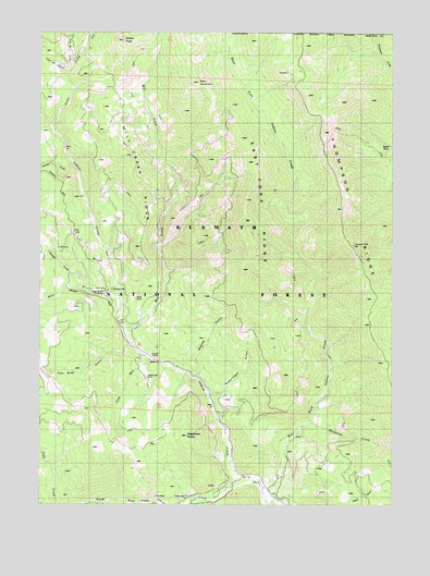
Deadman Point, CA USGS Topographic Map
Click on map above to begin viewing in our Map Viewer.

This topographic map contains these locations and features:
Feature Name Type Latitude Longitude GNIS ID View Map
Bald Hornet CreekStreamN41.8760°W123.4417°256454View Map
Bare MountainSummitN41.9862°W123.4464°256510View Map
Blue Bar MineMineN41.9004°W123.4409°257223View Map
Cedar SpringSpringN41.9762°W123.4339°258155View Map
Classic Hill MineMineN41.9079°W123.4634°258418View Map
Clauson CreekStreamN41.8771°W123.4473°258419View Map
Coon RunStreamN41.9146°W123.4648°258686View Map
County MineMineN41.9137°W123.4609°258785View Map
Deadman PointSummitN41.8926°W123.4439°1655956View Map
Des Moines CreekStreamN41.9751°W123.4981°259283View Map
East Fork Indian CreekStreamN41.8794°W123.4219°259738View Map
East Fork RidgeRidgeN41.9551°W123.4295°259747View Map
Four Bit GulchValleyN41.9898°W123.4923°260290View Map
Granite CreekStreamN41.9651°W123.4898°260748View Map
Green CreekStreamN41.9747°W123.4972°260848View Map
Huey MineMineN41.9296°W123.4687°261595View Map
Jade MineMineN41.8768°W123.4623°261889View Map
King Bill RanchLocaleN41.9173°W123.4545°277187View Map
Mill CreekStreamN41.9204°W123.4706°263594View Map
Mill Creek RidgeRidgeN41.9579°W123.4670°263620View Map
Munson MineMineN41.9860°W123.4142°263962View Map
Rhodonite CreekStreamN41.8973°W123.4059°265390View Map
Rhodonite MineMineN41.8932°W123.3767°265391View Map
Silver GulchValleyN41.9848°W123.4889°274776View Map
Snowbrush MineMineN41.9787°W123.4259°267332View Map
South Fork Indian CreekStreamN41.8790°W123.4226°267464View Map
Spees PeakSummitN41.9979°W123.4723°267562View Map
Spees Peak TrailTrailN41.9690°W123.4778°267563View Map
Sutcliffe CreekStreamN41.9321°W123.4864°267993View Map
Swearingen GulchValleyN41.9029°W123.4409°262125View Map
Thompson RidgeRidgeN41.9393°W123.3906°268243View Map
Tom Gray GulchValleyN41.9165°W123.4701°268331View Map
Two Bit GulchValleyN41.9923°W123.4909°268554View Map
Wagner GulchValleyN41.9104°W123.4448°268731View Map
West Branch CampgroundLocaleN41.9315°W123.4751°277186View Map
West Branch Guard StationLocaleN41.9315°W123.4773°268870View Map
West Branch Indian CreekStreamN41.9279°W123.4717°268874View Map
Wood MineMineN41.9712°W123.3828°269283View Map

Note: Coordinates in the location and feature list above are referenced to NAD83 datum.


Copyright (C) 2008-2024 Ryan Niemi / Sunset Dynamics ... All Rights Reserved