TopoQuest Logo
Do you find TopoQuest useful?
Help keep TopoQuest running and adding new maps/features by donating!
Bitcoin:  19c7KJd3qBynnjoSw5npx9KScwjBe4ifkT
Litecoin:  LXs6TkuXGGXo1vDsWCkWVdjQX94eUKd6ui
Home View Maps Find Maps Find Places Resources & Links


Deacon Crossing, Oregon Topographic Map

USGS Map Title: Deacon Crossing, OR
USGS Map MRC: 42117D1
DRG (GeoTIFF) Download: o42117d1.tif


Neighboring USGS Topographic Map Quads:


  Three Forks, OR  
42117E2
 

  Brewster Reservoir, OR  
42117E1
 

  Fairylawn, ID  
42116E8
 

  Drummond Basin, OR  
42117D2
 

  Deacon Crossing, OR  
42117D1
 

  Bedstead Ridge, ID  
42116D8
 

  Rawhide Pocket, OR  
42117C2
 

  Beaver Charlie Breaks, OR  
42117C1
 

  Bull Basin Camp, ID  
42116C8


Map MRC Location:

N43°
W118°
N43°
W117°
H8 H7 H6 H5 H4 H3 H2 H1
G8 G7 G6 G5 G4 G3 G2 G1
F8 F7 F6 F5 F4 F3 F2 F1
E8 E7 E6 E5 E4 E3 E2 E1
D8 D7 D6 D5 D4 D3 D2 D1
C8 C7 C6 C5 C4 C3 C2 C1
B8 B7 B6 B5 B4 B3 B2 B1
A8 A7 A6 A5 A4 A3 A2 A1
N42°
W118°
N42°
W117°

Deacon Crossing, OR USGS 1:24K Topographic Map Preview:
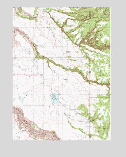
Deacon Crossing, OR USGS Topographic Map
Click on map above to begin viewing in our Map Viewer.

This topographic map contains these locations and features:
Feature Name Type Latitude Longitude GNIS ID View Map
Berry GulchValleyN42.4265°W117.0090°371467View Map
Bull CreekStreamN42.3763°W117.0726°1134356View Map
C RanchLocaleN42.3938°W117.0251°395163View Map
Deacon CrossingCrossingN42.4427°W117.0587°1134307View Map
Deacon FieldFlatN42.4429°W117.0704°1134311View Map
Deacon ReservoirReservoirN42.4317°W117.0557°1134308View Map
Dry LakesLakeN42.4135°W117.1130°1134306View Map
Dry Pit LakeReservoirN42.4918°W117.1101°1134310View Map
Field CreekStreamN42.4502°W117.0824°372688View Map
Idaho SpringSpringN42.3834°W117.0173°395507View Map
Maher DamDamN42.4182°W117.0743°1131277View Map
Maher ReservoirReservoirN42.4182°W117.0739°1161732View Map
Pole Creek BasinBasinN42.4735°W117.0732°1134302View Map
Pole Creek BreaksRangeN42.4818°W117.0253°374489View Map
Pole Creek ReservoirReservoirN42.4634°W117.0886°1134303View Map
Rentile FieldFlatN42.3938°W117.0251°394998View Map
Saddlehorse SpringSpringN42.3860°W117.0035°395900View Map
Sharon CreekStreamN42.3927°W117.1121°1134358View Map
Sharon Creek ReservoirReservoirN42.3834°W117.1142°1134357View Map
Soldier Meadows CreekStreamN42.4938°W117.0935°1127203View Map
State Line ReservoirReservoirN42.4585°W117.0565°1134309View Map
The DifficultyAreaN42.4574°W117.1010°1134304View Map
The Homestead CabinLocaleN42.4307°W117.0315°1134305View Map

Note: Coordinates in the location and feature list above are referenced to NAD83 datum.


Copyright (C) 2008-2024 Ryan Niemi / Sunset Dynamics ... All Rights Reserved