TopoQuest Logo
Do you find TopoQuest useful?
Help keep TopoQuest running and adding new maps/features by donating!
Bitcoin:  19c7KJd3qBynnjoSw5npx9KScwjBe4ifkT
Litecoin:  LXs6TkuXGGXo1vDsWCkWVdjQX94eUKd6ui
Home View Maps Find Maps Find Places Resources & Links


De Roche, Arkansas Topographic Map

USGS Map Title: De Roche, AR
USGS Map MRC: 34093C1
DRG (GeoTIFF) Download: o34093c1.tif


Neighboring USGS Topographic Map Quads:


  Hempwallace, AR  
34093D2
 

  Hot Springs South, AR  
34093D1
 

  Lake Catherine, AR  
34092D8
 

  Bismarck, AR  
34093C2
 

  De Roche, AR  
34093C1
 

  Social Hill, AR  
34092C8
 

  De Gray, AR  
34093B2
 

  Caddo Valley, AR  
34093B1
 

  Donaldson, AR  
34092B8


Map MRC Location:

N35°
W94°
N35°
W93°
H8 H7 H6 H5 H4 H3 H2 H1
G8 G7 G6 G5 G4 G3 G2 G1
F8 F7 F6 F5 F4 F3 F2 F1
E8 E7 E6 E5 E4 E3 E2 E1
D8 D7 D6 D5 D4 D3 D2 D1
C8 C7 C6 C5 C4 C3 C2 C1
B8 B7 B6 B5 B4 B3 B2 B1
A8 A7 A6 A5 A4 A3 A2 A1
N34°
W94°
N34°
W93°

De Roche, AR USGS 1:24K Topographic Map Preview:
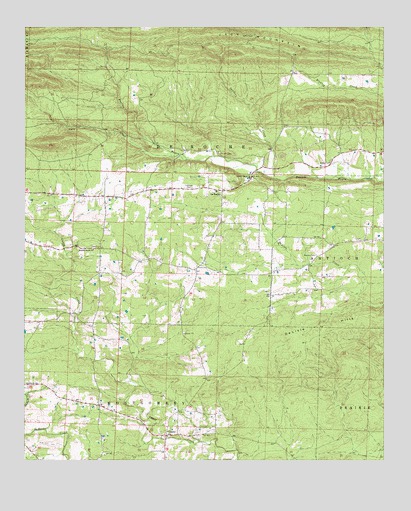
De Roche, AR USGS Topographic Map
Click on map above to begin viewing in our Map Viewer.

This topographic map contains these locations and features:
Feature Name Type Latitude Longitude GNIS ID View Map
Beason CemeteryCemeteryN34.3093°W93.0235°46253View Map
CaneyPopulated PlaceN34.2570°W93.0757°47386View Map
Curl CreekStreamN34.3379°W93.0741°48268View Map
De RochePopulated PlaceN34.3279°W93.0568°76757View Map
De Roche CemeteryCemeteryN34.2715°W93.1249°48408View Map
De Roche ChurchChurchN34.2718°W93.1243°48409View Map
DeLisle HillsRidgeN34.2920°W93.0035°76760View Map
Estep CemeteryCemeteryN34.3362°W93.0185°48917View Map
Hickory Grove ChurchChurchN34.3109°W93.1013°50064View Map
Holstein CemeteryCemeteryN34.3287°W93.0668°50264View Map
Jack MountainRidgeN34.3712°W93.0355°50539View Map
KLAZ-FM (Hot Springs)TowerN34.3723°W93.0477°85194View Map
KRZB-TV (Hot Springs)TowerN34.3723°W93.0466°85259View Map
New de Roche Fire DepartmentBuildingN34.3278°W93.0584°2116846View Map
Prairie Bayou ChurchChurchN34.3315°W93.0466°53756View Map
Prince CemeteryCemeteryN34.3390°W93.0574°53804View Map
Prince Field (historical)AirportN34.3376°W93.0238°83731View Map
Sanders (historical)Populated PlaceN34.3376°W93.0418°66137View Map
Sanders CreekStreamN34.3315°W93.0371°54556View Map
Township of De RocheCivilN34.3432°W93.0680°66657View Map
Township of MontgomeryCivilN34.2645°W93.1005°66666View Map

Note: Coordinates in the location and feature list above are referenced to NAD83 datum.


Copyright (C) 2008-2024 Ryan Niemi / Sunset Dynamics ... All Rights Reserved