TopoQuest Logo
Do you find TopoQuest useful?
Help keep TopoQuest running and adding new maps/features by donating!
Bitcoin:  19c7KJd3qBynnjoSw5npx9KScwjBe4ifkT
Litecoin:  LXs6TkuXGGXo1vDsWCkWVdjQX94eUKd6ui
Home View Maps Find Maps Find Places Resources & Links


Antelope Pass, New Mexico Topographic Map

USGS Map Title: Antelope Pass, NM
USGS Map MRC: 31108H8
DRG (GeoTIFF) Download: o31108h8.tif


Neighboring USGS Topographic Map Quads:


  San Simon Cienega, NM  
32109A1
 

  Cotton City, NM  
32108A8
 

  Table Top Mountain, NM  
32108A7
 

  Portal NE, AZ  
31109H1
 

  Antelope Pass, NM  
31108H8
 

  Animas, NM  
31108H7
 

  Rodeo, NM  
31109G1
 

  Indian Peak, NM  
31108G8
 

  Tank Mountain, NM  
31108G7


Map MRC Location:

N32°
W109°
N32°
W108°
H8 H7 H6 H5 H4 H3 H2 H1
G8 G7 G6 G5 G4 G3 G2 G1
F8 F7 F6 F5 F4 F3 F2 F1
E8 E7 E6 E5 E4 E3 E2 E1
D8 D7 D6 D5 D4 D3 D2 D1
C8 C7 C6 C5 C4 C3 C2 C1
B8 B7 B6 B5 B4 B3 B2 B1
A8 A7 A6 A5 A4 A3 A2 A1
N31°
W109°
N31°
W108°

Antelope Pass, NM USGS 1:24K Topographic Map Preview:
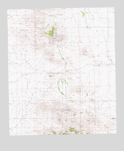
Antelope Pass, NM USGS Topographic Map
Click on map above to begin viewing in our Map Viewer.

This topographic map contains these locations and features:
Feature Name Type Latitude Longitude GNIS ID View Map
01635 Water WellWellN31.9520°W108.9623°927659View Map
10132 Water WellWellN31.9918°W108.9014°921377View Map
10136 Water WellWellN31.9506°W108.8845°921375View Map
Amy KMineN31.9601°W108.9839°915009View Map
Antelope PassGapN31.9398°W108.9431°885782View Map
Basin CanyonValleyN31.9404°W108.9353°901058View Map
Beacon hillSummitN31.9331°W108.9503°901059View Map
Black CanyonValleyN31.9256°W108.9062°901060View Map
Grey MountainSummitN31.8787°W108.9264°900944View Map
Henderson RanchLocaleN31.9965°W108.9053°889901View Map
Henderson Ranch (historical)LocaleN31.9959°W108.9070°933945View Map
Kukendall Prop.MineN31.9590°W108.9120°915010View Map
Long CanyonValleyN31.9329°W108.9417°900886View Map
Nipple HillSummitN31.8901°W108.8784°901134View Map
PrattLocaleN31.9429°W108.8948°900728View Map
Pratt Fire Clay QuarryMineN31.9151°W108.9020°915227View Map
Pratt Post Office (historical)Post OfficeN31.9429°W108.8948°937562View Map
Purple Spar ProspectMineN31.8973°W108.9645°915230View Map
Robinson RanchLocaleN31.9793°W108.8973°894025View Map
Robinson Ranch (historical)LocaleN31.9790°W108.9003°933946View Map
Rodeo Intermediate Field (historical)AirportN31.9292°W108.9964°2507807View Map
Spencer RanchLocaleN31.8784°W108.9923°895226View Map

Note: Coordinates in the location and feature list above are referenced to NAD83 datum.


Copyright (C) 2008-2024 Ryan Niemi / Sunset Dynamics ... All Rights Reserved