TopoQuest Logo
Do you find TopoQuest useful?
Help keep TopoQuest running and adding new maps/features by donating!
Bitcoin:  19c7KJd3qBynnjoSw5npx9KScwjBe4ifkT
Litecoin:  LXs6TkuXGGXo1vDsWCkWVdjQX94eUKd6ui
Home View Maps Find Maps Find Places Resources & Links


De Mossville, Kentucky Topographic Map

USGS Map Title: De Mossville, KY
USGS Map MRC: 38084G4
DRG (GeoTIFF) Download: o38084g4.tif


Neighboring USGS Topographic Map Quads:


  Independence, KY  
38084H5
 

  Alexandria, KY  
38084H4
 

  New Richmond, OH  
38084H3
 

  Walton, KY  
38084G5
 

  De Mossville, KY  
38084G4
 

  Butler, KY  
38084G3
 

  Williamstown, KY  
38084F5
 

  Goforth, KY  
38084F4
 

  Falmouth, KY  
38084F3


Map MRC Location:

N39°
W85°
N39°
W84°
H8 H7 H6 H5 H4 H3 H2 H1
G8 G7 G6 G5 G4 G3 G2 G1
F8 F7 F6 F5 F4 F3 F2 F1
E8 E7 E6 E5 E4 E3 E2 E1
D8 D7 D6 D5 D4 D3 D2 D1
C8 C7 C6 C5 C4 C3 C2 C1
B8 B7 B6 B5 B4 B3 B2 B1
A8 A7 A6 A5 A4 A3 A2 A1
N38°
W85°
N38°
W84°

De Mossville, KY USGS 1:24K Topographic Map Preview:
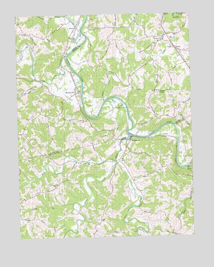
De Mossville, KY USGS Topographic Map
Click on map above to begin viewing in our Map Viewer.

This topographic map contains these locations and features:
Feature Name Type Latitude Longitude GNIS ID View Map
Abbott (historical)Populated PlaceN38.8598°W84.4323°2564910View Map
Abbott School (historical)SchoolN38.8598°W84.4330°2564911View Map
AlexanderPopulated PlaceN38.8231°W84.4280°507383View Map
Alexandria Railroad Station (historical)LocaleN38.8228°W84.4290°2557702View Map
Baker School (historical)SchoolN38.8442°W84.4540°2564914View Map
Benton Ferry (historical)CrossingN38.8665°W84.4528°2557797View Map
Bloody RunStreamN38.7687°W84.4616°487492View Map
Bryants Ford (historical)CrossingN38.8526°W84.4626°2557794View Map
Bryants Ford Railroad Station (historical)LocaleN38.8531°W84.4642°2557795View Map
CaldwellPopulated PlaceN38.8067°W84.3913°507636View Map
Caldwell CemeteryCemeteryN38.7792°W84.4730°488588View Map
Clay RidgeRidgeN38.8563°W84.4330°2564929View Map
Clay Ridge (historical)Populated PlaceN38.8404°W84.4180°2742130View Map
Clay Ridge School (historical)SchoolN38.8405°W84.4177°2564930View Map
Cruises CreekStreamN38.8520°W84.4641°490420View Map
DeMossvillePopulated PlaceN38.8051°W84.4169°490712View Map
FairlanePopulated PlaceN38.8560°W84.3855°2742133View Map
Forest Grove School (historical)SchoolN38.8500°W84.4378°2564941View Map
Gardnersville School (historical)SchoolN38.7620°W84.4499°2564257View Map
Grants LickPopulated PlaceN38.8603°W84.3977°493122View Map
Grants Lick Post Office (historical)Post OfficeN38.8602°W84.3951°2564942View Map
Grants Lick School (historical)SchoolN38.8597°W84.3976°2564943View Map
Grassy CreekStreamN38.8065°W84.4180°493152View Map
Grassy Creek Baptist Church (historical)ChurchN38.7732°W84.4494°2558275View Map
Grassy Creek ChurchChurchN38.7926°W84.4297°493154View Map
Grassy Creek Church CemeteryCemeteryN38.7937°W84.4263°2564258View Map
Grassy Creek Post Office (historical)Post OfficeN38.7932°W84.4274°2564259View Map
GreenwoodPopulated PlaceN38.7512°W84.3891°508133View Map
Greenwood HillSummitN38.7502°W84.3876°2564260View Map
Greenwood Hill Post Office (historical)Post OfficeN38.7507°W84.3900°2564261View Map
Greenwood School (historical)SchoolN38.7510°W84.3893°2564262View Map
Hopeful (historical)Populated PlaceN38.8176°W84.3954°2564949View Map
Hopeful School (historical)SchoolN38.8177°W84.3960°2564902View Map
KentonPopulated PlaceN38.8684°W84.4561°495659View Map
Kenton Fire Protection DistrictBuildingN38.8644°W84.4592°2636850View Map
Kenton Post Office (historical)Post OfficeN38.8689°W84.4558°2557798View Map
Little Cruises CreekStreamN38.8362°W84.4772°496695View Map
Middle Fork Grassy CreekStreamN38.7928°W84.4299°498122View Map
Morning ViewPopulated PlaceN38.8320°W84.4563°498605View Map
Morning View Railroad Station (historical)LocaleN38.8322°W84.4557°2557792View Map
North Fork Grassy CreekStreamN38.7926°W84.4299°499551View Map
Oak Island ChurchChurchN38.8645°W84.4938°499712View Map
Oakland CemeteryCemeteryN38.8577°W84.4000°2564957View Map
Oakland School (historical)SchoolN38.8418°W84.4489°2564958View Map
Phillips CreekStreamN38.8176°W84.4436°500540View Map
Pleasant RidgeRidgeN38.8573°W84.4329°2564966View Map
Plum CreekStreamN38.8250°W84.4222°500966View Map
Redmond BranchStreamN38.8745°W84.4694°501683View Map
Roberts Ferry (historical)CrossingN38.8246°W84.4227°2557704View Map
Saint Marys ChurchChurchN38.8148°W84.4561°502693View Map
Sandy BranchStreamN38.8076°W84.3838°502973View Map
Schuler Post Office (historical)Post OfficeN38.7535°W84.4452°2564321View Map
Smith CemeteryCemeteryN38.7592°W84.4410°503770View Map
South Fork Grassy CreekStreamN38.7928°W84.4288°503923View Map
Sugar Camp School (historical)SchoolN38.8223°W84.4054°2564981View Map
Thorn Hill Drag StripLocaleN38.8604°W84.4543°2557796View Map
Thorn Hill LakeReservoirN38.8621°W84.4556°505217View Map
Three Forks Grassy CreekLocaleN38.7927°W84.4300°2564325View Map
Trace RunStreamN38.8570°W84.4936°505452View Map
Wilmington (historical)Populated PlaceN38.8512°W84.4631°2564990View Map
Wilmington BottomFlatN38.8500°W84.4656°2557793View Map

Note: Coordinates in the location and feature list above are referenced to NAD83 datum.


Copyright (C) 2008-2024 Ryan Niemi / Sunset Dynamics ... All Rights Reserved