TopoQuest Logo
Do you find TopoQuest useful?
Help keep TopoQuest running and adding new maps/features by donating!
Bitcoin:  19c7KJd3qBynnjoSw5npx9KScwjBe4ifkT
Litecoin:  LXs6TkuXGGXo1vDsWCkWVdjQX94eUKd6ui
Home View Maps Find Maps Find Places Resources & Links


De Armond Mountain, Oregon Topographic Map

USGS Map Title: De Armond Mountain, OR
USGS Map MRC: 43118H1
DRG (GeoTIFF) Download: o43118h1.tif


Neighboring USGS Topographic Map Quads:


  Castle Rock, OR  
44118A2
 

  Hunter Mountain, OR  
44118A1
 

  Little Juniper Spring, OR  
44117A8
 

  Beulah, OR  
43118H2
 

  De Armond Mountain, OR  
43118H1
 

  Westfall Butte, OR  
43117H8
 

  Petes Mountain, OR  
43118G2
 

  Stemler Ridge, OR  
43118G1
 

  Jonesboro, OR  
43117G8


Map MRC Location:

N44°
W119°
N44°
W118°
H8 H7 H6 H5 H4 H3 H2 H1
G8 G7 G6 G5 G4 G3 G2 G1
F8 F7 F6 F5 F4 F3 F2 F1
E8 E7 E6 E5 E4 E3 E2 E1
D8 D7 D6 D5 D4 D3 D2 D1
C8 C7 C6 C5 C4 C3 C2 C1
B8 B7 B6 B5 B4 B3 B2 B1
A8 A7 A6 A5 A4 A3 A2 A1
N43°
W119°
N43°
W118°

De Armond Mountain, OR USGS 1:24K Topographic Map Preview:
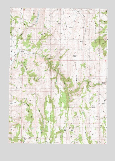
De Armond Mountain, OR USGS Topographic Map
Click on map above to begin viewing in our Map Viewer.

This topographic map contains these locations and features:
Feature Name Type Latitude Longitude GNIS ID View Map
Angel Wells ReservoirReservoirN43.9088°W118.0152°1116949View Map
Baker SpringSpringN43.9074°W118.0177°1131771View Map
Barrel SpringSpringN43.8797°W118.0994°1117258View Map
Becker ReservoirReservoirN43.9129°W118.0085°1160718View Map
Bendire CreekStreamN43.9602°W118.1171°1637893View Map
Bendire MountainSummitN43.9802°W118.0541°1637894View Map
Bendire RidgeRidgeN43.9693°W118.0171°1637895View Map
Big FlatFlatN43.9443°W118.0024°1131787View Map
Big Flat SpringSpringN43.9499°W118.0002°1131798View Map
Burnt Mountain ReservoirReservoirN43.8757°W118.0681°1160717View Map
De Armond MountainSummitN43.9479°W118.0430°1119727View Map
Goldy ReservoirReservoirN43.9822°W118.0454°1121223View Map
Indian SpringSpringN43.8878°W118.0430°1122245View Map
Juniper ReservoirReservoirN43.9856°W118.0602°1122604View Map
Juniper SpringSpringN43.8876°W118.0546°1122614View Map
Lower Morton SpringSpringN43.9821°W118.0299°1123573View Map
Morton SpringSpringN43.9696°W118.0325°1124380View Map
Munkers RanchLocaleN43.9596°W118.1066°1162318View Map
Munkers SpringSpringN43.9407°W118.0316°1131775View Map
Murphy DamDamN43.9866°W118.0920°1133620View Map
Murphy ReservoirReservoirN43.9916°W118.0897°1124554View Map
North Fork Warm Springs CreekStreamN43.9218°W118.0496°1124816View Map
Pole GulchValleyN43.9582°W118.1049°1125536View Map
Poverty FlatFlatN43.9129°W118.1199°1125628View Map
Poverty Flat SpringSpringN43.9067°W118.0993°1131780View Map
Rattlesnake ReservoirReservoirN43.9560°W118.0397°1160719View Map
Rattlesnake SpringSpringN43.9557°W118.0399°1131781View Map
Rodeo SpringSpringN43.8832°W118.0538°1131772View Map
Slaughter GulchValleyN43.9124°W118.1085°1127060View Map
Table ReservoirReservoirN43.9884°W118.0749°1127866View Map
Warm Springs ReservoirReservoirN43.9309°W118.0069°1128655View Map

Note: Coordinates in the location and feature list above are referenced to NAD83 datum.


Copyright (C) 2008-2024 Ryan Niemi / Sunset Dynamics ... All Rights Reserved