TopoQuest Logo
Do you find TopoQuest useful?
Help keep TopoQuest running and adding new maps/features by donating!
Bitcoin:  19c7KJd3qBynnjoSw5npx9KScwjBe4ifkT
Litecoin:  LXs6TkuXGGXo1vDsWCkWVdjQX94eUKd6ui
Home View Maps Find Maps Find Places Resources & Links


Dawson, Iowa Topographic Map

USGS Map Title: Dawson, IA
USGS Map MRC: 41094G2
DRG (GeoTIFF) Download: o41094g2.tif


Neighboring USGS Topographic Map Quads:


  Cooper, IA  
41094H3
 

  Rippey, IA  
41094H2
 

  Berkley, IA  
41094H1
 

  Yale, IA  
41094G3
 

  Dawson, IA  
41094G2
 

  Perry, IA  
41094G1
 

  Panora, IA  
41094F3
 

  Adel NW, IA  
41094F2
 

  Panther, IA  
41094F1


Map MRC Location:

N42°
W95°
N42°
W94°
H8 H7 H6 H5 H4 H3 H2 H1
G8 G7 G6 G5 G4 G3 G2 G1
F8 F7 F6 F5 F4 F3 F2 F1
E8 E7 E6 E5 E4 E3 E2 E1
D8 D7 D6 D5 D4 D3 D2 D1
C8 C7 C6 C5 C4 C3 C2 C1
B8 B7 B6 B5 B4 B3 B2 B1
A8 A7 A6 A5 A4 A3 A2 A1
N41°
W95°
N41°
W94°

Dawson, IA USGS 1:24K Topographic Map Preview:
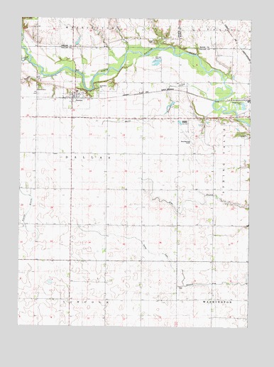
Dawson, IA USGS Topographic Map
Click on map above to begin viewing in our Map Viewer.

This topographic map contains these locations and features:
Feature Name Type Latitude Longitude GNIS ID View Map
Alton SchoolSchoolN41.8489°W94.1261°454158View Map
Angus CemeteryCemeteryN41.8658°W94.1777°1823134View Map
Bower CemeteryCemeteryN41.8655°W94.1783°454773View Map
Bucks BranchStreamN41.8425°W94.1455°454943View Map
Cargill Incorporated ElevatorLocaleN41.8428°W94.2225°1996349View Map
City of DawsonCivilN41.8431°W94.2203°2394470View Map
Dallas Township CemeteriesCemeteryN41.8471°W94.2413°455776View Map
DawsonPopulated PlaceN41.8428°W94.2225°455814View Map
DawsonLocaleN41.8422°W94.2197°1996350View Map
Dawson Fire DepartmentBuildingN41.8418°W94.2218°2577221View Map
Dawson Post OfficePost OfficeN41.8439°W94.2217°1996348View Map
Dawson School Number 7SchoolN41.7914°W94.1827°465665View Map
Fannys BranchStreamN41.8519°W94.2389°1823135View Map
Garfield SchoolSchoolN41.7950°W94.1447°456837View Map
Greenbrier CreekStreamN41.8586°W94.2461°457117View Map
Perry Municipal AirportAirportN41.8284°W94.1593°466917View Map
Pilot Lake (historical)LakeN41.7589°W94.2113°465441View Map
Snake CreekStreamN41.8617°W94.1925°461722View Map
Sportsmens ParkParkN41.8472°W94.2100°1823170View Map
Township of DallasCivilN41.8199°W94.2223°467675View Map
United Methodist ChurchChurchN41.8428°W94.2225°1996347View Map
Valleyview CemeteryCemeteryN41.8281°W94.1260°463170View Map
West Central Co-op ElevatorLocaleN41.8428°W94.2225°1996346View Map

Note: Coordinates in the location and feature list above are referenced to NAD83 datum.


Copyright (C) 2008-2024 Ryan Niemi / Sunset Dynamics ... All Rights Reserved