TopoQuest Logo
Do you find TopoQuest useful?
Help keep TopoQuest running and adding new maps/features by donating!
Bitcoin:  19c7KJd3qBynnjoSw5npx9KScwjBe4ifkT
Litecoin:  LXs6TkuXGGXo1vDsWCkWVdjQX94eUKd6ui
Home View Maps Find Maps Find Places Resources & Links


Davis, California Topographic Map

USGS Map Title: Davis, CA
USGS Map MRC: 38121E6
DRG (GeoTIFF) Download: o38121e6.tif


Neighboring USGS Topographic Map Quads:


  Woodland, CA  
38121F7
 

  Grays Bend, CA  
38121F6
 

  Taylor Monument, CA  
38121F5
 

  Merritt, CA  
38121E7
 

  Davis, CA  
38121E6
 

  Sacramento West, CA  
38121E5
 

  Dixon, CA  
38121D7
 

  Saxon, CA  
38121D6
 

  Clarksburg, CA  
38121D5


Map MRC Location:

N39°
W122°
N39°
W121°
H8 H7 H6 H5 H4 H3 H2 H1
G8 G7 G6 G5 G4 G3 G2 G1
F8 F7 F6 F5 F4 F3 F2 F1
E8 E7 E6 E5 E4 E3 E2 E1
D8 D7 D6 D5 D4 D3 D2 D1
C8 C7 C6 C5 C4 C3 C2 C1
B8 B7 B6 B5 B4 B3 B2 B1
A8 A7 A6 A5 A4 A3 A2 A1
N38°
W122°
N38°
W121°

Davis, CA USGS 1:24K Topographic Map Preview:
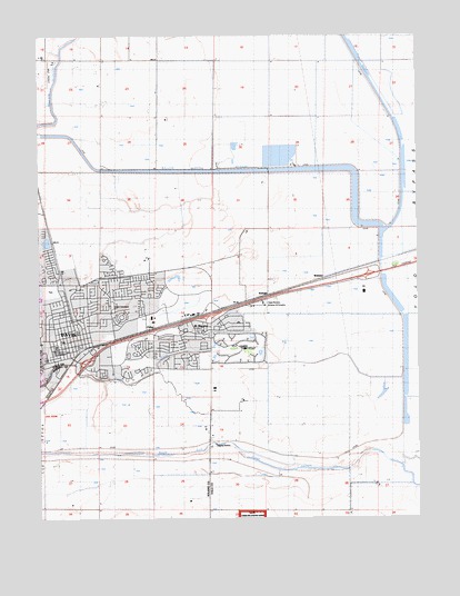
Davis, CA USGS Topographic Map
Click on map above to begin viewing in our Map Viewer.

This topographic map contains these locations and features:
Feature Name Type Latitude Longitude GNIS ID View Map
A Street Intramural FieldParkN38.5441°W121.7477°1665463View Map
Birch Lane Elementary SchoolSchoolN38.5606°W121.7273°219307View Map
Briggston (historical)Populated PlaceN38.5313°W121.7489°1666064View Map
Buehler Alumni-Visitors CenterBuildingN38.5352°W121.7480°1665468View Map
Cedar ParkParkN38.5507°W121.7361°1703122View Map
Central ParkParkN38.5463°W121.7450°1703123View Map
Chestnut ParkParkN38.5563°W121.7297°1703124View Map
City of DavisCivilN38.5552°W121.7366°2410296View Map
Civic Center ParkParkN38.5477°W121.7466°1703129View Map
Community ParkParkN38.5596°W121.7469°1703133View Map
Covell ParkParkN38.5663°W121.7491°1703135View Map
DavisPopulated PlaceN38.5449°W121.7405°277498View Map
Davis Branch Yolo County LibraryBuildingN38.5569°W121.7472°1703136View Map
Davis Cemetery District and ArboretumCemeteryN38.5552°W121.7269°222041View Map
Davis DivisionCivilN38.5554°W121.7023°1935068View Map
Davis Fire Department Station 31BuildingN38.5468°W121.7424°2623668View Map
Davis Fire Department Station 33BuildingN38.5493°W121.6948°2624384View Map
Davis Mobile EstatesPopulated PlaceN38.5422°W121.7381°2507929View Map
Davis Police DepartmentBuildingN38.5511°W121.7190°2755811View Map
Davis Post OfficePost OfficeN38.5483°W121.7258°2769351View Map
Downtown Davis Post OfficePost OfficeN38.5441°W121.7428°1703139View Map
Dry SloughStreamN38.6021°W121.7422°1662202View Map
El MaceroPopulated PlaceN38.5469°W121.6941°1655989View Map
El Macero Golf and Country ClubLocaleN38.5430°W121.6847°1703145View Map
Emerson Junior High SchoolSchoolN38.5477°W121.7452°223179View Map
First Church of Christ ScientistChurchN38.5482°W121.7433°1703153View Map
Hickey GymnasiumBuildingN38.5438°W121.7486°1665479View Map
Hill ParkParkN38.5607°W121.7163°1703165View Map
Howard Intramural FieldParkN38.5452°W121.7497°1665481View Map
King HallBuildingN38.5360°W121.7500°1665486View Map
KSFM-FM (Woodland)TowerN38.5888°W121.7261°1665144View Map
Lake SpaffordReservoirN38.5374°W121.7479°1665508View Map
Martin Luther King Junior High SchoolSchoolN38.5489°W121.7463°1703179View Map
Medlock FieldAirportN38.6186°W121.7478°1653383View Map
Memorial UnionBuildingN38.5424°W121.7494°1665492View Map
Mrak HallBuildingN38.5371°W121.7491°1665494View Map
North Davis Elementary SchoolSchoolN38.5573°W121.7453°229629View Map
North HallBuildingN38.5419°W121.7483°1665495View Map
O W Holmes Junior High SchoolSchoolN38.5566°W121.7370°230015View Map
Oak Grove ParkParkN38.5657°W121.7286°1703181View Map
Olson HallBuildingN38.5402°W121.7475°1665496View Map
Pioneer Elementary SchoolSchoolN38.5512°W121.6855°1703183View Map
Pioneer ParkParkN38.5513°W121.6872°1703184View Map
Play Fields ParkParkN38.5444°W121.7247°1703186View Map
Putah CreekStreamN38.5432°W121.6975°234522View Map
Rancho Yolo Mobile Home ParkPopulated PlaceN38.5522°W121.7239°2507913View Map
Royal Oak Manufactured Home CommunityPopulated PlaceN38.5447°W121.7300°2507909View Map
Saint James SchoolSchoolN38.5538°W121.7477°1703195View Map
Shields LibraryBuildingN38.5402°W121.7489°1665506View Map
South HallBuildingN38.5413°W121.7480°1665507View Map
Sproul HallBuildingN38.5402°W121.7469°1665509View Map
State Nursery Division of ForestryLocaleN38.5555°W121.6766°1654468View Map
SwinglePopulated PlaceN38.5582°W121.6755°1656352View Map
Sykes SloughStreamN38.5357°W121.7297°1666078View Map
Toomey FieldParkN38.5452°W121.7483°1665513View Map
Valley Oak Elementary SchoolSchoolN38.5527°W121.7336°1703206View Map
Veterans Memorial BuildingBuildingN38.5569°W121.7477°1703209View Map
Voorhies HallBuildingN38.5413°W121.7469°1665515View Map
WebsterPopulated PlaceN38.5621°W121.6552°1656402View Map
Willow Slough BypassCanalN38.5894°W121.6983°237933View Map
Wyatt Pavilion TheatreBuildingN38.5382°W121.7466°1665520View Map
Yolo County Central LandfillLocaleN38.5969°W121.6869°2705319View Map
Young HallBuildingN38.5424°W121.7477°1665521View Map

Note: Coordinates in the location and feature list above are referenced to NAD83 datum.


Copyright (C) 2008-2024 Ryan Niemi / Sunset Dynamics ... All Rights Reserved