TopoQuest Logo
Do you find TopoQuest useful?
Help keep TopoQuest running and adding new maps/features by donating!
Bitcoin:  19c7KJd3qBynnjoSw5npx9KScwjBe4ifkT
Litecoin:  LXs6TkuXGGXo1vDsWCkWVdjQX94eUKd6ui
Home View Maps Find Maps Find Places Resources & Links


Danville, Arkansas Topographic Map

USGS Map Title: Danville, AR
USGS Map MRC: 35093A4
DRG (GeoTIFF) Download: o35093a4.tif


Neighboring USGS Topographic Map Quads:


  Magazine Mountain NE, AR  
35093B5
 

  Chickalah Mountain West, AR  
35093B4
 

  Chickalah Mountain East, AR  
35093B3
 

  Havana, AR  
35093A5
 

  Danville, AR  
35093A4
 

  Danville Mountain, AR  
35093A3
 

  Bluffton, AR  
34093H5
 

  Rover, AR  
34093H4
 

  Plainview, AR  
34093H3


Map MRC Location:

N36°
W94°
N36°
W93°
H8 H7 H6 H5 H4 H3 H2 H1
G8 G7 G6 G5 G4 G3 G2 G1
F8 F7 F6 F5 F4 F3 F2 F1
E8 E7 E6 E5 E4 E3 E2 E1
D8 D7 D6 D5 D4 D3 D2 D1
C8 C7 C6 C5 C4 C3 C2 C1
B8 B7 B6 B5 B4 B3 B2 B1
A8 A7 A6 A5 A4 A3 A2 A1
N35°
W94°
N35°
W93°

Danville, AR USGS 1:24K Topographic Map Preview:
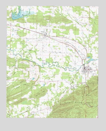
Danville, AR USGS Topographic Map
Click on map above to begin viewing in our Map Viewer.

This topographic map contains these locations and features:
Feature Name Type Latitude Longitude GNIS ID View Map
15th Judicial District Drug Task ForceBuildingN35.0571°W93.3945°2118868View Map
Bailey BranchStreamN35.0501°W93.4049°70486View Map
Bailey Branch LakeReservoirN35.0368°W93.4491°80426View Map
Bailey Branch R C and D Structure One DamDamN35.0384°W93.4485°80425View Map
Bailey School (historical)SchoolN35.0373°W93.4588°67854View Map
BellevillePopulated PlaceN35.0931°W93.4485°76294View Map
Belleville Fire DepartmentBuildingN35.0927°W93.4477°2116129View Map
Belleville Post OfficePost OfficeN35.0928°W93.4486°84998View Map
Belleville RidgeRidgeN35.0887°W93.4141°70618View Map
Blackman HollowValleyN35.0337°W93.4696°70706View Map
Buckman LakeLakeN35.0758°W93.4707°74718View Map
Caroline BranchStreamN35.0509°W93.4035°67863View Map
Cedar Creek Ranch AirportAirportN35.1250°W93.4767°83636View Map
Cedar Hill School (historical)SchoolN35.1243°W93.3874°67867View Map
Cedar Piney Lake DamDamN35.1134°W93.4935°80412View Map
Cedar-Piney LakeReservoirN35.1138°W93.4864°74733View Map
Chambers LakeReservoirN35.0437°W93.4636°80424View Map
Chambers Lake DamDamN35.0451°W93.4619°80423View Map
Chambers Memorial HospitalHospitalN35.0545°W93.3881°67968View Map
City of BellevilleCivilN35.0916°W93.4456°2403845View Map
City of DanvilleCivilN35.0528°W93.3903°2404184View Map
CorinthPopulated PlaceN35.0734°W93.4294°71230View Map
Corinth School (historical)SchoolN35.0740°W93.4341°67871View Map
Cowger LakeLakeN35.0524°W93.4100°74766View Map
DanvillePopulated PlaceN35.0540°W93.3935°81853View Map
Danville CemeteryCemeteryN35.0540°W93.3966°2027408View Map
Danville Fire DepartmentBuildingN35.0541°W93.3835°2116340View Map
Danville High SchoolSchoolN35.0519°W93.3916°67881View Map
Danville Municipal AirportAirportN35.0869°W93.4323°2650747View Map
Danville Police DepartmentBuildingN35.0547°W93.3811°2118871View Map
Danville Post OfficePost OfficeN35.0545°W93.3893°85009View Map
Deadman CreekStreamN35.0676°W93.4802°71348View Map
Dowel Town RidgesRidgeN35.0276°W93.4535°71415View Map
Dry BranchStreamN35.1137°W93.4196°71428View Map
Dutch CreekStreamN35.0537°W93.4027°81856View Map
Earl Ladd Memorial CemeteryCemeteryN35.0362°W93.4077°72275View Map
Few BranchStreamN35.0873°W93.4530°71608View Map
Fourche Ranger StationLocaleN35.0529°W93.3780°74446View Map
Fox LakeSwampN35.0456°W93.4110°71676View Map
Harris CemeteryCemeteryN35.0393°W93.3968°71916View Map
Harris ChapelLocaleN35.0990°W93.4907°71920View Map
Horseshoe LakeLakeN35.0605°W93.4511°74913View Map
Jones RidgeRidgeN35.1090°W93.4549°72217View Map
Little Petit Jean RiverStreamN35.0634°W93.4657°72412View Map
Lower Spring Creek CemeteryCemeteryN35.1065°W93.3974°72514View Map
Lower Spring Creek Presbyterian Church (historical)ChurchN35.1073°W93.3977°67905View Map
Lower Spring Creek School (historical)SchoolN35.1073°W93.3977°67906View Map
Lynch CemeteryCemeteryN35.1154°W93.4796°72521View Map
MacedoniaPopulated PlaceN35.0059°W93.4660°72526View Map
Macedonia CemeteryCemeteryN35.0112°W93.4377°72528View Map
Macedonia School (historical)SchoolN35.0026°W93.4685°67908View Map
Mason LakeLakeN35.0656°W93.4565°75015View Map
McCargo BranchStreamN35.0645°W93.3827°72581View Map
Millan (historical)Populated PlaceN35.1070°W93.4007°67911View Map
Moss CreekStreamN35.0009°W93.4994°72741View Map
Petite BranchStreamN35.0593°W93.4571°73056View Map
Pleasant Home Church (historical)ChurchN35.0440°W93.4744°67969View Map
Riley CreekStreamN35.0668°W93.4863°78178View Map
Riley Creek (historical)Populated PlaceN35.0556°W93.4877°67970View Map
Riley Creek CemeteryCemeteryN35.0559°W93.4871°73301View Map
Russell BranchStreamN35.0734°W93.4607°73442View Map
Russell CemeteryCemeteryN35.0868°W93.4549°73443View Map
S C Tucker Elementary SchoolSchoolN35.0529°W93.3902°67947View Map
S C Tucker Elementary SchoolSchoolN35.0531°W93.3908°2039182View Map
Spring CreekStreamN35.0620°W93.3888°73671View Map
Springdale Church (historical)ChurchN35.0984°W93.3882°67957View Map
Surrat SloughStreamN35.0629°W93.4460°73787View Map
The BackboneRidgeN35.0370°W93.4857°73844View Map
The IslandIslandN35.0681°W93.4749°73845View Map
Thompson CemeteryCemeteryN35.1198°W93.4810°73856View Map
Town of CorinthCivilN35.0690°W93.4235°2406313View Map
Township of DanvilleCivilN35.0474°W93.3906°69873View Map
Township of FergusonCivilN35.0842°W93.4727°69876View Map
Township of Reed Keathly (historical)CivilN35.0584°W93.4960°69887View Map
Western Yell County Elementary SchoolSchoolN35.0936°W93.4459°67964View Map
Yell CountyCivilN35.0026°W93.4112°69908View Map
Yell County Emergency Medical ServicesBuildingN35.0542°W93.3833°2119101View Map
Yell County Hospital HeliportAirportN35.0545°W93.3877°83671View Map
Yell County Sheriff Danville OfficeBuildingN35.0572°W93.3939°2118869View Map

Note: Coordinates in the location and feature list above are referenced to NAD83 datum.


Copyright (C) 2008-2024 Ryan Niemi / Sunset Dynamics ... All Rights Reserved