TopoQuest Logo
Do you find TopoQuest useful?
Help keep TopoQuest running and adding new maps/features by donating!
Bitcoin:  19c7KJd3qBynnjoSw5npx9KScwjBe4ifkT
Litecoin:  LXs6TkuXGGXo1vDsWCkWVdjQX94eUKd6ui
Home View Maps Find Maps Find Places Resources & Links


Dannemora, New York Topographic Map

USGS Map Title: Dannemora, NY
USGS Map MRC: 44073F6
DRG (GeoTIFF) Download: o44073f6.tif


Neighboring USGS Topographic Map Quads:


  Ellenburg Mountain, NY  
44073G7
 

  Jericho, NY  
44073G6
 

  West Chazy, NY  
44073G5
 

  Moffitsville, NY  
44073F7
 

  Dannemora, NY  
44073F6
 

  Morrisonville, NY  
44073F5
 

  Redford, NY  
44073E7
 

  Peasleeville, NY  
44073E6
 

  Peru, NY  
44073E5


Map MRC Location:

N45°
W74°
N45°
W73°
H8 H7 H6 H5 H4 H3 H2 H1
G8 G7 G6 G5 G4 G3 G2 G1
F8 F7 F6 F5 F4 F3 F2 F1
E8 E7 E6 E5 E4 E3 E2 E1
D8 D7 D6 D5 D4 D3 D2 D1
C8 C7 C6 C5 C4 C3 C2 C1
B8 B7 B6 B5 B4 B3 B2 B1
A8 A7 A6 A5 A4 A3 A2 A1
N44°
W74°
N44°
W73°

Dannemora, NY USGS 1:24K Topographic Map Preview:
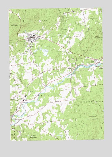
Dannemora, NY USGS Topographic Map
Click on map above to begin viewing in our Map Viewer.

This topographic map contains these locations and features:
Feature Name Type Latitude Longitude GNIS ID View Map
Behan BrookStreamN44.6684°W73.7107°943563View Map
CadyvillePopulated PlaceN44.6981°W73.6315°945429View Map
Cadyville Post OfficePost OfficeN44.6978°W73.6330°2598574View Map
Cadyville Wesleyan ChurchChurchN44.6982°W73.6304°2597557View Map
Campbell's GreenhouseLocaleN44.6908°W73.7103°2559398View Map
Canfield BrookStreamN44.6878°W73.6663°945770View Map
Clinton Correctional FacilityBuildingN44.7233°W73.7210°974352View Map
Clinton Correctional Facility AnnexBuildingN44.7236°W73.7159°2756182View Map
Clinton CountyCivilN44.7462°W73.6782°974108View Map
Corners BrookStreamN44.6600°W73.7299°947473View Map
DannemoraPopulated PlaceN44.7214°W73.7238°948021View Map
Dannemora MountainSummitN44.7362°W73.7293°948022View Map
Dannemora Post OfficePost OfficeN44.7225°W73.7169°2781151View Map
Dannemora Town HallBuildingN44.7219°W73.7244°2598620View Map
Dannemora Village Water Treatment PlantLocaleN44.7069°W73.7104°2598626View Map
Duquette FarmsLocaleN44.6828°W73.6347°2703161View Map
ElsinorePopulated PlaceN44.6937°W73.6668°949610View Map
Kelly BrookStreamN44.6959°W73.6435°954469View Map
Picketts CornersLocaleN44.6609°W73.7346°960337View Map
Russia MountainSummitN44.6300°W73.7485°963120View Map
Ryans BrookStreamN44.6475°W73.7343°963138View Map
Saint James Minor ChurchChurchN44.6987°W73.6354°963565View Map
Saint Josephs CemeteryCemeteryN44.7183°W73.7228°963737View Map
Saint Josephs SchoolSchoolN44.7139°W73.7210°963789View Map
SaranacPopulated PlaceN44.6514°W73.7435°964478View Map
Saranac Central SchoolSchoolN44.6634°W73.7310°964479View Map
Saranac High SchoolSchoolN44.6667°W73.7288°964480View Map
Saranac Middle SchoolSchoolN44.6667°W73.7293°2597549View Map
Saranac Town HallBuildingN44.6417°W73.7495°2598623View Map
Saranac United Methodist ChurchChurchN44.6525°W73.7415°2597583View Map
State Hospital CemeteryCemeteryN44.7304°W73.7058°966269View Map
State Prison and Hospital CemeteryCemeteryN44.7073°W73.7187°966277View Map
State Prison CemeteryCemeteryN44.7089°W73.7239°966278View Map
Village of DannemoraCivilN44.7197°W73.7185°2391632View Map

Note: Coordinates in the location and feature list above are referenced to NAD83 datum.


Copyright (C) 2008-2024 Ryan Niemi / Sunset Dynamics ... All Rights Reserved