TopoQuest Logo
Do you find TopoQuest useful?
Help keep TopoQuest running and adding new maps/features by donating!
Bitcoin:  19c7KJd3qBynnjoSw5npx9KScwjBe4ifkT
Litecoin:  LXs6TkuXGGXo1vDsWCkWVdjQX94eUKd6ui
Home View Maps Find Maps Find Places Resources & Links


Cutler, Ohio Topographic Map

USGS Map Title: Cutler, OH
USGS Map MRC: 39081C7
DRG (GeoTIFF) Download: o39081c7.tif


Neighboring USGS Topographic Map Quads:


  Amesville, OH  
39081D8
 

  Chesterhill, OH  
39081D7
 

  Watertown, OH  
39081D6
 

  Stewart, OH  
39081C8
 

  Cutler, OH  
39081C7
 

  Little Hocking, OH  
39081C6
 

  Alfred, OH  
39081B8
 

  Coolville, OH  
39081B7
 

  Lubeck, WV  
39081B6


Map MRC Location:

N40°
W82°
N40°
W81°
H8 H7 H6 H5 H4 H3 H2 H1
G8 G7 G6 G5 G4 G3 G2 G1
F8 F7 F6 F5 F4 F3 F2 F1
E8 E7 E6 E5 E4 E3 E2 E1
D8 D7 D6 D5 D4 D3 D2 D1
C8 C7 C6 C5 C4 C3 C2 C1
B8 B7 B6 B5 B4 B3 B2 B1
A8 A7 A6 A5 A4 A3 A2 A1
N39°
W82°
N39°
W81°

Cutler, OH USGS 1:24K Topographic Map Preview:
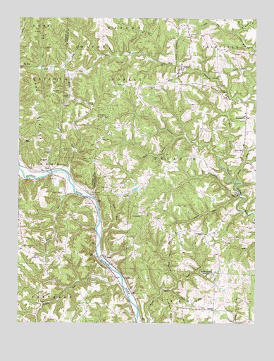
Cutler, OH USGS Topographic Map
Click on map above to begin viewing in our Map Viewer.

This topographic map contains these locations and features:
Feature Name Type Latitude Longitude GNIS ID View Map
Badger LakeReservoirN39.3047°W81.8133°1077767View Map
Badger Lake DamDamN39.3051°W81.8115°1077766View Map
Barrows CemeteryCemeteryN39.3029°W81.8367°1075312View Map
BeebePopulated PlaceN39.3129°W81.8579°1075336View Map
Beebe CemeteryCemeteryN39.3130°W81.8674°1075337View Map
Bethany CemeteryCemeteryN39.2770°W81.8646°1699464View Map
Bethany ChurchChurchN39.2767°W81.8640°1075353View Map
Big RunPopulated PlaceN39.3554°W81.8726°1075380View Map
Bogie HollowValleyN39.2676°W81.7907°1075419View Map
Bogie RunStreamN39.2634°W81.7940°1075420View Map
Boyles CemeteryCemeteryN39.3426°W81.8496°1075430View Map
Burnett CemeteryCemeteryN39.3448°W81.7662°1075485View Map
Burnett RunStreamN39.3415°W81.7621°1075486View Map
Butts CemeteryCemeteryN39.2990°W81.8361°1075497View Map
Centenary ChurchChurchN39.3673°W81.7851°1075552View Map
Centennial ChurchChurchN39.2937°W81.8104°1075553View Map
Centennial Church CemeteryCemeteryN39.2945°W81.8104°1963887View Map
Centerpoint MissionChurchN39.2865°W81.7776°1075557View Map
Crippen CemeteryCemeteryN39.3088°W81.8554°1075653View Map
Cubbison RidgeRidgeN39.2545°W81.7943°1075659View Map
CutlerPopulated PlaceN39.3542°W81.7901°1075667View Map
Cutler Elementary SchoolSchoolN39.3531°W81.7890°1050608View Map
Cutler SchoolSchoolN39.3495°W81.7965°1075669View Map
Dark Cave RunStreamN39.2673°W81.7915°1039582View Map
Decatur ChapelChurchN39.3215°W81.7557°1039634View Map
DecaturvillePopulated PlaceN39.3348°W81.7549°1075695View Map
Ellis RunStreamN39.3517°W81.8490°1075804View Map
Falls CreekStreamN39.3709°W81.7560°1058197View Map
Finsterwald CemeteryCemeteryN39.3162°W81.8632°1075849View Map
FrostPopulated PlaceN39.2767°W81.8296°1064690View Map
Frost Post Office (historical)Post OfficeN39.2765°W81.8304°1964646View Map
Gilbert RunStreamN39.3184°W81.7701°1075916View Map
Haga ChurchChurchN39.3337°W81.8657°1075978View Map
Haga Church CemeteryCemeteryN39.3331°W81.8657°1699495View Map
Haga MissionChurchN39.3248°W81.8718°1075979View Map
Haga RidgeRidgeN39.3379°W81.8682°1075980View Map
Harris CemeteryCemeteryN39.3567°W81.8199°1076013View Map
Hatch CemeteryCemeteryN39.3206°W81.8492°1076022View Map
Hatch Fork Big RunStreamN39.3540°W81.8521°1076023View Map
IrelandPopulated PlaceN39.2556°W81.7715°1076114View Map
Ireland CemeteryCemeteryN39.2728°W81.7765°1699500View Map
Jarvis CemeteryCemeteryN39.3398°W81.8362°1076136View Map
Joes RunStreamN39.3542°W81.8632°1076147View Map
Jordan RunStreamN39.2662°W81.8204°1058206View Map
Ladd CemeteryCemeteryN39.3057°W81.8279°1076199View Map
Laurel RunStreamN39.3026°W81.7585°1076211View Map
Lead RunStreamN39.2859°W81.8324°1076222View Map
Long RunStreamN39.3687°W81.7610°1076300View Map
Longs RunStreamN39.3081°W81.7579°1076305View Map
Miller CemeteryCemeteryN39.3477°W81.8190°1076392View Map
Mount Liberty Chapel CemeteryCemeteryN39.3342°W81.8301°1963923View Map
Mount Liberty ChurchChurchN39.3342°W81.8310°1043579View Map
Nellis RunStreamN39.3534°W81.8637°1058840View Map
Norris CemeteryCemeteryN39.3682°W81.8077°1043897View Map
Old Decatur Chapel CemeteryCemeteryN39.3215°W81.7560°1963926View Map
QualeyPopulated PlaceN39.3548°W81.7585°1065241View Map
Rock BridgeArchN39.3117°W81.8197°1679035View Map
Root BridgeBridgeN39.3426°W81.7543°1050609View Map
Rowell CemeteryCemeteryN39.3034°W81.8529°1076776View Map
Rowell RunStreamN39.3037°W81.8460°1076777View Map
Sawyer CemeteryCemeteryN39.3465°W81.8065°1076842View Map
South Fork Gilbert RunStreamN39.3259°W81.7926°1076934View Map
South Fork Laurel RunStreamN39.3012°W81.7607°1076935View Map
Timothy Jones CemeteryCemeteryN39.3462°W81.8574°1699545View Map
Township of DecaturCivilN39.3153°W81.7822°1087129View Map
Troy CemeteryCemeteryN39.2687°W81.8229°1699548View Map
Troy ChurchChurchN39.2687°W81.8235°1077076View Map
Twomile RunStreamN39.3117°W81.8496°1077091View Map
Wildcat RunStreamN39.3612°W81.8157°1077191View Map
Wyers CemeteryCemeteryN39.2812°W81.8726°1077237View Map

Note: Coordinates in the location and feature list above are referenced to NAD83 datum.


Copyright (C) 2008-2024 Ryan Niemi / Sunset Dynamics ... All Rights Reserved