TopoQuest Logo
Do you find TopoQuest useful?
Help keep TopoQuest running and adding new maps/features by donating!
Bitcoin:  19c7KJd3qBynnjoSw5npx9KScwjBe4ifkT
Litecoin:  LXs6TkuXGGXo1vDsWCkWVdjQX94eUKd6ui
Home View Maps Find Maps Find Places Resources & Links


Cushing, Oklahoma Topographic Map

USGS Map Title: Cushing, OK
USGS Map MRC: 35096H7
DRG (GeoTIFF) Download: o35096h7.tif


Neighboring USGS Topographic Map Quads:


  Ripley, OK  
36096A8
 

  Twin Mounds, OK  
36096A7
 

  Yale, OK  
36096A6
 

  Tryon North, OK  
35096H8
 

  Cushing, OK  
35096H7
 

  North Village, OK  
35096H6
 

  Tryon South, OK  
35096G8
 

  Kendrick, OK  
35096G7
 

  Stroud North, OK  
35096G6


Map MRC Location:

N36°
W97°
N36°
W96°
H8 H7 H6 H5 H4 H3 H2 H1
G8 G7 G6 G5 G4 G3 G2 G1
F8 F7 F6 F5 F4 F3 F2 F1
E8 E7 E6 E5 E4 E3 E2 E1
D8 D7 D6 D5 D4 D3 D2 D1
C8 C7 C6 C5 C4 C3 C2 C1
B8 B7 B6 B5 B4 B3 B2 B1
A8 A7 A6 A5 A4 A3 A2 A1
N35°
W97°
N35°
W96°

Cushing, OK USGS 1:24K Topographic Map Preview:
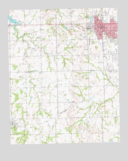
Cushing, OK USGS Topographic Map
Click on map above to begin viewing in our Map Viewer.

This topographic map contains these locations and features:
Feature Name Type Latitude Longitude GNIS ID View Map
AgraPopulated PlaceN35.8948°W96.8722°1102837View Map
Agra Elementary SchoolSchoolN35.8933°W96.8720°1790535View Map
Agra High SchoolSchoolN35.8936°W96.8727°1790247View Map
Agra Police DepartmentBuildingN35.8945°W96.8726°2757732View Map
Agra Volunteer Fire DepartmentBuildingN35.8965°W96.8713°2656816View Map
AveryPopulated PlaceN35.8842°W96.7522°1089770View Map
Avery CemeteryCemeteryN35.8981°W96.7528°1089771View Map
Church of the Brethren CemeteryCemeteryN35.9819°W96.8375°2705511View Map
Church of the NazarenceChurchN35.9831°W96.7778°1782802View Map
Cimarron Baptist AssociationChurchN35.9853°W96.7539°1782803View Map
Cimarron Correctional FacilityBuildingN35.9436°W96.7818°2766634View Map
City of CushingCivilN35.9798°W96.7603°2410279View Map
Covenant FellowshipChurchN35.9820°W96.7578°1782804View Map
CushingPopulated PlaceN35.9851°W96.7670°1091897View Map
Cushing DivisionCivilN35.9953°W96.7671°1937681View Map
Cushing Fire Department and Ambulance ServiceBuildingN35.9829°W96.7718°2656819View Map
Cushing Middle SchoolSchoolN35.9827°W96.7683°1803943View Map
Cushing Municipal AirportAirportN35.9532°W96.7728°1102433View Map
Cushing Police DepartmentBuildingN35.9847°W96.7746°2757702View Map
Cushing Regional HospitalHospitalN35.9787°W96.7569°2695752View Map
Cushing Regional Hospital HeliportAirportN35.9787°W96.7570°1102434View Map
Drakes CornerPopulated PlaceN35.9859°W96.8736°1100366View Map
Elm CreekStreamN35.9742°W96.8584°1092559View Map
First Assembly of GodChurchN35.9840°W96.7681°1782806View Map
First Baptist ChurchChurchN35.8923°W96.8672°1778561View Map
First Baptist Church-SouthernChurchN35.9812°W96.7689°1782807View Map
First Christian ChurchChurchN35.9812°W96.7703°1782808View Map
First Church of GodChurchN35.9842°W96.7709°1782810View Map
First Free Will Baptist ChurchChurchN35.9853°W96.7547°1782811View Map
First United Methodist ChurchChurchN35.9720°W96.7678°1782812View Map
Flynn CemeteryCemeteryN35.9414°W96.8378°1092914View Map
Full Gospel Assembly of GodChurchN35.9992°W96.7675°1782813View Map
Harrison Elementary SchoolSchoolN35.9749°W96.7700°1093582View Map
HSI HeliportAirportN35.9240°W96.7845°1102435View Map
Lone Oak Community HallLocaleN35.9276°W96.7842°1094911View Map
Lutheran Church-Our RedeemerChurchN35.9795°W96.7634°1782815View Map
Lutheran Redeemers CemeteryCemeteryN35.9342°W96.7842°2704481View Map
New Life Christian CenterChurchN35.9792°W96.7692°1782816View Map
Northeast Lincoln County Fire DepartmentBuildingN35.8832°W96.7501°2657237View Map
Odum ParkParkN35.9748°W96.7589°1096176View Map
Presbyterian ChurchChurchN35.9809°W96.7703°1782809View Map
Saints Peter and Paul Catholic ChurchChurchN35.9809°W96.7692°1782818View Map
Smith CemeteryCemeteryN35.8942°W96.7880°2745648View Map
SoonervillePopulated PlaceN35.9276°W96.8375°1100840View Map
Sunnyside Elementary SchoolSchoolN35.9619°W96.7855°1098654View Map
Town of AgraCivilN35.8951°W96.8702°2412338View Map
Township of CimarronCivilN35.9778°W96.8586°1824864View Map
Township of OsageCivilN35.8778°W96.8697°1824906View Map
Township of PawneeCivilN35.8778°W96.7559°1824907View Map
Washington ParkParkN35.9937°W96.7722°1099391View Map
WildhorsePopulated PlaceN35.9128°W96.8039°1100938View Map
Wilson SchoolSchoolN35.9786°W96.7547°1099907View Map

Note: Coordinates in the location and feature list above are referenced to NAD83 datum.


Copyright (C) 2008-2024 Ryan Niemi / Sunset Dynamics ... All Rights Reserved