TopoQuest Logo
Do you find TopoQuest useful?
Help keep TopoQuest running and adding new maps/features by donating!
Bitcoin:  19c7KJd3qBynnjoSw5npx9KScwjBe4ifkT
Litecoin:  LXs6TkuXGGXo1vDsWCkWVdjQX94eUKd6ui
Home View Maps Find Maps Find Places Resources & Links


Crook Peak, Oregon Topographic Map

USGS Map Title: Crook Peak, OR
USGS Map MRC: 42120C2
DRG (GeoTIFF) Download: o42120c2.tif


Neighboring USGS Topographic Map Quads:


  Valley Falls, OR  
42120D3
 

  Little Honey Creek, OR  
42120D2
 

  Drake Peak NE, OR  
42120D1
 

  Crooked Creek Valley, OR  
42120C3
 

  Crook Peak, OR  
42120C2
 

  Drake Peak, OR  
42120C1
 

  Lakeview, OR  
42120B3
 

  Horse Prairie, OR  
42120B2
 

  Sage Hen Butte, OR  
42120B1


Map MRC Location:

N43°
W121°
N43°
W120°
H8 H7 H6 H5 H4 H3 H2 H1
G8 G7 G6 G5 G4 G3 G2 G1
F8 F7 F6 F5 F4 F3 F2 F1
E8 E7 E6 E5 E4 E3 E2 E1
D8 D7 D6 D5 D4 D3 D2 D1
C8 C7 C6 C5 C4 C3 C2 C1
B8 B7 B6 B5 B4 B3 B2 B1
A8 A7 A6 A5 A4 A3 A2 A1
N42°
W121°
N42°
W120°

Crook Peak, OR USGS 1:24K Topographic Map Preview:
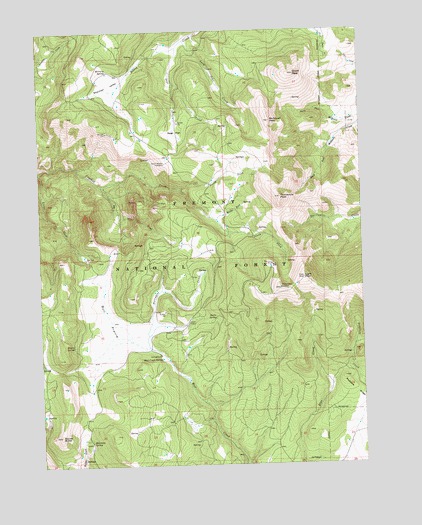
Crook Peak, OR USGS Topographic Map
Click on map above to begin viewing in our Map Viewer.

This topographic map contains these locations and features:
Feature Name Type Latitude Longitude GNIS ID View Map
Aspen CabinLocaleN42.2913°W120.1933°1117068View Map
Aspen Cabin Recreation SiteLocaleN42.2913°W120.1933°1952917View Map
Big Cove CreekStreamN42.3307°W120.2272°1117597View Map
Bull PrairieFlatN42.2924°W120.2250°1118287View Map
Crook PeakSummitN42.3621°W120.1511°1119558View Map
Drake Peak LookoutLocaleN42.3004°W120.1577°1120072View Map
Drake SpringSpringN42.2923°W120.1828°1120074View Map
Emery SpringSpringN42.2845°W120.2382°1120495View Map
Light PeakSummitN42.3035°W120.1488°1123079View Map
Long John CreekStreamN42.3721°W120.1927°1123432View Map
McDowell PeakSummitN42.3488°W120.1608°1123947View Map
Middle Fork Crooked CreekStreamN42.3204°W120.1819°1146135View Map
Military SpringSpringN42.3634°W120.2238°1124142View Map
Mud Creek Recreation SiteLocaleN42.2818°W120.2050°1167684View Map
Mud Creek SpringSpringN42.2806°W120.2043°1124451View Map
North Fork Crooked CreekStreamN42.3296°W120.1961°1124765View Map
North Warner ViewpointSummitN42.3368°W120.2016°1136580View Map
North Warner ViewpointLocaleN42.3369°W120.2020°2548687View Map
Overton Reservoir Recreation SiteLocaleN42.3746°W120.2333°1952931View Map
Porcupine CreekStreamN42.2840°W120.2088°1125564View Map
Sage CreekStreamN42.3702°W120.1958°1126433View Map
Sage FlatFlatN42.3460°W120.1969°1126436View Map
Sherman ValleyBasinN42.3577°W120.2208°1126875View Map
South Fork Crooked CreekStreamN42.3296°W120.1961°1127279View Map
South Fork Crooked Creek Horse CampLocaleN42.3163°W120.1672°1952937View Map
Squaw ButteSummitN42.2585°W120.2444°1127473View Map
Stairstep SpringSpringN42.2569°W120.2320°1127519View Map
Twelvemile PeakSummitN42.3268°W120.1572°1128332View Map
Walker TrailheadLocaleN42.2637°W120.2339°2548781View Map
Woodchopper SpringSpringN42.2527°W120.2358°1131009View Map

Note: Coordinates in the location and feature list above are referenced to NAD83 datum.


Copyright (C) 2008-2024 Ryan Niemi / Sunset Dynamics ... All Rights Reserved