TopoQuest Logo
Do you find TopoQuest useful?
Help keep TopoQuest running and adding new maps/features by donating!
Bitcoin:  19c7KJd3qBynnjoSw5npx9KScwjBe4ifkT
Litecoin:  LXs6TkuXGGXo1vDsWCkWVdjQX94eUKd6ui
Home View Maps Find Maps Find Places Resources & Links


Crockett, Texas Topographic Map

USGS Map Title: Crockett, TX
USGS Map MRC: 31095C4
DRG (GeoTIFF) Download: o31095c4.tif


Neighboring USGS Topographic Map Quads:


  Hays Spring, TX  
31095D5
 

  Grapeland, TX  
31095D4
 

  Crockett NE, TX  
31095D3
 

  Porter Springs, TX  
31095C5
 

  Crockett, TX  
31095C4
 

  Berea, TX  
31095C3
 

  Pearsons Chapel, TX  
31095B5
 

  Lovelady North, TX  
31095B4
 

  Fodice, TX  
31095B3


Map MRC Location:

N32°
W96°
N32°
W95°
H8 H7 H6 H5 H4 H3 H2 H1
G8 G7 G6 G5 G4 G3 G2 G1
F8 F7 F6 F5 F4 F3 F2 F1
E8 E7 E6 E5 E4 E3 E2 E1
D8 D7 D6 D5 D4 D3 D2 D1
C8 C7 C6 C5 C4 C3 C2 C1
B8 B7 B6 B5 B4 B3 B2 B1
A8 A7 A6 A5 A4 A3 A2 A1
N31°
W96°
N31°
W95°

Crockett, TX USGS 1:24K Topographic Map Preview:
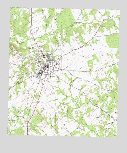
Crockett, TX USGS Topographic Map
Click on map above to begin viewing in our Map Viewer.

This topographic map contains these locations and features:
Feature Name Type Latitude Longitude GNIS ID View Map
Allday DamDamN31.2768°W95.4919°1860709View Map
Allday LakeReservoirN31.2777°W95.4950°1860710View Map
Arnold CreekStreamN31.2893°W95.4280°1351267View Map
Beaver CreekStreamN31.2693°W95.4158°1351721View Map
Box CemeteryCemeteryN31.2746°W95.4227°1352763View Map
City of CrockettCivilN31.3177°W95.4564°2410266View Map
Cook CemeteryCemeteryN31.2730°W95.4333°1354899View Map
Cook DamDamN31.2718°W95.3886°1860715View Map
Cook LakeReservoirN31.2718°W95.3886°1860716View Map
Cooks LakeLakeN31.2709°W95.3866°1377338View Map
CrockettPopulated PlaceN31.3182°W95.4566°1355365View Map
Crockett City HallBuildingN31.3195°W95.4567°2753653View Map
Crockett DivisionCivilN31.3082°W95.3802°1938658View Map
Crockett Intermediate SchoolSchoolN31.3168°W95.4552°2006287View Map
Crockett Police DepartmentBuildingN31.3196°W95.4567°2751213View Map
Crockett Post OfficePost OfficeN31.3179°W95.4559°2731201View Map
Crockett Volunteer Fire DepartmentBuildingN31.3194°W95.4558°2655232View Map
Davy Crockett Memorial ParkParkN31.3088°W95.4516°1355721View Map
Douglas School (historical)SchoolN31.2941°W95.3761°1377343View Map
Downes-Aldrich HouseBuildingN31.3199°W95.4549°2014612View Map
DrusoPopulated PlaceN31.3563°W95.3883°1377325View Map
Druso DepotBuildingN31.3541°W95.3916°1377326View Map
Dutch Smith CreekStreamN31.2827°W95.4213°1356492View Map
Early Childhood Center - CrockettSchoolN31.3013°W95.4719°2006289View Map
East Texas Medical CenterHospitalN31.3238°W95.4388°2015790View Map
Evergreen Memorial ParkParkN31.3338°W95.4666°1377455View Map
Flat BranchStreamN31.3618°W95.4177°1383093View Map
Glenwood Cemetery North SectorCemeteryN31.3221°W95.4613°1377341View Map
Glenwood Cemetery South SectorCemeteryN31.3210°W95.4608°1377340View Map
Hammond CreekStreamN31.3546°W95.4441°1358709View Map
Houston CountyCivilN31.3177°W95.4227°1383898View Map
Houston County AirportAirportN31.3124°W95.4032°1386450View Map
Houston County Constable's Office Precinct 1BuildingN31.3098°W95.4571°2751321View Map
Houston County Constable's Office Precinct 2BuildingN31.3098°W95.4572°2751322View Map
Houston County Hospital/Kings Inn HeliportAirportN31.3222°W95.4389°1384786View Map
Houston County Law Enforcement CenterBuildingN31.3189°W95.4601°2738688View Map
Houston County Museum and Visitors CenterBuildingN31.3105°W95.4619°2014613View Map
Houston County Sheriff's OfficeBuildingN31.3095°W95.4572°2751165View Map
Hunley CemeteryCemeteryN31.2657°W95.4580°1359830View Map
Jasper ChurchChurchN31.2821°W95.4013°1360164View Map
Jones ChapelChurchN31.3302°W95.4924°1360385View Map
Julian Grist Mill (historical)BuildingN31.3605°W95.3972°1377336View Map
KIVY-AM (Crockett)TowerN31.3057°W95.4519°1385538View Map
KIVY-FM (Crockett)TowerN31.3057°W95.4519°1385831View Map
Mary Allen CollegeSchoolN31.3280°W95.4599°1362243View Map
Mary Allen Seminary for Colored Girls (historical)BuildingN31.3277°W95.4633°2030787View Map
Monroe Crook HouseBuildingN31.3185°W95.4527°2014614View Map
New Hope AcademySchoolN31.3152°W95.4552°2006299View Map
Northcutt LakeReservoirN31.2768°W95.4369°1860712View Map
Northcutt Lake DamDamN31.2768°W95.4369°1860711View Map
Nottingham WoodsPopulated PlaceN31.3421°W95.4466°1377448View Map
Old Stagecoach InnBuildingN31.3585°W95.3972°1364489View Map
Pearson Chapel SchoolSchoolN31.2643°W95.4986°1364944View Map
Pleasant Grove ChurchChurchN31.2685°W95.4824°1365414View Map
Post Oak ChurchChurchN31.2582°W95.4208°1365642View Map
Rice CemeteryCemeteryN31.3577°W95.3969°1377339View Map
Rice ChapelLocaleN31.3693°W95.3955°1366413View Map
Rocky Mount ChurchChurchN31.3324°W95.4961°1366800View Map
Sands BranchStreamN31.3496°W95.4580°1367684View Map
Sims BranchStreamN31.3643°W95.4563°1368313View Map
Smith CemeteryCemeteryN31.3307°W95.3858°1368468View Map
Spring CreekStreamN31.3393°W95.4891°1368965View Map
Texas Forest Service Crockett OfficeBuildingN31.3003°W95.4713°2655581View Map
Town BranchStreamN31.3357°W95.4733°1370052View Map
Traylor DamDamN31.3252°W95.4836°1860713View Map
Traylor LakeReservoirN31.3262°W95.4843°1860714View Map

Note: Coordinates in the location and feature list above are referenced to NAD83 datum.


Copyright (C) 2008-2024 Ryan Niemi / Sunset Dynamics ... All Rights Reserved