TopoQuest Logo
Do you find TopoQuest useful?
Help keep TopoQuest running and adding new maps/features by donating!
Bitcoin:  19c7KJd3qBynnjoSw5npx9KScwjBe4ifkT
Litecoin:  LXs6TkuXGGXo1vDsWCkWVdjQX94eUKd6ui
Home View Maps Find Maps Find Places Resources & Links


Crete South, Nebraska Topographic Map

USGS Map Title: Crete South, NE
USGS Map MRC: 40096E8
DRG (GeoTIFF) Download: o40096e8.tif


Neighboring USGS Topographic Map Quads:


  Dorchester, NE  
40097F1
 

  Crete North, NE  
40096F8
 

  Denton, NE  
40096F7
 

  Pleasant Hill, NE  
40097E1
 

  Crete South, NE  
40096E8
 

  Hallam, NE  
40096E7
 

  Swanton, NE  
40097D1
 

  Wilber, NE  
40096D8
 

  Clatonia, NE  
40096D7


Map MRC Location:

N41°
W97°
N41°
W96°
H8 H7 H6 H5 H4 H3 H2 H1
G8 G7 G6 G5 G4 G3 G2 G1
F8 F7 F6 F5 F4 F3 F2 F1
E8 E7 E6 E5 E4 E3 E2 E1
D8 D7 D6 D5 D4 D3 D2 D1
C8 C7 C6 C5 C4 C3 C2 C1
B8 B7 B6 B5 B4 B3 B2 B1
A8 A7 A6 A5 A4 A3 A2 A1
N40°
W97°
N40°
W96°

Crete South, NE USGS 1:24K Topographic Map Preview:
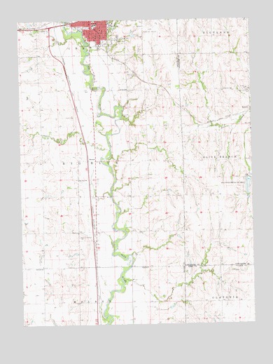
Crete South, NE USGS Topographic Map
Click on map above to begin viewing in our Map Viewer.

This topographic map contains these locations and features:
Feature Name Type Latitude Longitude GNIS ID View Map
All American Rose Test GardenParkN40.6231°W96.9484°1882572View Map
Bauer HouseBuildingN40.6186°W96.9523°1882586View Map
Bertwell SchoolSchoolN40.5236°W96.9889°827354View Map
Bethlehem Lutheran ChurchChurchN40.6208°W96.9559°1882481View Map
Big Blue Election PrecinctCivilN40.5669°W96.9700°1928731View Map
Big Blue SchoolSchoolN40.5594°W96.9686°827408View Map
Blue Valley CemeteryCemeteryN40.6025°W96.9395°827513View Map
Blue Valley Mental Health CenterHospitalN40.6214°W96.9598°1882473View Map
Bohemian National CemeteryCemeteryN40.5358°W96.9689°827552View Map
Boswell ObservatoryLocaleN40.6225°W96.9345°1882574View Map
Boy Scout CampLocaleN40.5850°W96.9425°827603View Map
Burrage HallBuildingN40.6247°W96.9503°1882581View Map
Butler Gymnasium and PoolBuildingN40.6236°W96.9492°1882566View Map
Cassell Open Air TheatreBuildingN40.6228°W96.9498°1882570View Map
Central Heating PlantBuildingN40.6200°W96.9506°1882576View Map
City of CreteCivilN40.6248°W96.9580°2393673View Map
College Heights Country ClubLocaleN40.6164°W96.9475°1882500View Map
Colonial HallBuildingN40.6247°W96.9509°1882585View Map
Communications BuildingBuildingN40.6228°W96.9486°1882571View Map
Crete City ParkParkN40.6247°W96.9592°1882491View Map
Crete Elementary SchoolSchoolN40.6231°W96.9600°1882498View Map
Crete JunctionLocaleN40.6244°W96.9753°1882463View Map
Crete ManorHospitalN40.6147°W96.9525°1882471View Map
Crete Medical ClinicHospitalN40.6247°W96.9564°1882470View Map
Crete Municipal AirportAirportN40.6216°W96.9272°837531View Map
Crete Vision ClinicHospitalN40.6239°W96.9620°1882472View Map
Crists Sky Ranch (historical)AirportN40.6222°W96.9022°837532View Map
Dean PergolaParkN40.6211°W96.9498°1882577View Map
Doane CollegeSchoolN40.6236°W96.9511°828741View Map
Doane LakeLakeN40.6216°W96.9487°1882580View Map
Doane VillageBuildingN40.6192°W96.9492°1882589View Map
Fairchild and Faculty ApartmentsBuildingN40.6175°W96.9517°1882587View Map
Faith Christian ChurchChurchN40.6236°W96.9614°1882487View Map
First Congregational United Church of ChristChurchN40.6244°W96.9570°1882484View Map
Fiske LodgeBuildingN40.6236°W96.9503°1882565View Map
Frees HallBuildingN40.6206°W96.9500°1882578View Map
Fuhrer FieldhouseBuildingN40.6244°W96.9456°1882583View Map
Gaylord HallBuildingN40.6211°W96.9514°1882575View Map
Goodall Science BuildingBuildingN40.6236°W96.9514°1882563View Map
Grace United Methodist ChurchChurchN40.6247°W96.9581°1882486View Map
Gregory GroveWoodsN40.6200°W96.9481°1882584View Map
Gus Stoll ParkParkN40.6217°W96.9656°1882494View Map
Heart CemeteryCemeteryN40.6211°W96.9817°829906View Map
KramerPopulated PlaceN40.5883°W96.8753°830548View Map
KramerLocaleN40.5883°W96.8753°1898424View Map
Kramer Post Office (historical)Post OfficeN40.5883°W96.8753°1898425View Map
Lee Memorial Chapel and Whitcomb ConservatoryBuildingN40.6222°W96.9347°1882573View Map
Little League ParkParkN40.6211°W96.9592°1882548View Map
Lothrop DamDamN40.6186°W96.9395°1769618View Map
Lothrop ReservoirLakeN40.6186°W96.9379°1769619View Map
Merrill TowerTowerN40.6231°W96.9503°1882568View Map
Miller PondLakeN40.6241°W96.9513°1882562View Map
North SchoolSchoolN40.5964°W96.9420°831727View Map
Otoe CreekStreamN40.5711°W96.9514°833752View Map
Padour-Walker Administration BuildingBuildingN40.6231°W96.9503°1882567View Map
Perkins LibraryBuildingN40.6228°W96.9486°1882497View Map
Perry Memorial Campus CenterBuildingN40.6231°W96.9498°1882569View Map
Plymouth Congregational ChurchChurchN40.6217°W96.9564°1882483View Map
Sacred Heart CemeteryCemeteryN40.6211°W96.9820°1882547View Map
Saint Johns Lutheran ChurchChurchN40.5972°W96.8761°1899255View Map
Saint Johns SchoolSchoolN40.5967°W96.8772°832929View Map
Salt Creek Dam 22-ADamN40.5600°W96.8770°1767778View Map
Salt Creek Dam 26-ADamN40.6133°W96.8836°1767794View Map
Salt Creek Dam 27-ADamN40.6150°W96.9086°1767796View Map
Salt Creek Dam 27-BDamN40.6133°W96.9036°1767800View Map
Salt Creek Dam 27-CDamN40.5883°W96.8986°1767802View Map
Salt Creek Reservoir 26-AReservoirN40.6143°W96.8855°1767795View Map
Salt Creek Reservoir 27-AReservoirN40.6160°W96.9096°1767797View Map
School Number 72SchoolN40.5961°W96.8853°837047View Map
Sheldon HallBuildingN40.6208°W96.9489°1882579View Map
ShestakLocaleN40.5681°W96.9634°1882445View Map
ShestakPopulated PlaceN40.5681°W96.9634°835446View Map
Shestak Post Office (historical)Post OfficeN40.5681°W96.9634°1882446View Map
Simon FieldParkN40.6244°W96.9478°1882582View Map
Smith HallBuildingN40.6247°W96.9514°1882561View Map
Tanglewood LakeReservoirN40.5909°W96.8986°1767803View Map
Taylor HouseBuildingN40.6192°W96.9495°1882588View Map
Teal Lake State Wildlife Management AreaParkN40.5564°W96.8753°834055View Map
Teal ReservoirReservoirN40.5577°W96.8774°1767779View Map
Township of Big BlueCivilN40.5667°W96.9670°1882621View Map
Vilda SchoolSchoolN40.5233°W96.9317°834389View Map
Whitin Art BuildingBuildingN40.6236°W96.9509°1882564View Map
Wild Plum LakeReservoirN40.6151°W96.9024°1767801View Map
Wildwood ParkParkN40.6172°W96.9539°1882493View Map

Note: Coordinates in the location and feature list above are referenced to NAD83 datum.


Copyright (C) 2008-2024 Ryan Niemi / Sunset Dynamics ... All Rights Reserved