TopoQuest Logo
Do you find TopoQuest useful?
Help keep TopoQuest running and adding new maps/features by donating!
Bitcoin:  19c7KJd3qBynnjoSw5npx9KScwjBe4ifkT
Litecoin:  LXs6TkuXGGXo1vDsWCkWVdjQX94eUKd6ui
Home View Maps Find Maps Find Places Resources & Links


Coulter, Iowa Topographic Map

USGS Map Title: Coulter, IA
USGS Map MRC: 42093F3
DRG (GeoTIFF) Download: o42093f3.tif


Neighboring USGS Topographic Map Quads:


  Alexander, IA  
42093G4
 

  Latimer, IA  
42093G3
 

  Hampton North, IA  
42093G2
 

  Dows East, IA  
42093F4
 

  Coulter, IA  
42093F3
 

  Hampton South, IA  
42093F2
 

  Popejoy, IA  
42093E4
 

  Iowa Falls West, IA  
42093E3
 

  Iowa Falls East, IA  
42093E2


Map MRC Location:

N43°
W94°
N43°
W93°
H8 H7 H6 H5 H4 H3 H2 H1
G8 G7 G6 G5 G4 G3 G2 G1
F8 F7 F6 F5 F4 F3 F2 F1
E8 E7 E6 E5 E4 E3 E2 E1
D8 D7 D6 D5 D4 D3 D2 D1
C8 C7 C6 C5 C4 C3 C2 C1
B8 B7 B6 B5 B4 B3 B2 B1
A8 A7 A6 A5 A4 A3 A2 A1
N42°
W94°
N42°
W93°

Coulter, IA USGS 1:24K Topographic Map Preview:
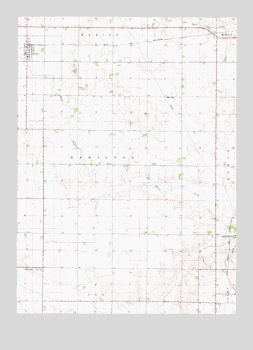
Coulter, IA USGS Topographic Map
Click on map above to begin viewing in our Map Viewer.

This topographic map contains these locations and features:
Feature Name Type Latitude Longitude GNIS ID View Map
City of CoulterCivilN42.7331°W93.3700°2393649View Map
Congress Post Office (historical)Post OfficeN42.6575°W93.2627°466478View Map
CoulterPopulated PlaceN42.7372°W93.3699°455671View Map
CoulterLocaleN42.7383°W93.3699°1944792View Map
Coulter CemeteryCemeteryN42.7389°W93.3719°1944793View Map
Coulter Community CenterBuildingN42.7372°W93.3699°1944788View Map
Coulter Post OfficePost OfficeN42.7372°W93.3699°1944789View Map
Coulter Public LibraryBuildingN42.7372°W93.3699°1944787View Map
Coulter Town HallBuildingN42.7372°W93.3699°1944791View Map
Coulter Volunteer Fire DepartmentBuildingN42.7371°W93.3690°2577323View Map
Franklin CountyCivilN42.7325°W93.2625°465223View Map
Maynes Grove CemeteryCemeteryN42.6576°W93.2517°458873View Map
Nazareth Lutheran ChurchChurchN42.7372°W93.3699°1944790View Map
ReevePopulated PlaceN42.6722°W93.2605°464108View Map
Saint Johns ChurchChurchN42.7194°W93.3399°461056View Map
Saint Johns Lutheran CemeteryCemeteryN42.7197°W93.3399°1944794View Map
Township of HamiltonCivilN42.6874°W93.3210°467992View Map
WashingtonPopulated PlaceN42.7478°W93.2713°464107View Map

Note: Coordinates in the location and feature list above are referenced to NAD83 datum.


Copyright (C) 2008-2024 Ryan Niemi / Sunset Dynamics ... All Rights Reserved