TopoQuest Logo
Do you find TopoQuest useful?
Help keep TopoQuest running and adding new maps/features by donating!
Bitcoin:  19c7KJd3qBynnjoSw5npx9KScwjBe4ifkT
Litecoin:  LXs6TkuXGGXo1vDsWCkWVdjQX94eUKd6ui
Home View Maps Find Maps Find Places Resources & Links


Cottonwood Springs, New Mexico Topographic Map

USGS Map Title: Cottonwood Springs, NM
USGS Map MRC: 35103H4
DRG (GeoTIFF) Download: o35103h4.tif


Neighboring USGS Topographic Map Quads:


  Minnie Butte, NM  
36103A5
 

  Pedernal Creek, NM  
36103A4
 

  Skull Mesa, NM  
36103A3
 

  Bueyeros NE, NM  
35103H5
 

  Cottonwood Springs, NM  
35103H4
 

  Hayden, NM  
35103H3
 

  Indian Bathtub, NM  
35103G5
 

  Rosebud, NM  
35103G4
 

  Ione, NM  
35103G3


Map MRC Location:

N36°
W104°
N36°
W103°
H8 H7 H6 H5 H4 H3 H2 H1
G8 G7 G6 G5 G4 G3 G2 G1
F8 F7 F6 F5 F4 F3 F2 F1
E8 E7 E6 E5 E4 E3 E2 E1
D8 D7 D6 D5 D4 D3 D2 D1
C8 C7 C6 C5 C4 C3 C2 C1
B8 B7 B6 B5 B4 B3 B2 B1
A8 A7 A6 A5 A4 A3 A2 A1
N35°
W104°
N35°
W103°

Cottonwood Springs, NM USGS 1:24K Topographic Map Preview:
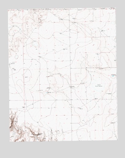
Cottonwood Springs, NM USGS Topographic Map
Click on map above to begin viewing in our Map Viewer.

This topographic map contains these locations and features:
Feature Name Type Latitude Longitude GNIS ID View Map
AdeeLocaleN35.9070°W103.4283°924300View Map
Amoco Number One State E NMineN35.9495°W103.4038°915000View Map
Big West Central WellWellN35.9248°W103.4519°886362View Map
Bobby LakeReservoirN35.9209°W103.4563°886555View Map
Chaffee WellWellN35.9764°W103.4380°887405View Map
ConeLocaleN35.9434°W103.4938°887778View Map
Cone LakeLakeN35.9487°W103.4982°887782View Map
Cottonwood SpringsSpringN35.8823°W103.4666°887939View Map
Crane WellWellN35.9503°W103.3758°888044View Map
East WellWellN35.9895°W103.4366°888739View Map
East West Central WellWellN35.9261°W103.4283°888741View Map
Ells WellWellN35.9564°W103.3961°888859View Map
Grover WellWellN35.9995°W103.3877°889642View Map
Hemphill WellWellN35.9425°W103.3950°889895View Map
Laguna Tierra AmatosaLakeN35.9271°W103.3964°897994View Map
Maytum CemeteryCemeteryN35.9439°W103.4955°891701View Map
Mosier WellWellN35.9761°W103.3752°892253View Map
North Jackard WellWellN35.9778°W103.3919°892610View Map
North School Section WellWellN35.9361°W103.3758°892655View Map
Northwest Holbert WellWellN35.8914°W103.3788°892743View Map
Northwest WellWellN35.9545°W103.4622°892747View Map
Old Swoyer WellWellN35.9864°W103.4213°892899View Map
Red WellWellN35.9142°W103.4005°893826View Map
Scales WellWellN35.9292°W103.4133°894622View Map
School Section WellWellN35.9614°W103.4363°894646View Map
School Section WellWellN35.9995°W103.3761°894647View Map
Sidenor WellWellN35.9228°W103.4650°894827View Map
South Scales WellWellN35.9061°W103.4186°895120View Map
South School Section WellWellN35.9186°W103.3816°895122View Map
TompkinsLocaleN35.8900°W103.4105°924324View Map
Vaughtrin WellWellN35.9903°W103.4222°896109View Map
Whiteside RanchLocaleN35.9078°W103.4816°896555View Map
Zahn WellWellN35.9878°W103.4019°896839View Map

Note: Coordinates in the location and feature list above are referenced to NAD83 datum.


Copyright (C) 2008-2024 Ryan Niemi / Sunset Dynamics ... All Rights Reserved