TopoQuest Logo
Do you find TopoQuest useful?
Help keep TopoQuest running and adding new maps/features by donating!
Bitcoin:  19c7KJd3qBynnjoSw5npx9KScwjBe4ifkT
Litecoin:  LXs6TkuXGGXo1vDsWCkWVdjQX94eUKd6ui
Home View Maps Find Maps Find Places Resources & Links


Corinth, Wisconsin Topographic Map

USGS Map Title: Corinth, WI
USGS Map MRC: 45090A2
DRG (GeoTIFF) Download: o45090a2.tif


Neighboring USGS Topographic Map Quads:


  Medford, WI  
45090B3
 

  Rib River Lookout Tower, WI  
45090B2
 

  Goodrich, WI  
45090B1
 

  Stetsonville, WI  
45090A3
 

  Corinth, WI  
45090A2
 

  Athens, WI  
45090A1
 

  Abbotsford, WI  
44090H3
 

  Milan, WI  
44090H2
 

  Wien, WI  
44090H1


Map MRC Location:

N46°
W91°
N46°
W90°
H8 H7 H6 H5 H4 H3 H2 H1
G8 G7 G6 G5 G4 G3 G2 G1
F8 F7 F6 F5 F4 F3 F2 F1
E8 E7 E6 E5 E4 E3 E2 E1
D8 D7 D6 D5 D4 D3 D2 D1
C8 C7 C6 C5 C4 C3 C2 C1
B8 B7 B6 B5 B4 B3 B2 B1
A8 A7 A6 A5 A4 A3 A2 A1
N45°
W91°
N45°
W90°

Corinth, WI USGS 1:24K Topographic Map Preview:
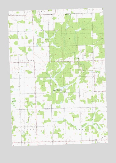
Corinth, WI USGS Topographic Map
Click on map above to begin viewing in our Map Viewer.

This topographic map contains these locations and features:
Feature Name Type Latitude Longitude GNIS ID View Map
9 ReservoirReservoirN45.0550°W90.1735°1792618View Map
Barry SchoolSchoolN45.0108°W90.2174°1561206View Map
Bern State Public Hunting GroundsParkN45.0511°W90.1849°1844052View Map
Bern TownhallBuildingN45.0689°W90.1396°1844053View Map
Black Creek 3WR130 DamDamN45.0550°W90.1735°1792617View Map
Brueckerville SchoolSchoolN45.0033°W90.2379°1562286View Map
CorinthPopulated PlaceN45.0027°W90.1393°1563398View Map
Corinth SchoolSchoolN45.0030°W90.1693°1563399View Map
Flat Meadow SchoolSchoolN45.1055°W90.2290°1565063View Map
Gad SchoolSchoolN45.1202°W90.1804°1565375View Map
Green Acre SchoolSchoolN45.0775°W90.2282°1565796View Map
Gunner FieldAirportN45.0790°W90.1749°1581864View Map
Hein's Fish FarmLocaleN45.0008°W90.1900°2723385View Map
Johnson TownhallBuildingN45.0011°W90.1390°1844168View Map
Kreie SchoolSchoolN45.0477°W90.2174°1567642View Map
Miltrim FarmsLocaleN45.0350°W90.1561°2723366View Map
Schreiner FarmsLocaleN45.0678°W90.1311°2723387View Map
Town of BernCivilN45.0777°W90.1394°1582802View Map
Van Buren SchoolSchoolN45.0619°W90.1399°1576031View Map
Washington SchoolSchoolN45.1211°W90.1268°1576278View Map
Whiton SchoolSchoolN45.0330°W90.1612°1576703View Map

Note: Coordinates in the location and feature list above are referenced to NAD83 datum.


Copyright (C) 2008-2024 Ryan Niemi / Sunset Dynamics ... All Rights Reserved