TopoQuest Logo
Do you find TopoQuest useful?
Help keep TopoQuest running and adding new maps/features by donating!
Bitcoin:  19c7KJd3qBynnjoSw5npx9KScwjBe4ifkT
Litecoin:  LXs6TkuXGGXo1vDsWCkWVdjQX94eUKd6ui
Home View Maps Find Maps Find Places Resources & Links


Corbin Knob, North Carolina Topographic Map

USGS Map Title: Corbin Knob, NC
USGS Map MRC: 35083B3
DRG (GeoTIFF) Download: o35083b3.tif


Neighboring USGS Topographic Map Quads:


  Alarka, NC  
35083C4
 

  Greens Creek, NC  
35083C3
 

  Sylva South, NC  
35083C2
 

  Franklin, NC  
35083B4
 

  Corbin Knob, NC  
35083B3
 

  Glenville, NC  
35083B2
 

  Prentiss, NC  
35083A4
 

  Scaly Mountain, NC  
35083A3
 

  Highlands, NC  
35083A2


Map MRC Location:

N36°
W84°
N36°
W83°
H8 H7 H6 H5 H4 H3 H2 H1
G8 G7 G6 G5 G4 G3 G2 G1
F8 F7 F6 F5 F4 F3 F2 F1
E8 E7 E6 E5 E4 E3 E2 E1
D8 D7 D6 D5 D4 D3 D2 D1
C8 C7 C6 C5 C4 C3 C2 C1
B8 B7 B6 B5 B4 B3 B2 B1
A8 A7 A6 A5 A4 A3 A2 A1
N35°
W84°
N35°
W83°

Corbin Knob, NC USGS 1:24K Topographic Map Preview:
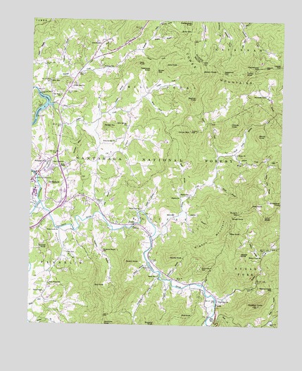
Corbin Knob, NC USGS Topographic Map
Click on map above to begin viewing in our Map Viewer.

This topographic map contains these locations and features:
Feature Name Type Latitude Longitude GNIS ID View Map
Ammons BranchStreamN35.2118°W83.3352°1008708View Map
Angel CemeteryCemeteryN35.1548°W83.3563°1008736View Map
Arnold BranchStreamN35.1715°W83.3185°1008773View Map
Battle BranchStreamN35.1757°W83.2979°1008956View Map
Berry CreekStreamN35.2187°W83.3190°1009197View Map
Berry MillPopulated PlaceN35.1695°W83.3029°1019098View Map
Bethel ChurchChurchN35.1745°W83.3390°1009214View Map
Bethlehem ChurchChurchN35.1918°W83.3677°1009226View Map
BrendletownPopulated PlaceN35.2404°W83.3404°1019286View Map
Brown CreekStreamN35.2379°W83.3221°1009654View Map
Brown GapGapN35.2293°W83.3129°1009659View Map
Bryson BranchStreamN35.1498°W83.3152°1009710View Map
Bryson KnobSummitN35.1512°W83.3265°1009720View Map
Buby GapGapN35.2457°W83.2963°1009723View Map
Burgoin GapGapN35.1707°W83.2713°1009822View Map
Buzzard KnobSummitN35.1251°W83.3118°1019454View Map
Cat CreekStreamN35.2068°W83.3490°1010091View Map
Cedar KnobSummitN35.1698°W83.2579°1019579View Map
Clark ChapelChurchN35.1381°W83.3677°1010296View Map
Clark Chapel School (historical)SchoolN35.1418°W83.3649°1010297View Map
Clarks Chapel Fire and Rescue DepartmentBuildingN35.1308°W83.3617°2639214View Map
Coon CreekStreamN35.2287°W83.3510°1010462View Map
Corbin CreekStreamN35.2187°W83.3190°1010483View Map
Corbin KnobSummitN35.2295°W83.2829°1019782View Map
Corundum HillSummitN35.1495°W83.2879°1019795View Map
Cove BranchStreamN35.1643°W83.3599°1018219View Map
Cowee Mountain MineMineN35.2301°W83.3393°1017678View Map
Cowee MountainsRangeN35.2282°W83.2743°1010525View Map
Crawford BranchStreamN35.1873°W83.3746°1010572View Map
Cross BranchStreamN35.1418°W83.2879°1010592View Map
CullasajaPopulated PlaceN35.1651°W83.3238°1019879View Map
Cullasaja Gorge Fire and Rescue DepartmentBuildingN35.1627°W83.3155°2639215View Map
Cullasaja RiverStreamN35.1751°W83.3696°1010609View Map
DeanPopulated PlaceN35.2143°W83.3596°1019931View Map
Deerlick KnobSummitN35.2176°W83.2929°1019942View Map
Dills KnobSummitN35.1284°W83.2977°1019974View Map
Dowdle KnobSummitN35.1565°W83.3660°1020023View Map
East FranklinPopulated PlaceN35.1907°W83.3638°1020080View Map
East Franklin Shopping CenterLocaleN35.1870°W83.3721°1017849View Map
EllijayPopulated PlaceN35.1918°W83.2704°1020137View Map
Ellijay ChurchChurchN35.1951°W83.2721°1011068View Map
Ellijay CreekStreamN35.1623°W83.3124°1011069View Map
Elmore BranchStreamN35.2112°W83.3410°1011080View Map
Falls BranchStreamN35.2129°W83.2532°1011166View Map
Flat Branch GapGapN35.2309°W83.2615°1011252View Map
Franklin Post OfficePost OfficeN35.1788°W83.3743°2773840View Map
Gem City MineMineN35.1937°W83.3638°1017679View Map
GneissPopulated PlaceN35.1334°W83.2813°1020456View Map
Guy KnobSummitN35.1412°W83.3421°1020583View Map
Hickory KnobSummitN35.2076°W83.2754°1020706View Map
Higdon BranchStreamN35.1707°W83.2999°986736View Map
Higdon MountainSummitN35.1634°W83.2752°1020726View Map
Higdon School (historical)SchoolN35.1784°W83.2963°986738View Map
HigdonvillePopulated PlaceN35.1776°W83.2999°1020727View Map
Hog CoveValleyN35.2437°W83.2677°1012094View Map
Holly Springs ChurchChurchN35.2001°W83.3327°1012143View Map
Holly Springs SchoolSchoolN35.2065°W83.3271°1012144View Map
Houston KnobSummitN35.1332°W83.2627°1012236View Map
Hughes BranchStreamN35.2423°W83.3160°1012255View Map
Hyatt KnobSummitN35.1851°W83.3493°1018108View Map
Indian Camp BranchStreamN35.1912°W83.2563°1012331View Map
Jack KnobSummitN35.2318°W83.3227°1020913View Map
Jacobs KnobSummitN35.1534°W83.3043°1020928View Map
Jane KnobSummitN35.2318°W83.3027°1020932View Map
Katie CreekStreamN35.1570°W83.2540°1012598View Map
Keener KnobSummitN35.1543°W83.2696°1021019View Map
Lake EmoryReservoirN35.2135°W83.3692°1011089View Map
Lake Emory DamDamN35.2193°W83.3713°1017092View Map
Laurel CreekStreamN35.1948°W83.2813°1012721View Map
Laurel GapGapN35.2315°W83.2510°1012739View Map
Laurel Valley MineMineN35.2320°W83.3621°1017675View Map
Ledford BranchStreamN35.1518°W83.2593°1012778View Map
Lickskillet BranchStreamN35.1437°W83.3057°1012864View Map
Little Buck CreekStreamN35.1270°W83.2546°1012920View Map
Lyle Knob MineMineN35.2340°W83.3713°1017677View Map
Macon County Sheriff's OfficeBuildingN35.1978°W83.3719°2769777View Map
Mashburn BranchStreamN35.1695°W83.3429°1013350View Map
Mashburn Branch School (historical)SchoolN35.1557°W83.3379°1013351View Map
Moore KnobSummitN35.2032°W83.2615°1021523View Map
Moses BranchStreamN35.1848°W83.2840°1013713View Map
Moss BranchStreamN35.1276°W83.2540°1013719View Map
Mountain GrovePopulated PlaceN35.2198°W83.2579°1021569View Map
Mountain Valley Volunteer Fire and Rescue DepartmentBuildingN35.2345°W83.3490°2638898View Map
Nickajack CreekStreamN35.1437°W83.3096°1013962View Map
Nikwasi Indian MoundLocaleN35.1851°W83.3732°1013964View Map
North Prong Ellijay CreekStreamN35.1962°W83.2771°1014016View Map
Oak Grove ChurchChurchN35.2215°W83.2568°1958593View Map
Oak Ridge SchoolSchoolN35.2193°W83.3599°1014063View Map
Onion MountainSummitN35.2043°W83.2954°1014121View Map
Passmore KnobSummitN35.2307°W83.3160°1021825View Map
Peak KnobSummitN35.1740°W83.2640°1021845View Map
Peeks CreekStreamN35.1256°W83.2854°1014300View Map
Pine Grove ChurchChurchN35.1351°W83.2804°1014422View Map
Pine Grove School (historical)SchoolN35.1279°W83.2815°1014426View Map
Pine Hill Trailer Park DamDamN35.1784°W83.3582°1017075View Map
Pine Hill Trailer Park LakeReservoirN35.1796°W83.3577°1017076View Map
Porter Bend DamDamN35.2195°W83.3707°1014599View Map
Porter CoveValleyN35.1628°W83.3605°1014600View Map
Rabbit CreekStreamN35.2126°W83.3635°1014693View Map
Rabbit MountainSummitN35.2065°W83.3324°1022130View Map
Rattlesnake KnobSummitN35.2487°W83.2960°1022157View Map
Ridge Crest ChurchChurchN35.2226°W83.3546°1014886View Map
Riley KnobSummitN35.1632°W83.2752°1022294View Map
Rocky Face MineMineN35.2262°W83.3607°1017676View Map
Rough KnobSummitN35.1695°W83.2743°1022405View Map
Salem ChurchChurchN35.1490°W83.3152°1015174View Map
Salem SchoolSchoolN35.1448°W83.3110°1015177View Map
Sassafras BranchStreamN35.2484°W83.2818°1015264View Map
Sassafras GapGapN35.2284°W83.2796°1015274View Map
Scott BranchStreamN35.1712°W83.3402°1015331View Map
Shansfield BranchStreamN35.1437°W83.3063°1015380View Map
Shell BranchStreamN35.2484°W83.2707°1015405View Map
Sloans ChapelChurchN35.1901°W83.3574°1015594View Map
Sugar Fork ChurchChurchN35.1726°W83.3196°1015919View Map
Thompson BranchStreamN35.2276°W83.3615°1016116View Map
Township of EllijayCivilN35.1689°W83.2963°1026904View Map
Township of MillshoalCivilN35.2225°W83.3074°1026908View Map
Turkey KnobSummitN35.2290°W83.2690°1023006View Map
Walnut CreekStreamN35.1359°W83.2813°1016421View Map
Walnut Creek GapGapN35.1407°W83.2527°1016424View Map
Walnut Creek SchoolSchoolN35.1543°W83.2593°1016425View Map
Watauga ChurchChurchN35.2312°W83.3413°1958594View Map
Watauga CreekStreamN35.2209°W83.3718°1016454View Map
Watauga SchoolSchoolN35.2307°W83.3393°1016457View Map
Watauga Vista DamDamN35.2484°W83.3115°1017101View Map
Watauga Vista LakeReservoirN35.2491°W83.3108°1017102View Map
Wells Grove ChurchChurchN35.1640°W83.3596°1016507View Map
WFSC-AM (Franklin)TowerN35.2118°W83.3685°1018412View Map
Whites LakeReservoirN35.1765°W83.3336°1017073View Map
Whites Lake DamDamN35.1763°W83.3344°1017074View Map
Wildcat CreekStreamN35.2129°W83.2535°1016671View Map
WLTM-AM (Franklin)TowerN35.1829°W83.3574°1018405View Map
Wooten MountainSummitN35.1982°W83.3510°1023325View Map
WRFR-FM (Franklin)TowerN35.2118°W83.3685°1018249View Map
Young CoveValleyN35.2490°W83.3120°1016881View Map

Note: Coordinates in the location and feature list above are referenced to NAD83 datum.


Copyright (C) 2008-2024 Ryan Niemi / Sunset Dynamics ... All Rights Reserved