TopoQuest Logo
Do you find TopoQuest useful?
Help keep TopoQuest running and adding new maps/features by donating!
Bitcoin:  19c7KJd3qBynnjoSw5npx9KScwjBe4ifkT
Litecoin:  LXs6TkuXGGXo1vDsWCkWVdjQX94eUKd6ui
Home View Maps Find Maps Find Places Resources & Links


Copper Mountain, Washington Topographic Map

USGS Map Title: Copper Mountain, WA
USGS Map MRC: 48121H4
DRG (GeoTIFF) Download: o48121h4.tif


Neighboring USGS Topographic Map Quads:


  Mount Sefrit, WA  
48121H5
 

  Copper Mountain, WA  
48121H4
 

  Mount Redoubt, WA  
48121H3
 

  Mount Shuksan, WA  
48121G5
 

  Mount Blum, WA  
48121G4
 

  Mount Challenger, WA  
48121G3


Map MRC Location:

N49°
W122°
N49°
W121°
H8 H7 H6 H5 H4 H3 H2 H1
G8 G7 G6 G5 G4 G3 G2 G1
F8 F7 F6 F5 F4 F3 F2 F1
E8 E7 E6 E5 E4 E3 E2 E1
D8 D7 D6 D5 D4 D3 D2 D1
C8 C7 C6 C5 C4 C3 C2 C1
B8 B7 B6 B5 B4 B3 B2 B1
A8 A7 A6 A5 A4 A3 A2 A1
N48°
W122°
N48°
W121°

Copper Mountain, WA USGS 1:24K Topographic Map Preview:
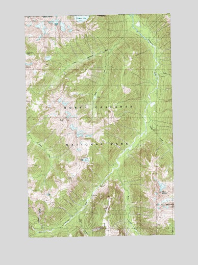
Copper Mountain, WA USGS Topographic Map
Click on map above to begin viewing in our Map Viewer.

This topographic map contains these locations and features:
Feature Name Type Latitude Longitude GNIS ID View Map
Bear CreekStreamN48.9657°W121.3893°1516257View Map
Bear Creek ShelterLocaleN48.9646°W121.3862°1529858View Map
Brush CreekStreamN48.9126°W121.4240°1517005View Map
Copper CreekStreamN48.8785°W121.4865°1518075View Map
Copper LakeLakeN48.9181°W121.4508°1518089View Map
Copper MountainSummitN48.9405°W121.4670°1518094View Map
Copper Mountain Lookout TowerTowerN48.9087°W121.4626°1533308View Map
Easy CreekStreamN48.8885°W121.4587°1519155View Map
Egg LakeLakeN48.8990°W121.4845°1519200View Map
Greyball ShelterLocaleN48.8985°W121.4471°1529794View Map
Hanging LakeLakeN48.9982°W121.4525°1520503View Map
Indian CreekStreamN48.9474°W121.3987°1521178View Map
Indian Creek ShelterLocaleN48.9351°W121.3943°1521181View Map
Indian MountainSummitN48.8988°W121.3898°1521192View Map
Little Chilliwack RiverStreamN48.9929°W121.4107°1522183View Map
Little Chilliwack ShelterLocaleN48.9901°W121.4046°1522184View Map
Little Fork Little Chilliwack RiverStreamN48.9801°W121.4287°1522215View Map
Middle PeakSummitN48.9954°W121.4775°1523102View Map
United States CabinLocaleN48.8968°W121.4485°1527616View Map

Note: Coordinates in the location and feature list above are referenced to NAD83 datum.


Copyright (C) 2008-2024 Ryan Niemi / Sunset Dynamics ... All Rights Reserved