TopoQuest Logo
Do you find TopoQuest useful?
Help keep TopoQuest running and adding new maps/features by donating!
Bitcoin:  19c7KJd3qBynnjoSw5npx9KScwjBe4ifkT
Litecoin:  LXs6TkuXGGXo1vDsWCkWVdjQX94eUKd6ui
Home View Maps Find Maps Find Places Resources & Links


Copper Mountain, California Topographic Map

USGS Map Title: Copper Mountain, CA
USGS Map MRC: 37121D3
DRG (GeoTIFF) Download: o37121d3.tif


Neighboring USGS Topographic Map Quads:


  Lone Tree Creek, CA  
37121E4
 

  Solyo, CA  
37121E3
 

  Westley, CA  
37121E2
 

  Mount Boardman, CA  
37121D4
 

  Copper Mountain, CA  
37121D3
 

  Patterson, CA  
37121D2
 

  Mount Stakes, CA  
37121C4
 

  Wilcox Ridge, CA  
37121C3
 

  Orestimba Peak, CA  
37121C2


Map MRC Location:

N38°
W122°
N38°
W121°
H8 H7 H6 H5 H4 H3 H2 H1
G8 G7 G6 G5 G4 G3 G2 G1
F8 F7 F6 F5 F4 F3 F2 F1
E8 E7 E6 E5 E4 E3 E2 E1
D8 D7 D6 D5 D4 D3 D2 D1
C8 C7 C6 C5 C4 C3 C2 C1
B8 B7 B6 B5 B4 B3 B2 B1
A8 A7 A6 A5 A4 A3 A2 A1
N37°
W122°
N37°
W121°

Copper Mountain, CA USGS 1:24K Topographic Map Preview:
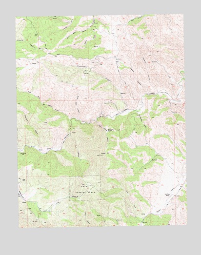
Copper Mountain, CA USGS Topographic Map
Click on map above to begin viewing in our Map Viewer.

This topographic map contains these locations and features:
Feature Name Type Latitude Longitude GNIS ID View Map
Adobe FlatFlatN37.3941°W121.3677°1702995View Map
Adobe MineMineN37.4033°W121.3727°217995View Map
Arkansas CanyonValleyN37.4213°W121.3608°218366View Map
Atkins RanchLocaleN37.4366°W121.3222°1702996View Map
Ballard FlatFlatN37.4730°W121.2999°218627View Map
Blind Mans GulchValleyN37.4927°W121.3199°219450View Map
Copper MountainSummitN37.4177°W121.3144°221543View Map
Diablo GrandePopulated PlaceN37.4017°W121.2595°2680803View Map
Diablo Grande Census Designated PlaceCensusN37.4006°W121.2699°2582995View Map
Fall CanyonValleyN37.4291°W121.3363°223362View Map
Falls CreekStreamN37.4297°W121.3372°1702997View Map
Fellows SpringSpringN37.3927°W121.3361°223433View Map
Frame RanchLocaleN37.4191°W121.3588°1702998View Map
Frank Raines ParkParkN37.4205°W121.3724°223808View Map
Garden CanyonValleyN37.4527°W121.2788°224042View Map
Garden Canyon CreekStreamN37.4527°W121.2791°1702999View Map
Gerber RanchLocaleN37.3905°W121.3622°1703000View Map
Gleason Ranch (historical)LocaleN37.4288°W121.3369°1703001View Map
KUOP-FM (Stockton)TowerN37.4799°W121.3516°1663107View Map
Lawley RanchLocaleN37.4394°W121.3166°1703005View Map
Lotta CreekStreamN37.3794°W121.2833°227722View Map
Mullally RanchLocaleN37.4897°W121.3052°1703008View Map
Murderers GulchValleyN37.4435°W121.2847°229339View Map
North Fork Del Puerto CreekStreamN37.4385°W121.3369°229663View Map
Oak Flats RanchLocaleN37.3927°W121.2627°229848View Map
Patterson DivisionCivilN37.4993°W121.2668°1935247View Map
Salt Grass CanyonValleyN37.4374°W121.3169°232318View Map
Salt Grass SpringsSpringN37.4310°W121.3093°232319View Map
Slick Rock CanyonValleyN37.4383°W121.3297°233272View Map
Washington CanyonValleyN37.4433°W121.2927°237269View Map
West Stanislaus County Fire Protection District Diablo Grande Station 7BuildingN37.3994°W121.2671°2624507View Map
Windmill CanyonValleyN37.4530°W121.2705°238009View Map

Note: Coordinates in the location and feature list above are referenced to NAD83 datum.


Copyright (C) 2008-2024 Ryan Niemi / Sunset Dynamics ... All Rights Reserved