TopoQuest Logo
Do you find TopoQuest useful?
Help keep TopoQuest running and adding new maps/features by donating!
Bitcoin:  19c7KJd3qBynnjoSw5npx9KScwjBe4ifkT
Litecoin:  LXs6TkuXGGXo1vDsWCkWVdjQX94eUKd6ui
Home View Maps Find Maps Find Places Resources & Links


Chelan, Washington Topographic Map

USGS Map Title: Chelan, WA
USGS Map MRC: 47120G1
DRG (GeoTIFF) Download: o47120g1.tif


Neighboring USGS Topographic Map Quads:


  Manson, WA  
47120H2
 

  Cooper Ridge, WA  
47120H1
 

  Azwell, WA  
47119H8
 

  Winesap, WA  
47120G2
 

  Chelan, WA  
47120G1
 

  Chelan Falls, WA  
47119G8
 

  Entiat, WA  
47120F2
 

  Waterville, WA  
47120F1
 

  Lamoine, WA  
47119F8


Map MRC Location:

N48°
W121°
N48°
W120°
H8 H7 H6 H5 H4 H3 H2 H1
G8 G7 G6 G5 G4 G3 G2 G1
F8 F7 F6 F5 F4 F3 F2 F1
E8 E7 E6 E5 E4 E3 E2 E1
D8 D7 D6 D5 D4 D3 D2 D1
C8 C7 C6 C5 C4 C3 C2 C1
B8 B7 B6 B5 B4 B3 B2 B1
A8 A7 A6 A5 A4 A3 A2 A1
N47°
W121°
N47°
W120°

Chelan, WA USGS 1:24K Topographic Map Preview:
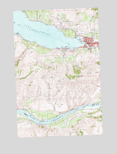
Chelan, WA USGS Topographic Map
Click on map above to begin viewing in our Map Viewer.

This topographic map contains these locations and features:
Feature Name Type Latitude Longitude GNIS ID View Map
Bear Mountain Ranch Golf CourseLocaleN47.8339°W120.1239°2608375View Map
Berean Baptist ChurchChurchN47.8400°W120.0098°2609363View Map
Cagle GulchValleyN47.8474°W120.0153°1517211View Map
ChelanPopulated PlaceN47.8410°W120.0165°1530831View Map
Chelan ButteSummitN47.8071°W120.0337°1517644View Map
Chelan Butte State Wildlife AreaReserveN47.7957°W120.0512°1531323View Map
Chelan Church of the NazareneChurchN47.8383°W120.0146°2609364View Map
Chelan County Fire Protection District 7BuildingN47.8386°W120.0155°2643821View Map
Chelan County ParkParkN47.8271°W120.0306°1529701View Map
Chelan Ferry LandingLocaleN47.8357°W120.0386°2608108View Map
Chelan Fraternal CemeteryCemeteryN47.8507°W120.0085°1517646View Map
Chelan High SchoolSchoolN47.8351°W120.0203°1530718View Map
Chelan Middle SchoolSchoolN47.8351°W120.0203°1530648View Map
Chelan Police DepartmentBuildingN47.8411°W120.0171°2722016View Map
Chelan Post OfficePost OfficeN47.8406°W120.0171°2781728View Map
Chelan Prepatory High SchoolSchoolN47.8412°W120.0141°1529398View Map
Chelan Ranger StationLocaleN47.8396°W120.0051°1529690View Map
Chelan River Boat LaunchLocaleN47.8354°W120.0156°1529698View Map
Chelan Riverwalk ParkParkN47.8388°W120.0182°1529699View Map
Chelan Seventh Day Adventist ChurchChurchN47.8460°W120.0182°2608453View Map
City of ChelanCivilN47.8282°W120.0310°2409440View Map
DarnellsLocaleN47.8507°W120.0303°1529700View Map
Dover FlatFlatN47.7707°W120.0862°1518903View Map
Glacier Valley High SchoolSchoolN47.8412°W120.0141°2606552View Map
Greens CanyonValleyN47.7635°W120.0537°1520337View Map
Homestead CanyonValleyN47.7687°W120.0698°1520880View Map
Kingdom Hall of Jehovahs WitnessesChurchN47.8380°W120.0048°2609365View Map
KOZI-AM (Chelan)TowerN47.8471°W120.0092°1534490View Map
Lady of the Lake Commercial DockLocaleN47.8362°W120.0384°1529697View Map
Lake Chelan Community HospitalHospitalN47.8450°W120.0097°1530157View Map
Lake Chelan DamDamN47.8345°W120.0124°1529658View Map
Lake Chelan Golf CourseLocaleN47.8524°W120.0270°1533146View Map
Lake Chelan HillsPopulated PlaceN47.8546°W120.0615°1530156View Map
Lake Chelan Lutheran ChurchChurchN47.8441°W120.0222°2609366View Map
Lake Chelan United Methodist ChurchChurchN47.8411°W120.0163°2609367View Map
Lake Chelan Valley Emergency Medical ServicesBuildingN47.8449°W120.0098°2643570View Map
Lakeshore ParkParkN47.8449°W120.0259°1521864View Map
LakesidePopulated PlaceN47.8354°W120.0503°1521865View Map
Lakeside City ParkParkN47.8374°W120.0540°1529696View Map
Little Stone ChurchChurchN47.8354°W120.0520°2609368View Map
McLeans Orchard (historical)Populated PlaceN47.7635°W120.0706°1530344View Map
Minneapolis BeachBeachN47.8518°W120.1192°1523244View Map
Morgen Owings Elementary SchoolSchoolN47.8402°W120.0119°1530170View Map
Purtteman GulchValleyN47.8635°W120.0876°1524706View Map
Regency ManorBuildingN47.8468°W120.0178°2607684View Map
Saint Andrew's Episcopal ChurchChurchN47.8397°W120.0184°2609369View Map
Saint Francis Catholic ChurchChurchN47.8425°W120.0205°2609370View Map
Spaders BayBayN47.8460°W120.0337°1526329View Map
StaymanPopulated PlaceN47.7657°W120.0898°1526514View Map
The Church of Jesus Christ of Latter Day SaintsChurchN47.8543°W120.0500°2609371View Map
Woodin Avenue BridgeBridgeN47.8395°W120.0209°2607980View Map

Note: Coordinates in the location and feature list above are referenced to NAD83 datum.


Copyright (C) 2008-2024 Ryan Niemi / Sunset Dynamics ... All Rights Reserved