TopoQuest Logo
Do you find TopoQuest useful?
Help keep TopoQuest running and adding new maps/features by donating!
Bitcoin:  19c7KJd3qBynnjoSw5npx9KScwjBe4ifkT
Litecoin:  LXs6TkuXGGXo1vDsWCkWVdjQX94eUKd6ui
Home View Maps Find Maps Find Places Resources & Links


Buckhorn, Wyoming Topographic Map

USGS Map Title: Buckhorn, WY
USGS Map MRC: 44104B1
DRG (GeoTIFF) Download: o44104b1.tif


Neighboring USGS Topographic Map Quads:


  Moskee, WY  
44104C2
 

  Old Baldy Mountain, SD  
44104C1
 

  Savoy, SD  
44103C8
 

  Dry Draw, WY  
44104B2
 

  Buckhorn, WY  
44104B1
 

  Crooks Tower, SD  
44103B8
 

  Four Corners, WY  
44104A2
 

  Parmlee Canyon, WY  
44104A1
 

  Crows Nest Peak, SD  
44103A8


Map MRC Location:

N45°
W105°
N45°
W104°
H8 H7 H6 H5 H4 H3 H2 H1
G8 G7 G6 G5 G4 G3 G2 G1
F8 F7 F6 F5 F4 F3 F2 F1
E8 E7 E6 E5 E4 E3 E2 E1
D8 D7 D6 D5 D4 D3 D2 D1
C8 C7 C6 C5 C4 C3 C2 C1
B8 B7 B6 B5 B4 B3 B2 B1
A8 A7 A6 A5 A4 A3 A2 A1
N44°
W105°
N44°
W104°

Buckhorn, WY USGS 1:24K Topographic Map Preview:
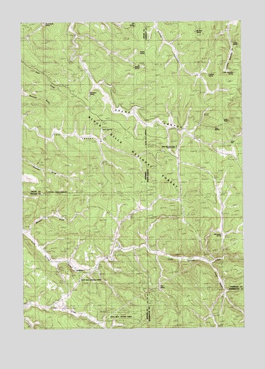
Buckhorn, WY USGS Topographic Map
Click on map above to begin viewing in our Map Viewer.

This topographic map contains these locations and features:
Feature Name Type Latitude Longitude GNIS ID View Map
Barnett DrawValleyN44.1644°W104.1213°1585138View Map
Big Mud SpringSpringN44.2458°W104.0263°1263141View Map
BuckhornPopulated PlaceN44.1494°W104.0958°1597235View Map
Cold CreekStreamN44.1511°W104.0183°1261467View Map
Crowley SpringSpringN44.2289°W104.0203°1261514View Map
Deer SpringSpringN44.1419°W104.0480°1261551View Map
Dugout SpringSpringN44.2313°W104.0610°1604879View Map
Dugout SpringSpringN44.2325°W104.0610°1587907View Map
Elk SpringSpringN44.2489°W104.0609°1588250View Map
Hain SpringSpringN44.2063°W104.0796°1589233View Map
Hardy Guard StationLocaleN44.1983°W104.0372°1261768View Map
Laird PeakSummitN44.2094°W104.0085°1263142View Map
Little Spearfish SpringSpringN44.2291°W104.0042°1261976View Map
McInerny SpringSpringN44.1624°W104.0109°1262043View Map
Michelson SpringSpringN44.2211°W104.0867°1591496View Map
O'Neil PassGapN44.2000°W104.0110°1262157View Map
O'Neil SchoolSchoolN44.2025°W104.0005°1262158View Map
Rawhauser Quarry MineMineN44.1391°W104.1113°1704333View Map
Scott-Hardy SpringSpringN44.2492°W104.1115°1597584View Map
Tom SpringSpringN44.2059°W104.0150°1262598View Map
Valley SpringSpringN44.2400°W104.0019°1263143View Map

Note: Coordinates in the location and feature list above are referenced to NAD83 datum.


Copyright (C) 2008-2024 Ryan Niemi / Sunset Dynamics ... All Rights Reserved