TopoQuest Logo
Do you find TopoQuest useful?
Help keep TopoQuest running and adding new maps/features by donating!
Bitcoin:  19c7KJd3qBynnjoSw5npx9KScwjBe4ifkT
Litecoin:  LXs6TkuXGGXo1vDsWCkWVdjQX94eUKd6ui
Home View Maps Find Maps Find Places Resources & Links


Moskee, Wyoming Topographic Map

USGS Map Title: Moskee, WY
USGS Map MRC: 44104C2
DRG (GeoTIFF) Download: o44104c2.tif


Neighboring USGS Topographic Map Quads:


  Sundance East, WY  
44104D3
 

  Red Canyon Creek, WY  
44104D2
 

  Tinton, SD  
44104D1
 

  Duling Hill, WY  
44104C3
 

  Moskee, WY  
44104C2
 

  Old Baldy Mountain, SD  
44104C1
 

  Inyan Kara Mountain, WY  
44104B3
 

  Dry Draw, WY  
44104B2
 

  Buckhorn, WY  
44104B1


Map MRC Location:

N45°
W105°
N45°
W104°
H8 H7 H6 H5 H4 H3 H2 H1
G8 G7 G6 G5 G4 G3 G2 G1
F8 F7 F6 F5 F4 F3 F2 F1
E8 E7 E6 E5 E4 E3 E2 E1
D8 D7 D6 D5 D4 D3 D2 D1
C8 C7 C6 C5 C4 C3 C2 C1
B8 B7 B6 B5 B4 B3 B2 B1
A8 A7 A6 A5 A4 A3 A2 A1
N44°
W105°
N44°
W104°

Moskee, WY USGS 1:24K Topographic Map Preview:
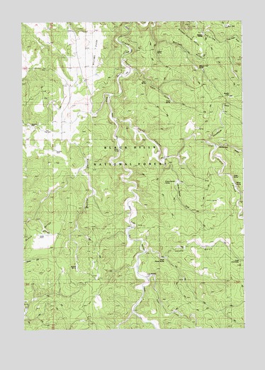
Moskee, WY USGS Topographic Map
Click on map above to begin viewing in our Map Viewer.

This topographic map contains these locations and features:
Feature Name Type Latitude Longitude GNIS ID View Map
Adams GulchValleyN44.2819°W104.1799°1597684View Map
Bear LakeLakeN44.3733°W104.1341°1598016View Map
Bearing TreeLocaleN44.2964°W104.1327°1604874View Map
Buckley CanyonValleyN44.3461°W104.2016°1598455View Map
Buckley SpringSpringN44.2743°W104.2191°1598457View Map
Calvary Sacket DrawValleyN44.3180°W104.1719°1598580View Map
Calvert-Sacket SpringSpringN44.3094°W104.1622°1604691View Map
Deer CreekStreamN44.2705°W104.1808°1599201View Map
G Reynolds RanchLocaleN44.3330°W104.2452°1599885View Map
Grand CanyonValleyN44.3353°W104.1979°1261735View Map
Grand CanyonValleyN44.3358°W104.1969°1600015View Map
H Reynolds RanchLocaleN44.3230°W104.2313°1600154View Map
Jones SpringSpringN44.3119°W104.1315°1600658View Map
Katan SpringSpringN44.3428°W104.1647°1604876View Map
Kunath RanchLocaleN44.2900°W104.2386°1600758View Map
Lehner SpringSpringN44.3629°W104.1738°1600886View Map
MoskeePopulated PlaceN44.2717°W104.1788°1609128View Map
Plato GulchValleyN44.3555°W104.1866°1602206View Map
Plato RanchLocaleN44.3536°W104.1916°1602207View Map
Pole Cabin GulchValleyN44.3683°W104.1338°1602237View Map
Rattlesnake CanyonValleyN44.3244°W104.1388°1602403View Map
Schoolhouse GulchValleyN44.3269°W104.1455°1602773View Map
Straight LakeLakeN44.3439°W104.1319°1603401View Map
Wagon CanyonValleyN44.3042°W104.1255°1603946View Map
Wagon CanyonValleyN44.3044°W104.1269°1262648View Map
Williams GulchValleyN44.3739°W104.1747°1604187View Map
Williams Number Two SpringSpringN44.3555°W104.1519°1604878View Map
Williams SpringSpringN44.3687°W104.1472°1604877View Map
Williams-Surprise DivideRidgeN44.3728°W104.1638°1609425View Map
Willow SpringSpringN44.3089°W104.1285°1604225View Map
Willow SpringsPopulated PlaceN44.3117°W104.1388°1604226View Map

Note: Coordinates in the location and feature list above are referenced to NAD83 datum.


Copyright (C) 2008-2024 Ryan Niemi / Sunset Dynamics ... All Rights Reserved