TopoQuest Logo
Do you find TopoQuest useful?
Help keep TopoQuest running and adding new maps/features by donating!
Bitcoin:  19c7KJd3qBynnjoSw5npx9KScwjBe4ifkT
Litecoin:  LXs6TkuXGGXo1vDsWCkWVdjQX94eUKd6ui
Home View Maps Find Maps Find Places Resources & Links


Thurmond, North Carolina Topographic Map

USGS Map Title: Thurmond, NC
USGS Map MRC: 36080C8
DRG (GeoTIFF) Download: o36080c8.tif


Neighboring USGS Topographic Map Quads:


  Glade Valley, NC  
36081D1
 

  Roaring Gap, NC  
36080D8
 

  Bottom, NC  
36080D7
 

  Traphill, NC  
36081C1
 

  Thurmond, NC  
36080C8
 

  Elkin North, NC  
36080C7
 

  Roaring River, NC  
36081B1
 

  Ronda, NC  
36080B8
 

  Elkin South, NC  
36080B7


Map MRC Location:

N37°
W81°
N37°
W80°
H8 H7 H6 H5 H4 H3 H2 H1
G8 G7 G6 G5 G4 G3 G2 G1
F8 F7 F6 F5 F4 F3 F2 F1
E8 E7 E6 E5 E4 E3 E2 E1
D8 D7 D6 D5 D4 D3 D2 D1
C8 C7 C6 C5 C4 C3 C2 C1
B8 B7 B6 B5 B4 B3 B2 B1
A8 A7 A6 A5 A4 A3 A2 A1
N36°
W81°
N36°
W80°

Thurmond, NC USGS 1:24K Topographic Map Preview:
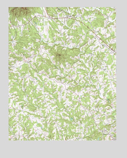
Thurmond, NC USGS Topographic Map
Click on map above to begin viewing in our Map Viewer.

This topographic map contains these locations and features:
Feature Name Type Latitude Longitude GNIS ID View Map
AustinPopulated PlaceN36.3237°W80.9770°1018877View Map
Austin Volunteer Fire DepartmentBuildingN36.3137°W80.9612°2638340View Map
BenhamPopulated PlaceN36.2904°W80.9176°1019088View Map
Benham ChurchChurchN36.2821°W80.9292°980990View Map
Brewers Store (historical)LocaleN36.2871°W80.9167°1959975View Map
Carter FallsFallsN36.2883°W80.8848°982695View Map
Charity ChurchChurchN36.3082°W80.9520°983035View Map
Cool Springs Baptist ChurchChurchN36.2815°W80.8962°983491View Map
DoughtonPopulated PlaceN36.3743°W80.9570°1020019View Map
Eller SchoolSchoolN36.2771°W80.8887°984722View Map
Grassy ForkStreamN36.3021°W80.9031°985962View Map
Hoots Mill (historical)LocaleN36.2790°W80.9326°1959996View Map
Knobs Baptist ChurchChurchN36.3235°W80.9779°988048View Map
Knobs CemeteryCemeteryN36.3232°W80.9773°1960000View Map
Little Elkin ChurchChurchN36.2526°W80.9179°988632View Map
Long BranchStreamN36.2699°W80.8751°988914View Map
Miners Ridge School (historical)SchoolN36.3349°W80.9167°1960006View Map
Mining Ridge ChurchChurchN36.3307°W80.9026°990060View Map
North Prong South Fork Mitchell RiverStreamN36.3737°W80.9006°991260View Map
Oak Level ChurchChurchN36.3049°W80.9709°991430View Map
Pleasant Grove ChurchChurchN36.3462°W80.8984°992504View Map
Pleasant Grove Church (historical)ChurchN36.3151°W80.8842°1960014View Map
Pleasant HillPopulated PlaceN36.2574°W80.8834°1022008View Map
Pleasant Hill Census Designated PlaceCensusN36.2580°W80.8904°2403430View Map
Pleasant Hill Volunteer Fire DepartmentBuildingN36.2593°W80.8915°2638099View Map
Pleasant Home ChurchChurchN36.2812°W80.9826°992547View Map
Pleasant RidgePopulated PlaceN36.3196°W80.8876°992563View Map
Roaring Gap CemeteryCemeteryN36.3632°W80.9542°1960019View Map
Roaring Gap ChurchChurchN36.3649°W80.9537°993432View Map
Sandy Creek ChurchChurchN36.3299°W80.9829°994263View Map
Shoaly Branch Baptist ChurchChurchN36.3079°W80.9095°994755View Map
State Road CemeteryCemeteryN36.3523°W80.8978°1731669View Map
State Road ChurchChurchN36.3326°W80.8804°995435View Map
State Road Primitive Baptist ChurchChurchN36.3515°W80.8976°995436View Map
State Road Volunteer Fire DepartmentBuildingN36.3315°W80.8756°2638285View Map
ThurmondPopulated PlaceN36.3665°W80.9284°996093View Map
Thurmond Post OfficePost OfficeN36.3653°W80.9255°2773910View Map
Township of EdwardsCivilN36.2651°W80.9534°1027325View Map
Union ChurchChurchN36.3524°W80.9767°996466View Map
Wells KnobSummitN36.3299°W80.9429°996952View Map
White Rock ChurchChurchN36.3665°W80.9315°997212View Map

Note: Coordinates in the location and feature list above are referenced to NAD83 datum.


Copyright (C) 2008-2024 Ryan Niemi / Sunset Dynamics ... All Rights Reserved