TopoQuest Logo
Do you find TopoQuest useful?
Help keep TopoQuest running and adding new maps/features by donating!
Bitcoin:  19c7KJd3qBynnjoSw5npx9KScwjBe4ifkT
Litecoin:  LXs6TkuXGGXo1vDsWCkWVdjQX94eUKd6ui
Home View Maps Find Maps Find Places Resources & Links


Glade Valley, North Carolina Topographic Map

USGS Map Title: Glade Valley, NC
USGS Map MRC: 36081D1
DRG (GeoTIFF) Download: o36081d1.tif


Neighboring USGS Topographic Map Quads:


  Sparta West, NC  
36081E2
 

  Sparta East, NC  
36081E1
 

  Cumberland Knob, NC  
36080E8
 

  Whitehead, NC  
36081D2
 

  Glade Valley, NC  
36081D1
 

  Roaring Gap, NC  
36080D8
 

  McGrady, NC  
36081C2
 

  Traphill, NC  
36081C1
 

  Thurmond, NC  
36080C8


Map MRC Location:

N37°
W82°
N37°
W81°
H8 H7 H6 H5 H4 H3 H2 H1
G8 G7 G6 G5 G4 G3 G2 G1
F8 F7 F6 F5 F4 F3 F2 F1
E8 E7 E6 E5 E4 E3 E2 E1
D8 D7 D6 D5 D4 D3 D2 D1
C8 C7 C6 C5 C4 C3 C2 C1
B8 B7 B6 B5 B4 B3 B2 B1
A8 A7 A6 A5 A4 A3 A2 A1
N36°
W82°
N36°
W81°

Glade Valley, NC USGS 1:24K Topographic Map Preview:
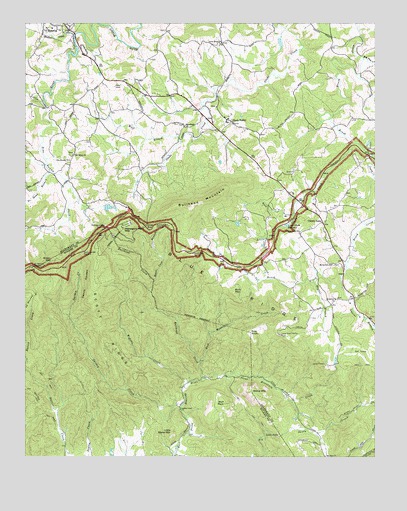
Glade Valley, NC USGS Topographic Map
Click on map above to begin viewing in our Map Viewer.

This topographic map contains these locations and features:
Feature Name Type Latitude Longitude GNIS ID View Map
Air Bellows OverlookLocaleN36.4304°W81.1223°980068View Map
Alton Thompson DamDamN36.4951°W81.0331°1000686View Map
Big Pine CreekStreamN36.4896°W81.0040°981435View Map
Bledsoe CreekStreamN36.4968°W81.1073°981590View Map
Blue Ridge ParkwayParkN36.4365°W81.0706°1009494View Map
Bullhead CreekStreamN36.3976°W81.0615°982225View Map
Bullhead MountainSummitN36.4474°W81.0670°982226View Map
Bullhead Mountain OverlookLocaleN36.4421°W81.0781°982227View Map
Camp Albert ButlerLocaleN36.4104°W81.0337°982484View Map
Camp CheerioLocaleN36.4015°W81.0170°982513View Map
Camp Cheerio DamDamN36.4018°W81.0131°1000591View Map
Camp Cheerio LakeReservoirN36.4018°W81.0131°1000590View Map
Cherry LanePopulated PlaceN36.4421°W81.0181°983084View Map
Cherry Lane CemeteryCemeteryN36.4398°W81.0267°1959871View Map
Cherry Lane Union Baptist ChurchChurchN36.4401°W81.0267°983085View Map
Cherry Lane Volunteer Fire DepartmentBuildingN36.4318°W81.0122°2638762View Map
Deep GapGapN36.4404°W81.0804°984079View Map
Devils GardenCliffN36.4254°W81.1034°984151View Map
Devils Garden OverlookLocaleN36.4343°W81.1045°984152View Map
Dogwood TrailTrailN36.3796°W81.0237°984261View Map
Elk Spur ChurchChurchN36.3754°W81.0176°984709View Map
Ellis KnollSummitN36.4110°W81.0440°984738View Map
Garden CreekStreamN36.3896°W81.0692°985556View Map
Garden Creek Baptist ChurchChurchN36.3887°W81.0695°985557View Map
Garden Creek School (historical)SchoolN36.3885°W81.0690°1959986View Map
Glade ValleyPopulated PlaceN36.4718°W81.0515°985716View Map
Glade Valley CemeteryCemeteryN36.4762°W81.0565°1959885View Map
Glade Valley High School (historical)SchoolN36.4718°W81.0529°1959886View Map
Glade Valley Post OfficePost OfficeN36.4714°W81.0502°2774112View Map
Glade Valley Presbyterian ChurchChurchN36.4760°W81.0565°1959887View Map
Green MountainSummitN36.4312°W81.1165°1020546View Map
Haynes BranchStreamN36.4257°W81.0217°986549View Map
Horse Cove BranchStreamN36.4260°W81.0787°987087View Map
Laura Glenn ChurchChurchN36.4943°W81.0548°988169View Map
Laurel BranchStreamN36.4240°W81.0117°988181View Map
Laurel Glenn CemeteryCemeteryN36.4946°W81.0542°1959903View Map
Little FallsFallsN36.3810°W81.0342°988638View Map
Little Glade CreekStreamN36.4654°W81.0081°988651View Map
Little Glade MillpondLakeN36.4420°W81.0315°988652View Map
Little Stone MountainSummitN36.3826°W81.0726°988780View Map
Macedonia Baptist ChurchChurchN36.4707°W81.0679°989203View Map
Macedonia CemeteryCemeteryN36.4712°W81.0684°1959906View Map
Mahogany Rock MountainSummitN36.4410°W81.0898°1021327View Map
Mahogany Rock OverlookLocaleN36.4415°W81.0959°989239View Map
MilesLocaleN36.3929°W81.0317°1023501View Map
Mount Carmel Union Baptist ChurchChurchN36.4307°W81.0154°990366View Map
New Salem Baptist ChurchChurchN36.4621°W81.1076°991097View Map
No Head BranchStreamN36.4571°W81.1159°991163View Map
NonameReservoirN36.4423°W81.0490°1000636View Map
Pine SwampPopulated PlaceN36.4593°W81.1087°1959932View Map
Pine Swamp ChurchChurchN36.4604°W81.1090°992288View Map
Pine Swamp CreekStreamN36.4762°W81.1173°992290View Map
Rich MountainSummitN36.4221°W81.0501°993297View Map
Rich Mountain CreekStreamN36.4024°W81.0620°993300View Map
Rock BranchStreamN36.4454°W81.0290°993482View Map
Scott RidgeRidgeN36.4101°W81.0968°994429View Map
Sparta Mill Pond (historical)ReservoirN36.4935°W81.1065°1959953View Map
Stone MountainSummitN36.3937°W81.0434°995534View Map
Stone Mountain CreekStreamN36.3976°W81.0615°995535View Map
Stone Mountain OverlookLocaleN36.4337°W81.0648°995536View Map
Stone Mountain State ParkParkN36.3987°W81.0623°1848186View Map
Temple LakeReservoirN36.4471°W81.0953°1000640View Map
Temple Lake DamDamN36.4468°W81.0948°1000641View Map
Thompson Mill (historical)LocaleN36.4674°W81.0712°1959956View Map
Township of Cherry LaneCivilN36.4354°W81.0182°1026364View Map
Van Dillon DamDamN36.4418°W81.0481°1000637View Map
WCOK-AM (Sparta)TowerN36.4782°W81.1026°1018573View Map
Widows CreekStreamN36.3965°W81.0665°997288View Map
Wolf BranchStreamN36.4660°W81.0692°997521View Map
Wolf RockSummitN36.3904°W81.0534°997544View Map
Woodruff CemeteryCemeteryN36.4210°W81.0137°1959965View Map
Woodruff Primitive Baptist ChurchChurchN36.4204°W81.0142°997606View Map

Note: Coordinates in the location and feature list above are referenced to NAD83 datum.


Copyright (C) 2008-2024 Ryan Niemi / Sunset Dynamics ... All Rights Reserved