TopoQuest Logo
Do you find TopoQuest useful?
Help keep TopoQuest running and adding new maps/features by donating!
Bitcoin:  19c7KJd3qBynnjoSw5npx9KScwjBe4ifkT
Litecoin:  LXs6TkuXGGXo1vDsWCkWVdjQX94eUKd6ui
Home View Maps Find Maps Find Places Resources & Links


Sylvan Falls, New York Topographic Map

USGS Map Title: Sylvan Falls, NY
USGS Map MRC: 44074E6
DRG (GeoTIFF) Download: o44074e6.tif


Neighboring USGS Topographic Map Quads:


  Parishville, NY  
44074F7
 

  Nicholville, NY  
44074F6
 

  Saint Regis Falls, NY  
44074F5
 

  Rainbow Falls, NY  
44074E7
 

  Sylvan Falls, NY  
44074E6
 

  Lake Ozonia, NY  
44074E5
 

  Stark, NY  
44074D7
 

  Carry Falls Reservoir, NY  
44074D6
 

  Augerhole Falls, NY  
44074D5


Map MRC Location:

N45°
W75°
N45°
W74°
H8 H7 H6 H5 H4 H3 H2 H1
G8 G7 G6 G5 G4 G3 G2 G1
F8 F7 F6 F5 F4 F3 F2 F1
E8 E7 E6 E5 E4 E3 E2 E1
D8 D7 D6 D5 D4 D3 D2 D1
C8 C7 C6 C5 C4 C3 C2 C1
B8 B7 B6 B5 B4 B3 B2 B1
A8 A7 A6 A5 A4 A3 A2 A1
N44°
W75°
N44°
W74°

Sylvan Falls, NY USGS 1:24K Topographic Map Preview:
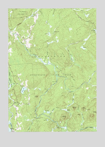
Sylvan Falls, NY USGS Topographic Map
Click on map above to begin viewing in our Map Viewer.

This topographic map contains these locations and features:
Feature Name Type Latitude Longitude GNIS ID View Map
Balsam BrookStreamN44.5490°W74.6382°975914View Map
Bear MountainSummitN44.5228°W74.6432°975942View Map
Bruner FallsFallsN44.5431°W74.6930°976042View Map
Coffee MountainSummitN44.5359°W74.7102°976156View Map
Cooperage ClubLocaleN44.5048°W74.6785°976185View Map
Coulon CemeteryCemeteryN44.5003°W74.7446°976190View Map
Dead CreekStreamN44.5098°W74.7474°976231View Map
Fenner Meadow BrookStreamN44.5709°W74.6927°976307View Map
Fenner MeadowsFlatN44.5742°W74.6971°976308View Map
Flower HillSummitN44.5764°W74.6702°976321View Map
Hamilton MountainSummitN44.5142°W74.6707°976402View Map
Harper School (historical)SchoolN44.5928°W74.7272°2493702View Map
Hogback BrookStreamN44.5142°W74.7105°976444View Map
Hopkinton PondLakeN44.6016°W74.6847°976453View Map
Kingsley FallsFallsN44.5506°W74.6807°976524View Map
Loon MountainSummitN44.5165°W74.6496°976600View Map
Mud PondLakeN44.5847°W74.6438°976705View Map
Mud Pond OutletStreamN44.5645°W74.6832°976706View Map
Randle Meadow BrookStreamN44.5151°W74.6921°976871View Map
Randle Meadow BrookStreamN44.5403°W74.6582°976872View Map
Randle MeadowsFlatN44.5217°W74.6674°976873View Map
Saint Lawrence State Forest Number 8ForestN44.6239°W74.7288°976937View Map
Santimaw BrookStreamN44.6026°W74.7480°976962View Map
School Number 13 (historical)SchoolN44.5478°W74.7322°2493701View Map
Slough PondLakeN44.5997°W74.6912°977010View Map
Sterling PondLakeN44.5424°W74.7285°977066View Map
Sterling Pond OutletStreamN44.5473°W74.7469°977067View Map
Stony BrookStreamN44.5609°W74.6824°977075View Map
Sugar Grove MountainSummitN44.5237°W74.6560°977085View Map
Sugar Grove PassGapN44.5259°W74.6499°977086View Map
Sylvan FallsFallsN44.5762°W74.7107°977092View Map
The BogSwampN44.5220°W74.6388°977103View Map
The Bog OutletStreamN44.5031°W74.6455°977104View Map
Thomas BrookStreamN44.5542°W74.6674°977115View Map
Town of HopkintonCivilN44.5404°W74.6621°979075View Map
Twin PondsLakeN44.5197°W74.6932°977156View Map
Welch BrookStreamN44.5295°W74.7413°977193View Map
Wick School (historical)SchoolN44.5044°W74.7375°2493700View Map
Willis BrookStreamN44.5070°W74.6805°977278View Map

Note: Coordinates in the location and feature list above are referenced to NAD83 datum.


Copyright (C) 2008-2024 Ryan Niemi / Sunset Dynamics ... All Rights Reserved