TopoQuest Logo
Do you find TopoQuest useful?
Help keep TopoQuest running and adding new maps/features by donating!
Bitcoin:  19c7KJd3qBynnjoSw5npx9KScwjBe4ifkT
Litecoin:  LXs6TkuXGGXo1vDsWCkWVdjQX94eUKd6ui
Home View Maps Find Maps Find Places Resources & Links


Starvout Creek, Oregon Topographic Map

USGS Map Title: Starvout Creek, OR
USGS Map MRC: 42123G2
DRG (GeoTIFF) Download: o42123g2.tif


Neighboring USGS Topographic Map Quads:


  Canyonville, OR  
42123H3
 

  Days Creek, OR  
42123H2
 

  Milo, OR  
42123H1
 

  Quines Creek, OR  
42123G3
 

  Starvout Creek, OR  
42123G2
 

  Cedar Springs Mountain, OR  
42123G1
 

  Golden, OR  
42123F3
 

  King Mountain, OR  
42123F2
 

  Skeleton Mountain, OR  
42123F1


Map MRC Location:

N43°
W124°
N43°
W123°
H8 H7 H6 H5 H4 H3 H2 H1
G8 G7 G6 G5 G4 G3 G2 G1
F8 F7 F6 F5 F4 F3 F2 F1
E8 E7 E6 E5 E4 E3 E2 E1
D8 D7 D6 D5 D4 D3 D2 D1
C8 C7 C6 C5 C4 C3 C2 C1
B8 B7 B6 B5 B4 B3 B2 B1
A8 A7 A6 A5 A4 A3 A2 A1
N42°
W124°
N42°
W123°

Starvout Creek, OR USGS 1:24K Topographic Map Preview:
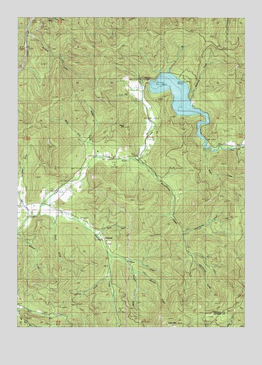
Starvout Creek, OR USGS Topographic Map
Click on map above to begin viewing in our Map Viewer.

This topographic map contains these locations and features:
Feature Name Type Latitude Longitude GNIS ID View Map
Albro CreekStreamN42.8082°W123.1831°1132228View Map
Alice CreekStreamN42.8221°W123.1401°1132231View Map
Anchor (historical)Populated PlaceN42.8485°W123.1651°1132229View Map
Anchor Post Office (historical)Post OfficeN42.8485°W123.1651°1164836View Map
Benjamin GulchValleyN42.8040°W123.2498°1132224View Map
Booth (historical)Populated PlaceN42.8026°W123.2290°1132223View Map
Booth GulchValleyN42.7929°W123.2303°1132225View Map
Booth Post Office (historical)Post OfficeN42.8026°W123.2290°1164941View Map
Boulder CreekStreamN42.7721°W123.1876°1117969View Map
Camp Gordon (historical)MilitaryN42.7833°W123.2500°1851660View Map
Chief Miwaleta County Park Boat RampLocaleN42.8487°W123.1593°2668393View Map
Clear CreekStreamN42.7929°W123.2459°1132723View Map
Dark CreekStreamN42.8498°W123.1845°1132230View Map
East Fork Whitehorse CreekStreamN42.7887°W123.1609°1132219View Map
Fizzleout CreekStreamN42.7790°W123.2001°1120813View Map
Galesvale School (historical)SchoolN42.8304°W123.1770°1121040View Map
Galesville DamDamN42.8490°W123.1789°1134095View Map
Galesville ReservoirReservoirN42.8428°W123.1632°2784869View Map
Green MountainSummitN42.7513°W123.1632°1136338View Map
Hogum CreekStreamN42.7771°W123.1934°1121889View Map
Jones CreekStreamN42.7693°W123.2234°1132220View Map
Long Fibre County ParkParkN42.8179°W123.1845°1132227View Map
McGinnis CreekStreamN42.8429°W123.1617°1123963View Map
Negro CreekStreamN42.8223°W123.1464°1146758View Map
Niday Branch Cow CreekStreamN42.7921°W123.2484°1132722View Map
No Name CreekStreamN42.7693°W123.2026°1132221View Map
Packard CreekStreamN42.8690°W123.2456°1125113View Map
Patrick MountainSummitN42.8309°W123.1921°1125222View Map
Quartz CreekStreamN42.7873°W123.2095°1132222View Map
Ramsey CreekStreamN42.7540°W123.2276°1132226View Map
Russel CreekStreamN42.8187°W123.2081°1126364View Map
StarvoutLocaleN42.7707°W123.2012°1132113View Map
Starvout CreekStreamN42.7987°W123.2384°1127543View Map
Starvout Creek AirportAirportN42.7957°W123.2317°1158855View Map
Starvout Post Office (historical)Post OfficeN42.7707°W123.2012°1165988View Map
Upper Ramp Galesville Resevior Boat RampLocaleN42.8488°W123.1594°2668455View Map
West Fork Russel CreekStreamN42.8187°W123.2078°1128866View Map
Whitehorse CreekStreamN42.8173°W123.1851°1129009View Map

Note: Coordinates in the location and feature list above are referenced to NAD83 datum.


Copyright (C) 2008-2024 Ryan Niemi / Sunset Dynamics ... All Rights Reserved