TopoQuest Logo
Do you find TopoQuest useful?
Help keep TopoQuest running and adding new maps/features by donating!
Bitcoin:  19c7KJd3qBynnjoSw5npx9KScwjBe4ifkT
Litecoin:  LXs6TkuXGGXo1vDsWCkWVdjQX94eUKd6ui
Home View Maps Find Maps Find Places Resources & Links


King Mountain, Oregon Topographic Map

USGS Map Title: King Mountain, OR
USGS Map MRC: 42123F2
DRG (GeoTIFF) Download: o42123f2.tif


Neighboring USGS Topographic Map Quads:


  Quines Creek, OR  
42123G3
 

  Starvout Creek, OR  
42123G2
 

  Cedar Springs Mountain, OR  
42123G1
 

  Golden, OR  
42123F3
 

  King Mountain, OR  
42123F2
 

  Skeleton Mountain, OR  
42123F1
 

  Sexton Mountain, OR  
42123E3
 

  Wimer, OR  
42123E2
 

  McConville Peak, OR  
42123E1


Map MRC Location:

N43°
W124°
N43°
W123°
H8 H7 H6 H5 H4 H3 H2 H1
G8 G7 G6 G5 G4 G3 G2 G1
F8 F7 F6 F5 F4 F3 F2 F1
E8 E7 E6 E5 E4 E3 E2 E1
D8 D7 D6 D5 D4 D3 D2 D1
C8 C7 C6 C5 C4 C3 C2 C1
B8 B7 B6 B5 B4 B3 B2 B1
A8 A7 A6 A5 A4 A3 A2 A1
N42°
W124°
N42°
W123°

King Mountain, OR USGS 1:24K Topographic Map Preview:
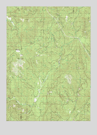
King Mountain, OR USGS Topographic Map
Click on map above to begin viewing in our Map Viewer.

This topographic map contains these locations and features:
Feature Name Type Latitude Longitude GNIS ID View Map
A K PrairieAreaN42.6707°W123.1581°1164040View Map
Baker CreekStreamN42.6582°W123.2014°1117152View Map
Beaver CreekStreamN42.6596°W123.2053°1132710View Map
Beck SpringSpringN42.6290°W123.1651°1132714View Map
Big Boulder CreekStreamN42.7051°W123.1684°1117589View Map
Boulder CreekStreamN42.6429°W123.1484°1158137View Map
Boulder CreekStreamN42.6426°W123.2231°1158138View Map
Clark CreekStreamN42.6496°W123.2401°1118968View Map
Cold SpringSpringN42.7096°W123.2151°1130354View Map
Hobbsford (historical)LocaleN42.7443°W123.1998°1130357View Map
Jamison GulchValleyN42.6251°W123.1664°1122383View Map
King MountainSummitN42.6919°W123.2303°1122750View Map
KOBI-TVTowerN42.6968°W123.2287°1131172View Map
KSOR-FMTowerN42.6923°W123.2301°1131159View Map
KSYS-TVTowerN42.6915°W123.2306°1131253View Map
Last Chance CreekStreamN42.7087°W123.1631°1122967View Map
Lick CreekStreamN42.6929°W123.1706°1132713View Map
Little Boulder CreekStreamN42.6973°W123.1692°1123137View Map
Mildred MineMineN42.7412°W123.1734°1164042View Map
Miser MineMineN42.7485°W123.1970°1164043View Map
Mud SpringsSpringN42.7123°W123.2039°1130358View Map
Onion SpringSpringN42.6929°W123.2317°1164039View Map
Onion SpringsSpringN42.7054°W123.2234°1130359View Map
Panther CreekStreamN42.7226°W123.1484°1164038View Map
Pease SpringSpringN42.6512°W123.2095°1130360View Map
Quartzmill MineMineN42.7373°W123.2470°1164044View Map
Quartzmill PeakSummitN42.7351°W123.2187°1125742View Map
Right Fork Pleasant CreekStreamN42.6271°W123.1576°1148442View Map
Roth CreekStreamN42.6651°W123.1984°1132711View Map
Slate CreekStreamN42.6693°W123.1942°1132712View Map
South Fork Quines CreekStreamN42.7240°W123.2337°1164045View Map
Spring CanyonValleyN42.7485°W123.1956°1130355View Map
Starvout Creek MinesMineN42.7332°W123.2026°1130356View Map
Waggoner GapGapN42.7407°W123.1739°1164041View Map

Note: Coordinates in the location and feature list above are referenced to NAD83 datum.


Copyright (C) 2008-2024 Ryan Niemi / Sunset Dynamics ... All Rights Reserved