TopoQuest Logo
Do you find TopoQuest useful?
Help keep TopoQuest running and adding new maps/features by donating!
Bitcoin:  19c7KJd3qBynnjoSw5npx9KScwjBe4ifkT
Litecoin:  LXs6TkuXGGXo1vDsWCkWVdjQX94eUKd6ui
Home View Maps Find Maps Find Places Resources & Links


South Fork, Missouri Topographic Map

USGS Map Title: South Fork, MO
USGS Map MRC: 36091F8
DRG (GeoTIFF) Download: o36091f8.tif


Neighboring USGS Topographic Map Quads:


  Siloam Springs, MO  
36092G1
 

  Pomona, MO  
36091G8
 

  White Church, MO  
36091G7
 

  Pottersville, MO  
36092F1
 

  South Fork, MO  
36091F8
 

  West Plains, MO  
36091F7
 

  Caulfield, MO  
36092E1
 

  Moody, MO  
36091E8
 

  Lanton, MO  
36091E7


Map MRC Location:

N37°
W92°
N37°
W91°
H8 H7 H6 H5 H4 H3 H2 H1
G8 G7 G6 G5 G4 G3 G2 G1
F8 F7 F6 F5 F4 F3 F2 F1
E8 E7 E6 E5 E4 E3 E2 E1
D8 D7 D6 D5 D4 D3 D2 D1
C8 C7 C6 C5 C4 C3 C2 C1
B8 B7 B6 B5 B4 B3 B2 B1
A8 A7 A6 A5 A4 A3 A2 A1
N36°
W92°
N36°
W91°

South Fork, MO USGS 1:24K Topographic Map Preview:
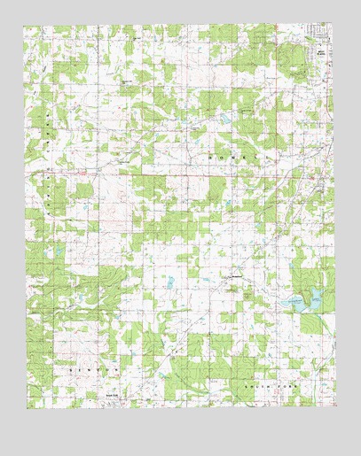
South Fork, MO USGS Topographic Map
Click on map above to begin viewing in our Map Viewer.

This topographic map contains these locations and features:
Feature Name Type Latitude Longitude GNIS ID View Map
Arrow Head LakeReservoirN36.6599°W91.8830°763685View Map
Arrowhead LakesReservoirN36.6585°W91.8912°738505View Map
Blue Mound CemeteryCemeteryN36.7026°W91.9695°2573881View Map
Blue Mound School (historical)SchoolN36.7034°W91.9693°735522View Map
Bradford SchoolSchoolN36.6342°W91.9252°714614View Map
Cedar Grove School (historical)SchoolN36.7312°W91.9782°735116View Map
Center of God ChurchChurchN36.7217°W91.9132°743074View Map
Center SchoolSchoolN36.6723°W91.9615°715654View Map
Fairview SchoolSchoolN36.7162°W91.9327°743075View Map
Forrest BranchStreamN36.7084°W91.9852°735122View Map
Grisham Lake (historical)ReservoirN36.7467°W91.8968°765347View Map
Grisham Lake DamDamN36.7467°W91.8968°765346View Map
Hayden Callahan DamDamN36.7217°W91.9535°764766View Map
Hill Crest ChurchChurchN36.6276°W91.9602°735118View Map
HomelandPopulated PlaceN36.6676°W91.9193°738506View Map
Homeland CemeteryCemeteryN36.6706°W91.9168°735120View Map
Homeland Church (historical)ChurchN36.6703°W91.9157°735117View Map
Homeland School (historical)SchoolN36.6695°W91.9157°719747View Map
Hope Rest ChurchChurchN36.7453°W91.9560°743073View Map
Howell County Rural Fire District Station 1BuildingN36.7263°W91.8861°2621463View Map
Howell County Rural Fire District Station 2BuildingN36.6262°W91.9613°2620592View Map
KKDY-FM (West Plains)TowerN36.7206°W91.9243°759132View Map
KSPQ-FM (West Plains)TowerN36.7428°W91.9052°754233View Map
Oak Ridge SchoolSchoolN36.7364°W91.9240°723642View Map
Ozarks Medical CenterHospitalN36.7382°W91.8751°743129View Map
Pleasant Hill CemeteryCemeteryN36.7312°W91.9607°735121View Map
Pleasant Hill ChurchChurchN36.7312°W91.9604°724522View Map
Pleasant Hill Church (historical)ChurchN36.7017°W91.9697°2573882View Map
Renfrow SchoolSchoolN36.7117°W91.8757°725214View Map
Rock Valley SchoolSchoolN36.7037°W91.9249°725473View Map
South ForkPopulated PlaceN36.6278°W91.9627°726724View Map
South Fork Census Designated PlaceCensusN36.6311°W91.9602°2587113View Map
Spears GraveyardCemeteryN36.6631°W91.9188°735119View Map
Spring Creek ChurchChurchN36.7056°W91.9621°743076View Map
Stokes Lake Number 1 DamDamN36.6567°W91.8885°764769View Map
Stokes Number 2 DamDamN36.6567°W91.8851°763684View Map

Note: Coordinates in the location and feature list above are referenced to NAD83 datum.


Copyright (C) 2008-2024 Ryan Niemi / Sunset Dynamics ... All Rights Reserved