TopoQuest Logo
Do you find TopoQuest useful?
Help keep TopoQuest running and adding new maps/features by donating!
Bitcoin:  19c7KJd3qBynnjoSw5npx9KScwjBe4ifkT
Litecoin:  LXs6TkuXGGXo1vDsWCkWVdjQX94eUKd6ui
Home View Maps Find Maps Find Places Resources & Links


San Jacinto, Texas Topographic Map

USGS Map Title: San Jacinto, TX
USGS Map MRC: 30095E6
DRG (GeoTIFF) Download: o30095e6.tif


Neighboring USGS Topographic Map Quads:


  Loma, TX  
30095F7
 

  Galilee, TX  
30095F6
 

  Huntsville, TX  
30095F5
 

  Richards, TX  
30095E7
 

  San Jacinto, TX  
30095E6
 

  Moore Grove, TX  
30095E5
 

  Dacus, TX  
30095D7
 

  Montgomery, TX  
30095D6
 

  Shepard Hill, TX  
30095D5


Map MRC Location:

N31°
W96°
N31°
W95°
H8 H7 H6 H5 H4 H3 H2 H1
G8 G7 G6 G5 G4 G3 G2 G1
F8 F7 F6 F5 F4 F3 F2 F1
E8 E7 E6 E5 E4 E3 E2 E1
D8 D7 D6 D5 D4 D3 D2 D1
C8 C7 C6 C5 C4 C3 C2 C1
B8 B7 B6 B5 B4 B3 B2 B1
A8 A7 A6 A5 A4 A3 A2 A1
N30°
W96°
N30°
W95°

San Jacinto, TX USGS 1:24K Topographic Map Preview:
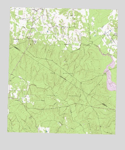
San Jacinto, TX USGS Topographic Map
Click on map above to begin viewing in our Map Viewer.

This topographic map contains these locations and features:
Feature Name Type Latitude Longitude GNIS ID View Map
Antony BranchStreamN30.5333°W95.6872°1381327View Map
Bay BranchStreamN30.5558°W95.7416°1381364View Map
Blue Bonnet HillSummitN30.5910°W95.7211°1381462View Map
Ebenezer ChurchChurchN30.6219°W95.7208°1381831View Map
Farris CemeteryCemeteryN30.5955°W95.7286°1381864View Map
Farris ChapelChurchN30.6049°W95.7247°1381865View Map
GoshenPopulated PlaceN30.6221°W95.7213°2034809View Map
Green BranchStreamN30.5210°W95.6766°1381942View Map
Kelly BranchStreamN30.5088°W95.6658°1360537View Map
Kellys Pond Recreation SiteLocaleN30.5091°W95.6594°1383458View Map
Lee BranchStreamN30.6041°W95.7286°1382131View Map
Lee CemeteryCemeteryN30.6080°W95.7272°1382132View Map
Little Zion SchoolSchoolN30.6235°W95.7122°1382188View Map
McDonald CreekStreamN30.5810°W95.6361°1382256View Map
Mount Prairie ChurchChurchN30.6180°W95.6777°1382350View Map
Pole Cat BranchStreamN30.5921°W95.6883°1382542View Map
Pool LookoutLocaleN30.5152°W95.7236°1382551View Map
Robinson CreekStreamN30.6002°W95.6577°1382629View Map
San JacintoPopulated PlaceN30.6221°W95.7211°1382693View Map
Stubblefield Lake TrailTrailN30.5624°W95.6519°2033130View Map
Stubblefield Recreation SiteLocaleN30.5580°W95.6402°1383459View Map
Union Grove CemeteryCemeteryN30.5324°W95.7377°1383465View Map
Union Grove ChurchChurchN30.5319°W95.7369°1382894View Map
Union Hill ChurchChurchN30.5996°W95.6252°1382896View Map
West Sandy CreekStreamN30.5908°W95.6544°1383212View Map

Note: Coordinates in the location and feature list above are referenced to NAD83 datum.


Copyright (C) 2008-2024 Ryan Niemi / Sunset Dynamics ... All Rights Reserved