TopoQuest Logo
Do you find TopoQuest useful?
Help keep TopoQuest running and adding new maps/features by donating!
Bitcoin:  19c7KJd3qBynnjoSw5npx9KScwjBe4ifkT
Litecoin:  LXs6TkuXGGXo1vDsWCkWVdjQX94eUKd6ui
Home View Maps Find Maps Find Places Resources & Links


Shepard Hill, Texas Topographic Map

USGS Map Title: Shepard Hill, TX
USGS Map MRC: 30095D5
DRG (GeoTIFF) Download: o30095d5.tif


Neighboring USGS Topographic Map Quads:


  San Jacinto, TX  
30095E6
 

  Moore Grove, TX  
30095E5
 

  New Waverly, TX  
30095E4
 

  Montgomery, TX  
30095D6
 

  Shepard Hill, TX  
30095D5
 

  Willis, TX  
30095D4
 

  Keenan, TX  
30095C6
 

  Cowl Spur, TX  
30095C5
 

  Conroe, TX  
30095C4


Map MRC Location:

N31°
W96°
N31°
W95°
H8 H7 H6 H5 H4 H3 H2 H1
G8 G7 G6 G5 G4 G3 G2 G1
F8 F7 F6 F5 F4 F3 F2 F1
E8 E7 E6 E5 E4 E3 E2 E1
D8 D7 D6 D5 D4 D3 D2 D1
C8 C7 C6 C5 C4 C3 C2 C1
B8 B7 B6 B5 B4 B3 B2 B1
A8 A7 A6 A5 A4 A3 A2 A1
N30°
W96°
N30°
W95°

Shepard Hill, TX USGS 1:24K Topographic Map Preview:
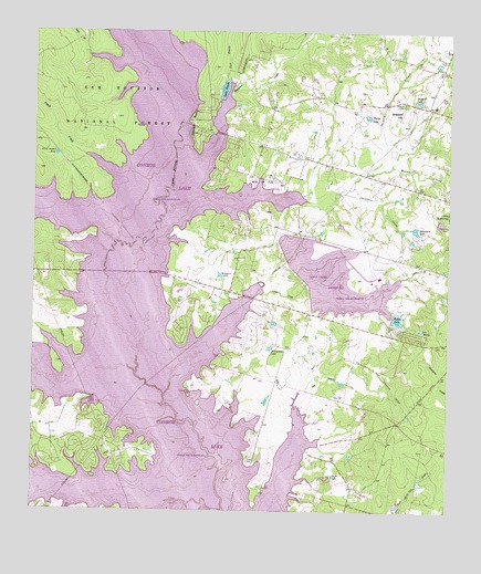
Shepard Hill, TX USGS Topographic Map
Click on map above to begin viewing in our Map Viewer.

This topographic map contains these locations and features:
Feature Name Type Latitude Longitude GNIS ID View Map
Atkins CreekStreamN30.3755°W95.5669°1381343View Map
Bell CreekStreamN30.4069°W95.5444°1351831View Map
Calfee LakeLakeN30.3844°W95.5347°1353544View Map
Camp Letcher PondLakeN30.4681°W95.6187°1353647View Map
Camp RobinwoodLocaleN30.4530°W95.5008°1353668View Map
Chambers CreekStreamN30.4571°W95.5336°1354281View Map
Chambers LakeReservoirN30.4485°W95.5103°1354283View Map
Chambers Lake DamDamN30.4485°W95.5119°1854466View Map
Flying Hare FieldAirportN30.3914°W95.5399°2675811View Map
Gdap Air RanchAirportN30.4802°W95.5399°1384843View Map
Glenview Number 1 HeliportAirportN30.3994°W95.6094°1386417View Map
Gum BranchStreamN30.4885°W95.5669°1383453View Map
Gum BranchStreamN30.4880°W95.5655°1358511View Map
Hostetter CreekStreamN30.4691°W95.5830°1372162View Map
Hulon LakeReservoirN30.4252°W95.5155°1359810View Map
Hulon Lake DamDamN30.4252°W95.5169°1854470View Map
Johnson BluffCliffN30.4769°W95.5774°1360315View Map
Kleimann LakeLakeN30.4362°W95.5688°1360712View Map
Lake AnnReservoirN30.4500°W95.5029°1864499View Map
Lake Ann DamDamN30.4502°W95.5036°1864498View Map
Lake ConroeReservoirN30.4328°W95.5959°1380953View Map
Lake PaulaReservoirN30.4851°W95.5683°1364898View Map
Lake WesleyLakeN30.4224°W95.5084°1371056View Map
Lewis CreekStreamN30.4324°W95.5552°1361123View Map
Lewis Creek DamDamN30.4302°W95.5436°1854468View Map
Lewis Creek ReservoirReservoirN30.4358°W95.5352°1361126View Map
Live BranchStreamN30.4060°W95.5441°1361521View Map
Montgomery County Sheriff's Office - Patrol District 5BuildingN30.3934°W95.6045°2751515View Map
Montgomery Fire Department Station 54BuildingN30.3957°W95.6131°2655463View Map
North Montgomery County Fire Department Station 94BuildingN30.3918°W95.5566°2655468View Map
North Montgomery County Fire Department Station 96BuildingN30.4696°W95.5547°2655467View Map
Peach CreekStreamN30.4683°W95.6113°1383429View Map
Peach CreekStreamN30.4677°W95.6099°1364923View Map
Phelps LakeLakeN30.4781°W95.5252°1365134View Map
Pin Oak RavineValleyN30.4443°W95.6177°1365259View Map
Protec Ambulance TransportBuildingN30.4032°W95.5296°2720995View Map
Sand BranchStreamN30.4941°W95.6091°1367567View Map
Sartor HeliportAirportN30.3758°W95.5574°1387752View Map
Shepard BranchStreamN30.4552°W95.5441°1368122View Map
Shepard CemeteryCemeteryN30.4816°W95.5136°1368123View Map
Shepard HillSummitN30.4788°W95.5141°1368124View Map
Shepard LakeReservoirN30.4821°W95.5097°1368125View Map
South BranchStreamN30.4930°W95.6088°1383431View Map
Weirs CreekStreamN30.4549°W95.5449°1383446View Map
Weirs CreekStreamN30.4638°W95.5249°1371002View Map
Williamson LakeLakeN30.4176°W95.5538°1371597View Map
Willis Oil FieldOilfieldN30.4621°W95.5549°1371606View Map

Note: Coordinates in the location and feature list above are referenced to NAD83 datum.


Copyright (C) 2008-2024 Ryan Niemi / Sunset Dynamics ... All Rights Reserved