TopoQuest Logo
Do you find TopoQuest useful?
Help keep TopoQuest running and adding new maps/features by donating!
Bitcoin:  19c7KJd3qBynnjoSw5npx9KScwjBe4ifkT
Litecoin:  LXs6TkuXGGXo1vDsWCkWVdjQX94eUKd6ui
Home View Maps Find Maps Find Places Resources & Links


Rumford, Maine Topographic Map

USGS Map Title: Rumford, ME
USGS Map MRC: 44070E5
DRG (GeoTIFF) Download: o44070e5.tif


Neighboring USGS Topographic Map Quads:


  Ellis Pond, ME  
44070F6
 

  Roxbury, ME  
44070F5
 

  Weld, ME  
44070F4
 

  East Andover, ME  
44070E6
 

  Rumford, ME  
44070E5
 

  Dixfield, ME  
44070E4
 

  Bryant Pond, ME  
44070D6
 

  Mount Zircon, ME  
44070D5
 

  Worthley Pond, ME  
44070D4


Map MRC Location:

N45°
W71°
N45°
W70°
H8 H7 H6 H5 H4 H3 H2 H1
G8 G7 G6 G5 G4 G3 G2 G1
F8 F7 F6 F5 F4 F3 F2 F1
E8 E7 E6 E5 E4 E3 E2 E1
D8 D7 D6 D5 D4 D3 D2 D1
C8 C7 C6 C5 C4 C3 C2 C1
B8 B7 B6 B5 B4 B3 B2 B1
A8 A7 A6 A5 A4 A3 A2 A1
N44°
W71°
N44°
W70°

Rumford, ME USGS 1:24K Topographic Map Preview:
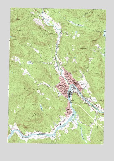
Rumford, ME USGS Topographic Map
Click on map above to begin viewing in our Map Viewer.

This topographic map contains these locations and features:
Feature Name Type Latitude Longitude GNIS ID View Map
Abbott SchoolSchoolN44.5570°W70.5390°561056View Map
Androscoggin River ReservoirReservoirN44.5466°W70.5476°1774546View Map
Androscoggin River ReservoirReservoirN44.5427°W70.5463°1773540View Map
Androscoggin River ReservoirReservoirN44.5380°W70.5437°1773542View Map
Back Kingdom CemeteryCemeteryN44.5899°W70.5082°2736844View Map
Bean BrookStreamN44.5420°W70.5478°561775View Map
Bisbee SchoolSchoolN44.5551°W70.5523°562369View Map
Carr MountainSummitN44.5961°W70.5165°563589View Map
Chisholm SchoolSchoolN44.5492°W70.5495°563960View Map
East Rumford CemeteryCemeteryN44.5203°W70.5553°565680View Map
Farrington - Morton CemeteryCemeteryN44.5367°W70.5131°566073View Map
Farrington MountainSummitN44.5409°W70.5026°566072View Map
First Baptist ChurchChurchN44.5584°W70.5434°1908008View Map
First Baptist ChurchChurchN44.5467°W70.5506°1908009View Map
FryePopulated PlaceN44.6215°W70.5801°579326View Map
Glass Face MountainSummitN44.5262°W70.5864°566824View Map
Glover CemeteryCemeteryN44.5756°W70.5972°566852View Map
Goff BrookStreamN44.5976°W70.5601°566865View Map
HalePopulated PlaceN44.5901°W70.5615°579376View Map
Halfmoon PondLakeN44.6033°W70.5006°567467View Map
Holy Savior SchoolSchoolN44.5481°W70.5519°1908172View Map
Hunt Airfield (historical)AirportN44.5320°W70.5023°1908054View Map
Joes PondLakeN44.5331°W70.5819°568880View Map
Kimball SchoolSchoolN44.5626°W70.5481°569184View Map
Kingdom Hall of Jehovahs WitnessesChurchN44.5428°W70.5253°1908062View Map
Kingdom Hall of Jehovahs WitnessesChurchN44.5392°W70.5237°1908063View Map
Lake MountainSummitN44.6177°W70.5052°569305View Map
Logan BrookStreamN44.5301°W70.5378°570156View Map
Mann HillSummitN44.5651°W70.5059°570701View Map
Mechanic Institute (historical)SchoolN44.5445°W70.5462°1908081View Map
Med Care Ambulance ServiceBuildingN44.5528°W70.5359°2666772View Map
Meroby Elementary SchoolSchoolN44.5561°W70.5316°1908082View Map
MexicoPopulated PlaceN44.5609°W70.5453°571196View Map
Mexico Census Designated PlaceCensusN44.5551°W70.5364°2377936View Map
Mexico Congregational ChurchChurchN44.5578°W70.5448°1908083View Map
Mexico Corner CemeteryCemeteryN44.5587°W70.5436°2724721View Map
Mexico Fire DepartmentBuildingN44.5563°W70.5416°2552893View Map
Mexico Free Public LibraryBuildingN44.5559°W70.5408°1908084View Map
Mexico Police DepartmentBuildingN44.5560°W70.5411°2735958View Map
Mexico Post OfficePost OfficeN44.5566°W70.5431°1908085View Map
Middle DamDamN44.5427°W70.5463°1773539View Map
Mitchell BrookStreamN44.6062°W70.5601°571466View Map
Mountain Valley High SchoolSchoolN44.5641°W70.5594°574585View Map
Mountain Valley Middle SchoolSchoolN44.5553°W70.5270°571197View Map
North Twin MountainSummitN44.6148°W70.6178°572419View Map
Oakdale Country ClubLocaleN44.5417°W70.5120°1908127View Map
Old Frye CemeteryCemeteryN44.6150°W70.5815°572699View Map
Old Rumford DamDamN44.5466°W70.5476°1774545View Map
Pettengill SchoolSchoolN44.5465°W70.5540°573243View Map
Praise Assembly of God ChurchChurchN44.5131°W70.6142°1908154View Map
RidlonvillePopulated PlaceN44.5553°W70.5395°574208View Map
Ridlonville Post Office (historical)Post OfficeN44.5567°W70.5426°1908156View Map
River Valley Christian SchoolSchoolN44.5473°W70.5544°2738198View Map
Roy House Rumford Group Home SchoolSchoolN44.5531°W70.5556°2738035View Map
Roy House SchoolSchoolN44.5512°W70.5562°1908160View Map
RumfordPopulated PlaceN44.5537°W70.5509°574581View Map
Rumford Census Designated PlaceCensusN44.5502°W70.5680°2377952View Map
Rumford CenterPopulated PlaceN44.5131°W70.6187°574582View Map
Rumford Center CemeteryCemeteryN44.5135°W70.6128°2736393View Map
Rumford Elementary SchoolSchoolN44.5527°W70.5527°1908164View Map
Rumford FallsFallsN44.5395°W70.5442°574584View Map
Rumford Fire DepartmentBuildingN44.5468°W70.5461°2552822View Map
Rumford Group HomeBuildingN44.5512°W70.5562°1908165View Map
Rumford HospitalHospitalN44.5516°W70.5564°1908162View Map
Rumford Hospital Health Science LibraryBuildingN44.5513°W70.5562°2738352View Map
Rumford Police DepartmentBuildingN44.5467°W70.5461°2735908View Map
Rumford Post OfficePost OfficeN44.5464°W70.5460°1908168View Map
Rumford Public LibraryBuildingN44.5468°W70.5495°1908170View Map
Saint Athanasius and Saint Johns Roman Catholic ChurchChurchN44.5478°W70.5537°1908173View Map
Saint Barnabas Episcopal ChurchChurchN44.5476°W70.5501°1908174View Map
Saint Johns CemeteryCemeteryN44.5748°W70.5698°574724View Map
Saint Johns SchoolSchoolN44.5481°W70.5367°1908176View Map
Saint Theresas ChurchChurchN44.5556°W70.5392°1908179View Map
School of Applied Technology Region 9SchoolN44.5356°W70.5068°1908180View Map
Scotty BrookStreamN44.5678°W70.5601°575059View Map
Smith CrossingPopulated PlaceN44.5395°W70.5234°575623View Map
South RumfordPopulated PlaceN44.5259°W70.5342°575902View Map
South Twin MountainSummitN44.6041°W70.6132°575918View Map
Split BrookStreamN44.5106°W70.6187°576061View Map
Sunnyside CemeteryCemeteryN44.5259°W70.5537°576544View Map
Swains NotchGapN44.5956°W70.6220°576571View Map
Swains PondLakeN44.5981°W70.6237°576572View Map
Swift RiverStreamN44.5545°W70.5442°576619View Map
Swift River ReservoirReservoirN44.5882°W70.5631°1774098View Map
The Church of Jesus Christ of Latter Day SaintsChurchN44.5512°W70.5334°1907966View Map
Thompson HillSummitN44.5886°W70.5319°577012View Map
Thurston BrookStreamN44.5059°W70.6056°577082View Map
Thurston Mill DamDamN44.5882°W70.5631°1774097View Map
Town of MexicoCivilN44.5735°W70.5136°582593View Map
Town of RumfordCivilN44.5347°W70.6154°582703View Map
United Methodist ChurchChurchN44.5301°W70.5462°1908230View Map
Upper DamDamN44.5380°W70.5437°1773541View Map
Virgin Memorial ChapelChurchN44.5301°W70.5462°1908233View Map
VirginiaPopulated PlaceN44.5306°W70.5459°577743View Map
Virginia SchoolSchoolN44.5309°W70.5476°1908234View Map
Walton BrookStreamN44.6048°W70.5578°577817View Map
Wheeler IslandIslandN44.5256°W70.5415°578313View Map
WTME-AM ( Rumford)TowerN44.5133°W70.5171°582276View Map
Wyman BrookStreamN44.5303°W70.5070°578723View Map
Wyman CemeteryCemeteryN44.5198°W70.5148°578728View Map
Zinck AirportAirportN44.5240°W70.5469°2443596View Map
Zircon BrookStreamN44.5087°W70.5631°578820View Map

Note: Coordinates in the location and feature list above are referenced to NAD83 datum.


Copyright (C) 2008-2024 Ryan Niemi / Sunset Dynamics ... All Rights Reserved