TopoQuest Logo
Do you find TopoQuest useful?
Help keep TopoQuest running and adding new maps/features by donating!
Bitcoin:  19c7KJd3qBynnjoSw5npx9KScwjBe4ifkT
Litecoin:  LXs6TkuXGGXo1vDsWCkWVdjQX94eUKd6ui
Home View Maps Find Maps Find Places Resources & Links


Big Table, Idaho Topographic Map

USGS Map Title: Big Table, ID
USGS Map MRC: 41115H6
DRG (GeoTIFF) Download: o41115h6.tif


Neighboring USGS Topographic Map Quads:


  Black Leg Creek, ID  
42115A7
 

  Triplet Butte, ID  
42115A6
 

  Cowan Reservoir, ID  
42115A5
 

  Hicks Mountain, NV  
41115H7
 

  Big Table, ID  
41115H6
 

  Bearpaw Mountain, NV  
41115H5
 

  Merritt Mountain, NV  
41115G7
 

  Tennessee Mountain, NV  
41115G6
 

  Coon Creek, NV  
41115G5


Map MRC Location:

N42°
W116°
N42°
W115°
H8 H7 H6 H5 H4 H3 H2 H1
G8 G7 G6 G5 G4 G3 G2 G1
F8 F7 F6 F5 F4 F3 F2 F1
E8 E7 E6 E5 E4 E3 E2 E1
D8 D7 D6 D5 D4 D3 D2 D1
C8 C7 C6 C5 C4 C3 C2 C1
B8 B7 B6 B5 B4 B3 B2 B1
A8 A7 A6 A5 A4 A3 A2 A1
N41°
W116°
N41°
W115°

Big Table, ID USGS 1:24K Topographic Map Preview:
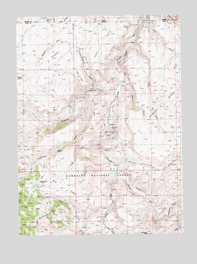
Big Table, ID USGS Topographic Map
Click on map above to begin viewing in our Map Viewer.

This topographic map contains these locations and features:
Feature Name Type Latitude Longitude GNIS ID View Map
Big TableFlatN41.9102°W115.7173°858912View Map
Bruneau MineMineN41.9332°W115.6831°859035View Map
Bryan DistrictCivilN41.9371°W115.6781°863014View Map
Budge Rizzi Ranch (historical)LocaleN41.9446°W115.6762°861205View Map
Bueasta (historical)Populated PlaceN41.9310°W115.6759°857680View Map
Bueasta Post OfficePost OfficeN41.9310°W115.6759°864373View Map
Casey TableSummitN41.9655°W115.7006°859168View Map
Cedar CanyonValleyN41.9607°W115.6698°859189View Map
Coffeepot CreekStreamN41.8793°W115.6834°859282View Map
Diamond A TrailTrailN41.9768°W115.6287°862335View Map
Diamond TrailTrailN41.9735°W115.6312°859525View Map
East Fork Robinson CanyonValleyN41.9188°W115.7295°859624View Map
East Robinson SpringSpringN41.9059°W115.7334°859632View Map
Gold Basin Mining DistrictCivilN41.9277°W115.6812°855612View Map
Hagenbuch RanchLocaleN41.9463°W115.7426°859922View Map
Hall RanchLocaleN41.8927°W115.7106°859927View Map
Hot SpringsSpringN41.8772°W115.6283°860058View Map
Hot Springs ButteSummitN41.8752°W115.6515°860059View Map
Ivada (historical)LocaleN41.9807°W115.6565°848261View Map
J-P DesertFlatN41.9885°W115.7093°860158View Map
Jack Scott RanchLocaleN41.8960°W115.6526°860174View Map
Last Chance SpringSpringN41.9984°W115.7271°384461View Map
Little TableSummitN41.9496°W115.6901°860384View Map
Long CanyonValleyN41.9968°W115.6481°860409View Map
Long Canyon ReservoirReservoirN41.9896°W115.6431°862384View Map
McDonald CreekStreamN41.9568°W115.6734°860518View Map
Meadow CreekStreamN41.9107°W115.6740°860542View Map
Mink RanchLocaleN41.9118°W115.6742°860606View Map
Mustang DrawValleyN41.9821°W115.7081°860706View Map
Mustang SpringSpringN41.9641°W115.7497°860712View Map
Old Scott RanchLocaleN41.9571°W115.6751°860837View Map
Rattlesnake CanyonValleyN41.8843°W115.6351°861064View Map
Road GulchValleyN41.9580°W115.6912°862352View Map
Robinson CanyonValleyN41.9563°W115.6959°861137View Map
Robinson SpringSpringN41.9236°W115.7200°861142View Map
Rock HousePopulated PlaceN41.9841°W115.6623°861147View Map
RowlandPopulated PlaceN41.9366°W115.6787°861195View Map
Rowland Post Office (historical)Post OfficeN41.9374°W115.6809°864882View Map
Scott RanchLocaleN41.9630°W115.6690°862653View Map
Scott TableFlatN41.9843°W115.6848°861291View Map
Scott TableSummitN41.9843°W115.6876°390051View Map
Scott Table ReservoirReservoirN41.9860°W115.7043°862385View Map
Taylor CreekStreamN41.9846°W115.6629°861675View Map
Taylor PocketBasinN41.9332°W115.6262°857148View Map
Timber GulchValleyN41.9235°W115.6937°861736View Map
Trail GulchValleyN41.8957°W115.6501°861770View Map

Note: Coordinates in the location and feature list above are referenced to NAD83 datum.


Copyright (C) 2008-2024 Ryan Niemi / Sunset Dynamics ... All Rights Reserved