TopoQuest Logo
Do you find TopoQuest useful?
Help keep TopoQuest running and adding new maps/features by donating!
Bitcoin:  19c7KJd3qBynnjoSw5npx9KScwjBe4ifkT
Litecoin:  LXs6TkuXGGXo1vDsWCkWVdjQX94eUKd6ui
Home View Maps Find Maps Find Places Resources & Links


Merritt Mountain, Nevada Topographic Map

USGS Map Title: Merritt Mountain, NV
USGS Map MRC: 41115G7
DRG (GeoTIFF) Download: o41115g7.tif


Neighboring USGS Topographic Map Quads:


  Winter Ridge, NV  
41115H8
 

  Hicks Mountain, NV  
41115H7
 

  Big Table, ID  
41115H6
 

  Mountain City, NV  
41115G8
 

  Merritt Mountain, NV  
41115G7
 

  Tennessee Mountain, NV  
41115G6
 

  Badger Creek, NV  
41115F8
 

  Wild Horse, NV  
41115F7
 

  Cornwall Mountain, NV  
41115F6


Map MRC Location:

N42°
W116°
N42°
W115°
H8 H7 H6 H5 H4 H3 H2 H1
G8 G7 G6 G5 G4 G3 G2 G1
F8 F7 F6 F5 F4 F3 F2 F1
E8 E7 E6 E5 E4 E3 E2 E1
D8 D7 D6 D5 D4 D3 D2 D1
C8 C7 C6 C5 C4 C3 C2 C1
B8 B7 B6 B5 B4 B3 B2 B1
A8 A7 A6 A5 A4 A3 A2 A1
N41°
W116°
N41°
W115°

Merritt Mountain, NV USGS 1:24K Topographic Map Preview:
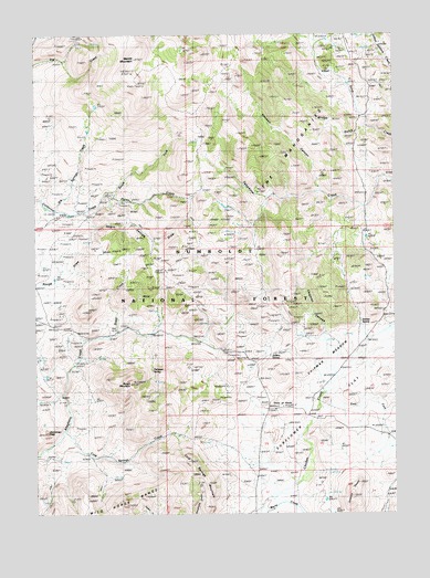
Merritt Mountain, NV USGS Topographic Map
Click on map above to begin viewing in our Map Viewer.

This topographic map contains these locations and features:
Feature Name Type Latitude Longitude GNIS ID View Map
Archies SpringSpringN41.8000°W115.7626°858742View Map
Baker CreekStreamN41.7980°W115.8476°858786View Map
Big Springs CreekStreamN41.8296°W115.8684°858909View Map
Bridge GulchValleyN41.8513°W115.7612°859012View Map
Chipman CanyonValleyN41.7857°W115.7712°859241View Map
Chipman MeadowFlatN41.7913°W115.7712°859242View Map
Cold Springs CreekStreamN41.7716°W115.8662°859296View Map
Cold Springs MountainSummitN41.7641°W115.8220°859299View Map
East Fork Chicken CreekStreamN41.7782°W115.7773°859223View Map
Jenkins PeaksSummitN41.7549°W115.7656°860198View Map
Jenkins SpringSpringN41.7912°W115.7940°860199View Map
Jenneman PeakSummitN41.7718°W115.8712°860200View Map
Merritt MountainSummitN41.8691°W115.8406°860550View Map
Negro George CreekStreamN41.8285°W115.8598°863254View Map
Negro George DrawValleyN41.8291°W115.8598°860735View Map
Pixley CreekStreamN41.8330°W115.8518°860978View Map
Point of RocksPopulated PlaceN41.7771°W115.7951°860989View Map
Rough MountainSummitN41.7843°W115.8423°861181View Map
South Fork California CreekStreamN41.8296°W115.8684°861462View Map
Sunflower FlatFlatN41.7713°W115.7656°861638View Map
Transient SpringSpringN41.7875°W115.8354°861773View Map
Vincenti CanyonValleyN41.8343°W115.7765°861850View Map

Note: Coordinates in the location and feature list above are referenced to NAD83 datum.


Copyright (C) 2008-2024 Ryan Niemi / Sunset Dynamics ... All Rights Reserved