TopoQuest Logo
Do you find TopoQuest useful?
Help keep TopoQuest running and adding new maps/features by donating!
Bitcoin:  19c7KJd3qBynnjoSw5npx9KScwjBe4ifkT
Litecoin:  LXs6TkuXGGXo1vDsWCkWVdjQX94eUKd6ui
Home View Maps Find Maps Find Places Resources & Links


Ringgold, Louisiana Topographic Map

USGS Map Title: Ringgold, LA
USGS Map MRC: 32093C3
DRG (GeoTIFF) Download: o32093c3.tif


Neighboring USGS Topographic Map Quads:


  Koran, LA  
32093D4
 

  Heflin, LA  
32093D3
 

  Fryeburg, LA  
32093D2
 

  Bossier Point, LA  
32093C4
 

  Ringgold, LA  
32093C3
 

  Jamestown, LA  
32093C2
 

  East Point, LA  
32093B4
 

  Hall Summit, LA  
32093B3
 

  Roy, LA  
32093B2


Map MRC Location:

N33°
W94°
N33°
W93°
H8 H7 H6 H5 H4 H3 H2 H1
G8 G7 G6 G5 G4 G3 G2 G1
F8 F7 F6 F5 F4 F3 F2 F1
E8 E7 E6 E5 E4 E3 E2 E1
D8 D7 D6 D5 D4 D3 D2 D1
C8 C7 C6 C5 C4 C3 C2 C1
B8 B7 B6 B5 B4 B3 B2 B1
A8 A7 A6 A5 A4 A3 A2 A1
N32°
W94°
N32°
W93°

Ringgold, LA USGS 1:24K Topographic Map Preview:
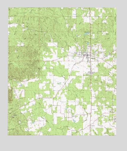
Ringgold, LA USGS Topographic Map
Click on map above to begin viewing in our Map Viewer.

This topographic map contains these locations and features:
Feature Name Type Latitude Longitude GNIS ID View Map
Armistead BranchStreamN32.3702°W93.3502°532215View Map
Bible Memory Association Camp DamDamN32.3485°W93.2868°556989View Map
Bienville Parish Fire Protection District Wards 4 and 5 Station 1BuildingN32.3233°W93.2805°2673067View Map
Bienville Parish Fire Protection District Wards 4 and 5 Station 4BuildingN32.2750°W93.2788°2673041View Map
Bienville Parish Fire Protection District Wards 4 and 5 Station 5BuildingN32.2761°W93.3627°2673058View Map
Bienville Parish Fire Protection District Wards 4 and 5 Station 6BuildingN32.3631°W93.3740°2673059View Map
Bryan CemeteryCemeteryN32.2638°W93.2502°533485View Map
Carter BranchStreamN32.2557°W93.3124°532056View Map
Coleman CemeteryCemeteryN32.3596°W93.3560°534036View Map
Davis CreekStreamN32.3679°W93.2504°534407View Map
Fourmile BayouStreamN32.3474°W93.2502°554468View Map
Grand Bayou ChurchChurchN32.2718°W93.2799°535319View Map
Hall Summit Lookout TowerTowerN32.2696°W93.3638°558778View Map
Hebrew ChurchChurchN32.3043°W93.3738°535603View Map
Israelite ChurchChurchN32.2977°W93.3227°535967View Map
Manning (historical)Populated PlaceN32.2627°W93.3527°1630979View Map
Miracle CampLocaleN32.3510°W93.2846°537156View Map
Mosley CemeteryCemeteryN32.3154°W93.3379°537247View Map
Myers TempleChurchN32.3310°W93.2966°537508View Map
Nornside ChurchChurchN32.3371°W93.2802°537705View Map
Parish Governing Authority District 4CivilN32.3681°W93.3085°1929999View Map
Parish Governing Authority District 5CivilN32.2961°W93.2726°1930064View Map
Providence ChurchChurchN32.3299°W93.2579°555735View Map
RinggoldPopulated PlaceN32.3285°W93.2799°555803View Map
RINGGOLD ELEMENTARY SCHOOLSchoolN32.3227°W93.2683°549100View Map
Ringgold Gas FieldOilfieldN32.3029°W93.3002°549101View Map
Ringgold High SchoolSchoolN32.3223°W93.2684°1633027View Map
Rocky Mount CemeteryCemeteryN32.3072°W93.3716°538675View Map
Rocky Mount Church (historical)ChurchN32.3071°W93.3724°540941View Map
Saint Lukes BranchStreamN32.3657°W93.3391°538950View Map
Saint Lukes ChurchChurchN32.3360°W93.3141°538957View Map
Saint Marys ChurchChurchN32.2979°W93.2807°538987View Map
Shehee CemeteryCemeteryN32.3663°W93.3686°539313View Map
Spring Hill ChurchChurchN32.3557°W93.3516°539599View Map
Stafford CemeteryCemeteryN32.2727°W93.2543°539615View Map
Tennyson CreekStreamN32.3738°W93.3460°539817View Map
Thomas BranchStreamN32.3482°W93.2507°539874View Map
Thomas Branch Gas FieldOilfieldN32.3490°W93.2691°549110View Map
Tooke CemeteryCemeteryN32.3445°W93.3564°539964View Map
Tooke CemeteryCemeteryN32.3487°W93.3443°539965View Map
Town of RinggoldCivilN32.3260°W93.2837°2407221View Map
Tucker CreekStreamN32.3446°W93.2502°540016View Map
TullisPopulated PlaceN32.2707°W93.2860°543739View Map
Union Church (historical)ChurchN32.2863°W93.3279°540942View Map
Ward FiveCivilN32.3007°W93.2910°544933View Map
Ward FourCivilN32.3488°W93.2977°544932View Map
West Ringgold Gas FieldOilfieldN32.3321°W93.3335°549114View Map
Wimberly CemeteryCemeteryN32.2738°W93.2557°540493View Map
WoodardvillePopulated PlaceN32.2599°W93.2802°543794View Map
Woodardville Gas FieldOilfieldN32.2738°W93.2816°549115View Map

Note: Coordinates in the location and feature list above are referenced to NAD83 datum.


Copyright (C) 2008-2024 Ryan Niemi / Sunset Dynamics ... All Rights Reserved