TopoQuest Logo
Do you find TopoQuest useful?
Help keep TopoQuest running and adding new maps/features by donating!
Bitcoin:  19c7KJd3qBynnjoSw5npx9KScwjBe4ifkT
Litecoin:  LXs6TkuXGGXo1vDsWCkWVdjQX94eUKd6ui
Home View Maps Find Maps Find Places Resources & Links


Red Bud, Illinois Topographic Map

USGS Map Title: Red Bud, IL
USGS Map MRC: 38089B8
DRG (GeoTIFF) Download: o38089b8.tif


Neighboring USGS Topographic Map Quads:


  Paderborn, IL  
38090C1
 

  New Athens West, IL  
38089C8
 

  New Athens East, IL  
38089C7
 

  Ames, IL  
38090B1
 

  Red Bud, IL  
38089B8
 

  Baldwin, IL  
38089B7
 

  Prairie du Rocher, IL  
38090A1
 

  Evansville, IL  
38089A8
 

  Walsh, IL  
38089A7


Map MRC Location:

N39°
W90°
N39°
W89°
H8 H7 H6 H5 H4 H3 H2 H1
G8 G7 G6 G5 G4 G3 G2 G1
F8 F7 F6 F5 F4 F3 F2 F1
E8 E7 E6 E5 E4 E3 E2 E1
D8 D7 D6 D5 D4 D3 D2 D1
C8 C7 C6 C5 C4 C3 C2 C1
B8 B7 B6 B5 B4 B3 B2 B1
A8 A7 A6 A5 A4 A3 A2 A1
N38°
W90°
N38°
W89°

Red Bud, IL USGS 1:24K Topographic Map Preview:
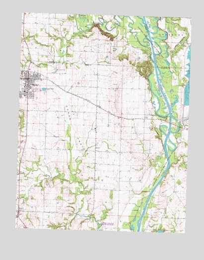
Red Bud, IL USGS Topographic Map
Click on map above to begin viewing in our Map Viewer.

This topographic map contains these locations and features:
Feature Name Type Latitude Longitude GNIS ID View Map
Baldwin Plant Cooling Lake DamDamN38.2100°W89.8768°1691636View Map
Baldwin Power Plant Cooling Lake DikeDamN38.2100°W89.8768°1692408View Map
Black CreekStreamN38.2417°W89.9582°404489View Map
Brickey CemeteryCemeteryN38.2359°W89.9343°404848View Map
Brickey School (historical)SchoolN38.2212°W89.9434°1821650View Map
City of Red BudCivilN38.2096°W89.9995°2396334View Map
Cleveland School (historical)SchoolN38.1787°W89.9432°1764825View Map
Doza CreekStreamN38.2167°W89.8970°426316View Map
GriggPopulated PlaceN38.1906°W89.9079°422762View Map
Horse PrairieFlatN38.1823°W89.9582°410558View Map
Koester Dairy FarmLocaleN38.1542°W89.9442°2680755View Map
Little Oak School (historical)SchoolN38.1823°W89.9165°1764855View Map
Long LakeLakeN38.2475°W89.9552°412582View Map
MedStar AmbulanceBuildingN38.2113°W89.9881°2674048View Map
Ohlwine School (historical)SchoolN38.1931°W89.9796°1764871View Map
PrairiePopulated PlaceN38.1731°W89.9432°416093View Map
Ralls CemeteryCemeteryN38.2103°W89.9282°416361View Map
Red BudPopulated PlaceN38.2117°W89.9943°416449View Map
Red Bud Election PrecinctCivilN38.1872°W89.9629°1928632View Map
Red Bud Fire DepartmentBuildingN38.2114°W89.9929°2640163View Map
Red Bud Historic DistrictParkN38.2117°W89.9940°1820701View Map
Red Bud Police DepartmentBuildingN38.2115°W89.9930°2759056View Map
Red Bud Post OfficePost OfficeN38.2110°W89.9938°2788468View Map
Red Bud Regional HospitalHospitalN38.2090°W89.9969°2662339View Map
Richland CreekStreamN38.2375°W89.9090°426483View Map
RumaPopulated PlaceN38.1351°W89.9979°417037View Map
Saint John CemeteryCemeteryN38.1350°W89.9707°417343View Map
Sauer Dairy FarmLocaleN38.1694°W89.9939°2680754View Map
Simpson PondReservoirN38.1384°W89.9584°1691959View Map
Simpson Pond DamDamN38.1384°W89.9584°1691958View Map
Smith LakeReservoirN38.2184°W89.8784°418640View Map
Stringtown School (historical)SchoolN38.1339°W89.8857°1764891View Map
Trinity SchoolSchoolN38.1839°W89.9437°419870View Map
Voges Airstrip (historical)AirportN38.2167°W89.9751°427726View Map

Note: Coordinates in the location and feature list above are referenced to NAD83 datum.


Copyright (C) 2008-2024 Ryan Niemi / Sunset Dynamics ... All Rights Reserved