TopoQuest Logo
Do you find TopoQuest useful?
Help keep TopoQuest running and adding new maps/features by donating!
Bitcoin:  19c7KJd3qBynnjoSw5npx9KScwjBe4ifkT
Litecoin:  LXs6TkuXGGXo1vDsWCkWVdjQX94eUKd6ui
Home View Maps Find Maps Find Places Resources & Links


Baldwin, Illinois Topographic Map

USGS Map Title: Baldwin, IL
USGS Map MRC: 38089B7
DRG (GeoTIFF) Download: o38089b7.tif


Neighboring USGS Topographic Map Quads:


  New Athens West, IL  
38089C8
 

  New Athens East, IL  
38089C7
 

  Saint Libory, IL  
38089C6
 

  Red Bud, IL  
38089B8
 

  Baldwin, IL  
38089B7
 

  Tilden, IL  
38089B6
 

  Evansville, IL  
38089A8
 

  Walsh, IL  
38089A7
 

  Steeleville, IL  
38089A6


Map MRC Location:

N39°
W90°
N39°
W89°
H8 H7 H6 H5 H4 H3 H2 H1
G8 G7 G6 G5 G4 G3 G2 G1
F8 F7 F6 F5 F4 F3 F2 F1
E8 E7 E6 E5 E4 E3 E2 E1
D8 D7 D6 D5 D4 D3 D2 D1
C8 C7 C6 C5 C4 C3 C2 C1
B8 B7 B6 B5 B4 B3 B2 B1
A8 A7 A6 A5 A4 A3 A2 A1
N38°
W90°
N38°
W89°

Baldwin, IL USGS 1:24K Topographic Map Preview:
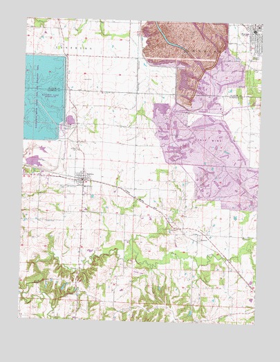
Baldwin, IL USGS Topographic Map
Click on map above to begin viewing in our Map Viewer.

This topographic map contains these locations and features:
Feature Name Type Latitude Longitude GNIS ID View Map
BaldwinPopulated PlaceN38.1831°W89.8426°403853View Map
Baldwin CemeteryCemeteryN38.1959°W89.8462°403856View Map
Baldwin Community Fire Protection District Main StationBuildingN38.1828°W89.8455°2640457View Map
Baldwin Community Fire Protection District Training FacilityBuildingN38.1848°W89.8476°2640750View Map
Baldwin Election PrecinctCivilN38.1779°W89.8300°1928442View Map
Baldwin Energy ComplexBuildingN38.2039°W89.8550°2419855View Map
Baldwin LakeReservoirN38.2169°W89.8661°1691637View Map
Baldwin Lake State Fish and Wildlife AreaParkN38.2175°W89.8693°1820671View Map
Baldwin Post OfficePost OfficeN38.1824°W89.8430°2788703View Map
East Doza School (historical)SchoolN38.2400°W89.7676°1821814View Map
Fairview ChurchChurchN38.1256°W89.7815°408192View Map
HoustonPopulated PlaceN38.1592°W89.7812°410601View Map
Jordan Grove CemeteryCemeteryN38.2025°W89.7923°411249View Map
Jordan Grove School (historical)SchoolN38.2070°W89.7893°1764849View Map
Jordans Grove Post Office (historical)Post OfficeN38.1981°W89.8154°1820688View Map
Leinecke CemeteryCemeteryN38.2250°W89.8443°426407View Map
Lessley CemeteryCemeteryN38.1637°W89.7923°411956View Map
Marissa City CemeteryCemeteryN38.2353°W89.7540°426422View Map
Marissa Post OfficePost OfficeN38.2462°W89.7539°2788720View Map
Marissa Volunteer Fire Protection DistrictBuildingN38.2471°W89.7556°2640453View Map
Marissa Woods Nature PreserveParkN38.2262°W89.7518°2013831View Map
McHatton School (historical)SchoolN38.1873°W89.7890°1764861View Map
Old Bethel ChurchChurchN38.1606°W89.7576°414990View Map
Pea Ridge School (historical)SchoolN38.1325°W89.8276°1764875View Map
Peabody-Pit 6-New Shop HeliportAirportN38.1803°W89.7795°427038View Map
Pleasant Grove School (historical)SchoolN38.2062°W89.8473°1764878View Map
Redpath RLA Airport (historical)AirportN38.1820°W89.8084°427037View Map
Risdon School (historical)SchoolN38.2345°W89.8523°1764884View Map
River King Mine Number 6MineN38.2200°W89.7823°1987820View Map
Saint Johns CemeteryCemeteryN38.1803°W89.8515°417363View Map
Saint Johns SchoolSchoolN38.1806°W89.8415°417410View Map
Schmoll CemeteryCemeteryN38.1662°W89.8620°418093View Map
Taphorn PondReservoirN38.1385°W89.8517°1691639View Map
Taphorn Pond DamDamN38.1367°W89.8518°1691638View Map
Village of BaldwinCivilN38.1838°W89.8452°2398021View Map
West Doza School (historical)SchoolN38.2428°W89.7962°1821899View Map

Note: Coordinates in the location and feature list above are referenced to NAD83 datum.


Copyright (C) 2008-2024 Ryan Niemi / Sunset Dynamics ... All Rights Reserved