TopoQuest Logo
Do you find TopoQuest useful?
Help keep TopoQuest running and adding new maps/features by donating!
Bitcoin:  19c7KJd3qBynnjoSw5npx9KScwjBe4ifkT
Litecoin:  LXs6TkuXGGXo1vDsWCkWVdjQX94eUKd6ui
Home View Maps Find Maps Find Places Resources & Links


Panther Spring, California Topographic Map

USGS Map Title: Panther Spring, CA
USGS Map MRC: 40121B7
DRG (GeoTIFF) Download: o40121b7.tif


Neighboring USGS Topographic Map Quads:


  Inskip Hill, CA  
40121C8
 

  Finley Butte, CA  
40121C7
 

  Lyonsville, CA  
40121C6
 

  Dewitt Peak, CA  
40121B8
 

  Panther Spring, CA  
40121B7
 

  Barkley Mountain, CA  
40121B6
 

  Acorn Hollow, CA  
40121A8
 

  Deer Creek Flat, CA  
40121A7
 

  Devils Parade Ground, CA  
40121A6


Map MRC Location:

N41°
W122°
N41°
W121°
H8 H7 H6 H5 H4 H3 H2 H1
G8 G7 G6 G5 G4 G3 G2 G1
F8 F7 F6 F5 F4 F3 F2 F1
E8 E7 E6 E5 E4 E3 E2 E1
D8 D7 D6 D5 D4 D3 D2 D1
C8 C7 C6 C5 C4 C3 C2 C1
B8 B7 B6 B5 B4 B3 B2 B1
A8 A7 A6 A5 A4 A3 A2 A1
N40°
W122°
N40°
W121°

Panther Spring, CA USGS 1:24K Topographic Map Preview:
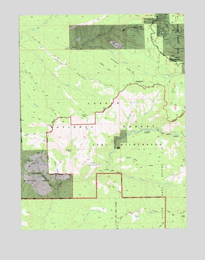
Panther Spring, CA USGS Topographic Map
Click on map above to begin viewing in our Map Viewer.

This topographic map contains these locations and features:
Feature Name Type Latitude Longitude GNIS ID View Map
Avery CreekStreamN40.1815°W121.7847°256385View Map
Avery PlacePopulated PlaceN40.1818°W121.7805°1657968View Map
Bear CanyonValleyN40.1546°W121.8161°256628View Map
Black Oak GroveWoodsN40.1954°W121.8422°257144View Map
Blunkall CrossingCrossingN40.1415°W121.8522°1658087View Map
Boat Gunwale CreekStreamN40.1590°W121.8122°257309View Map
Buckhorn GulchValleyN40.1535°W121.8447°257617View Map
Bucks FlatFlatN40.2304°W121.8022°257636View Map
Cave SpringSpringN40.1340°W121.7794°258097View Map
Cedar CrossingCrossingN40.2296°W121.8375°1658241View Map
Crazy CanyonValleyN40.2385°W121.8055°258901View Map
Davison SpringSpringN40.2068°W121.8050°259100View Map
Deadman GulchValleyN40.1485°W121.8500°259135View Map
East Tehama DivisionCivilN40.1975°W121.8036°1935088View Map
Emigrant SpringSpringN40.1318°W121.7872°259915View Map
Horseback RidgeRidgeN40.2190°W121.8033°261516View Map
Indian RidgeRidgeN40.2152°W121.8328°261758View Map
Kingsley CoveValleyN40.1563°W121.8378°262189View Map
Knass SpringSpringN40.2385°W121.7669°262218View Map
Little Bucks FlatFlatN40.1907°W121.7716°276252View Map
Long PointRidgeN40.2000°W121.7583°262867View Map
North Fork Antelope CreekStreamN40.2407°W121.8625°264132View Map
Panther SpringSpringN40.2472°W121.7731°264490View Map
Panther Spring Guard StationLocaleN40.2465°W121.7739°264492View Map
Pape PlacePopulated PlaceN40.1713°W121.8028°1659342View Map
Payne Spring CabinLocaleN40.1668°W121.8711°264578View Map
Peligreen GulchValleyN40.2268°W121.8222°264625View Map
Peligreen PlacePopulated PlaceN40.2088°W121.7883°1659363View Map
Rancheria CreekStreamN40.1796°W121.7944°265172View Map
Round MountainSummitN40.2238°W121.7616°265609View Map
Round Mountain CreekStreamN40.2290°W121.8322°265612View Map
Round Mountain SpringSpringN40.2136°W121.7605°265615View Map
South Fork Antelope CreekStreamN40.2413°W121.8625°267422View Map
Steep HollowValleyN40.1338°W121.7533°267712View Map
Stone Corral HollowValleyN40.1593°W121.8067°267769View Map
Table MountainSummitN40.1621°W121.8178°268051View Map
Tail Holt SpringSpringN40.2328°W121.7618°268066View Map
Two-Barrel SpringSpringN40.2359°W121.7533°268559View Map
Wild Horse CorralLocaleN40.1852°W121.8511°269079View Map

Note: Coordinates in the location and feature list above are referenced to NAD83 datum.


Copyright (C) 2008-2024 Ryan Niemi / Sunset Dynamics ... All Rights Reserved