TopoQuest Logo
Do you find TopoQuest useful?
Help keep TopoQuest running and adding new maps/features by donating!
Bitcoin:  19c7KJd3qBynnjoSw5npx9KScwjBe4ifkT
Litecoin:  LXs6TkuXGGXo1vDsWCkWVdjQX94eUKd6ui
Home View Maps Find Maps Find Places Resources & Links


Devils Parade Ground, California Topographic Map

USGS Map Title: Devils Parade Ground, CA
USGS Map MRC: 40121A6
DRG (GeoTIFF) Download: o40121a6.tif


Neighboring USGS Topographic Map Quads:


  Panther Spring, CA  
40121B7
 

  Barkley Mountain, CA  
40121B6
 

  Onion Butte, CA  
40121B5
 

  Deer Creek Flat, CA  
40121A7
 

  Devils Parade Ground, CA  
40121A6
 

  Butte Meadows, CA  
40121A5
 

  Campbell Mound, CA  
39121H7
 

  Cohasset, CA  
39121H6
 

  Stirling City, CA  
39121H5


Map MRC Location:

N41°
W122°
N41°
W121°
H8 H7 H6 H5 H4 H3 H2 H1
G8 G7 G6 G5 G4 G3 G2 G1
F8 F7 F6 F5 F4 F3 F2 F1
E8 E7 E6 E5 E4 E3 E2 E1
D8 D7 D6 D5 D4 D3 D2 D1
C8 C7 C6 C5 C4 C3 C2 C1
B8 B7 B6 B5 B4 B3 B2 B1
A8 A7 A6 A5 A4 A3 A2 A1
N40°
W122°
N40°
W121°

Devils Parade Ground, CA USGS 1:24K Topographic Map Preview:
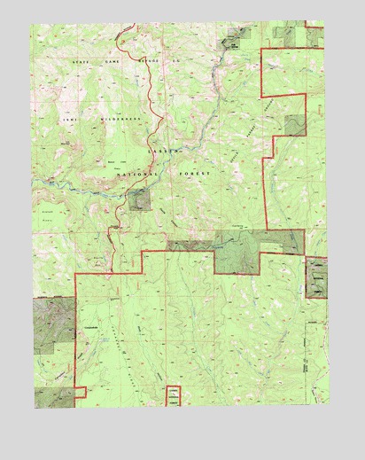
Devils Parade Ground, CA USGS Topographic Map
Click on map above to begin viewing in our Map Viewer.

This topographic map contains these locations and features:
Feature Name Type Latitude Longitude GNIS ID View Map
Bear CreekStreamN40.0838°W121.6811°256635View Map
Beaver CreekStreamN40.0824°W121.6916°256760View Map
Beaver Creek PineryFlatN40.0974°W121.7116°1655191View Map
Bennett SpringSpringN40.0221°W121.7222°256833View Map
Big Bear CreekStreamN40.0235°W121.6450°256879View Map
Big Smoky CreekStreamN40.1002°W121.6700°257009View Map
Campbell RidgeRidgeN40.0060°W121.7486°257918View Map
CampbellvillePopulated PlaceN40.0257°W121.7230°257921View Map
Cold SpringSpringN40.0513°W121.6749°258543View Map
Cold Spring HillSummitN40.0565°W121.6619°258560View Map
Devils DenBasinN40.0454°W121.7216°259307View Map
Devils KitchenAreaN40.0635°W121.6900°259321View Map
Devils Parade GroundAreaN40.0838°W121.6611°259325View Map
Ditch CreekStreamN40.1121°W121.6689°266646View Map
Graham Trail (historical)TrailN40.0749°W121.7472°1655081View Map
Iron CreekStreamN40.0735°W121.7364°261810View Map
Iron MountainSummitN40.0868°W121.7344°261817View Map
Little Bear CreekStreamN40.0093°W121.6525°262525View Map
Little Pine CreekStreamN40.0693°W121.7255°262688View Map
Little Smoky CreekStreamN40.0463°W121.6311°227371View Map
Murphy Trail (historical)TrailN40.0952°W121.6597°263980View Map
Ninemile CreekStreamN40.0460°W121.6372°229559View Map
Pinnacle PeakSummitN40.0579°W121.7144°1655192View Map
Polk SpringsPopulated PlaceN40.1171°W121.6653°264914View Map

Note: Coordinates in the location and feature list above are referenced to NAD83 datum.


Copyright (C) 2008-2024 Ryan Niemi / Sunset Dynamics ... All Rights Reserved